Lake Pleasant, New York
| Lake Pleasant, New York | |
|---|---|
| Town | |
|
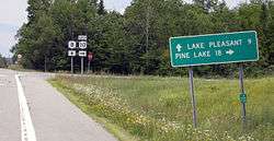
Route 8 near Lake Pleasant | |
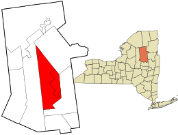 Location in Hamilton County and the state of New York. | |
| Coordinates: 43°28′N 74°25′W / 43.467°N 74.417°W | |
| Country | United States |
| State | New York |
| County | Hamilton |
| Government | |
| • Type | Town Council |
| • Town Supervisor | Dan Wilt (R) |
| • Town Council |
Members' List
|
| Area | |
| • Total | 198.0 sq mi (512.8 km2) |
| • Land | 188.1 sq mi (487.1 km2) |
| • Water | 9.9 sq mi (25.6 km2) |
| Elevation | 1,831 ft (558 m) |
| Population (2010) | |
| • Total | 781 |
| Time zone | Eastern (EST) (UTC-5) |
| • Summer (DST) | EDT (UTC-4) |
| ZIP code | 12108 |
| Area code(s) | 518 |
| FIPS code | 36-40794 |
| GNIS feature ID | 0979129 |
Lake Pleasant is a town in Hamilton County, New York, United States. The population was 781 at the 2010 census. It contains the county seat of Hamilton County,[1] which is also called Lake Pleasant.
The Town of Lake Pleasant is within the Adirondack Park and is centrally located in the county. The town is northwest of Schenectady.
Lake Pleasant is considered a tourist hub in Hamilton County. Estimates put the number of summer homes at around three-quarters of the homes in the area. Between Memorial Day and Labor Day, the unofficial Summer season, the small town is a busy community, with many activities including a parade, fireworks, Summer musical, camping, nature hiking, water activities, historical activities, art show, geocaching, Mountain Biking and so much more. Lake Pleasant is also famous for its fall foliage, and winter sport activities.
History
Native Americans
Archaeological evidence of Native Americans has been found in arrowheads and spearheads near the local lakes' shores of Lake Pleasant. Many historians believe Lake Pleasant was the hunting and fishing grounds of both Mohawks and Algonquin tribes. These Native Americans would only travel to the Adirondack Mountains to hunt during the warm months and their villages were located in the Mohawk and Hudson Valley Region. There was a Mohawk, who named himself Captain Gill, who lived in a wigwam at the outlet of the lake, Lake Pleasant, during the end of the eighteenth century and the beginning of the nineteenth century. He had a wife named Molly and Molly had a daughter named Molly Jr., however Capt. Gill didn't claim the daughter as his own. Old Capt. Gill was a trail guide for the first settlers. He would show them places to hunt and fish. Capt. Gill was most famous for his story telling and would tell folklore of the Iroquois Nation. One folklore told of a forgotten tribe that lived year round near Round Lake (now known as Lake Sacandaga) in the Town of Lake Pleasant. This forgotten tribe had their village on a hill which is now behind the Hamilton County buildings. The legend talks about an evil deed the tribe did and The Flying Head that came out of Lake Sacandaga and chased them out of the Adirondack Mountains.[2][3][4][5]
First settlers
The first settlers arrived around 1795; this area was then a part of the town of Mayfield in Montgomery County.[2][6]
The early town was once described as "A wild waste...so poor that nobody inclines to settle in it."[7]
The inexpensive land was offered by New York City landowners to induce settlement. The heavily forested majestic mountains and abundant game for food and furs and the numerous lakes and streams full of fish awaited the first settlers. A few hardy pioneers from the first thirteen states came to the wilderness, cleared the land and built self-sufficient farms. They built gristmills and sawmills for local use. All seemed good except for the heavy snows and lack of good roads meant they were isolated in the winter and muddy spring.
A short cool summer growing season meant adopting their farming to crops that would survive to feed themselves and livestock. Sheep was one of the main livestock and did well on the rocky hillsides and cloth was manufactured in many homes. Wild animals such as wolves, coyotes, bobcats and mountain lions had to be dealt with. Apple orchards were also planted with some success. A few mills to craft woodenware and tools were built. Some of the first settlers found income from shingle making in nearly every building was roofed with these wooden shingles. Small dairies supplied butter, cheese, and milk to neighbors and later to logging camps and large hotels. Development was slow and deprivation was numerous. Many left to be closer to their families were farm land was richer and jobs that offered a steady income could be found. Several small settlements separated by distance and a lack of passable roads soon became small towns. The large area was impractical to govern and the Montgomery County courthouse was sixty miles away. In 1805, the town of Wells, New York was established, which included the area of Lake Pleasant.
Lake Pleasant was formed in 1812 from part of the Town of Wells before the formation of Hamilton County with about 300 residents. It was a large area with scattered settlements and large reaching boundaries. It extended north indefinitely and to the west to the Herkimer county line. Hamilton County became a provisional county in 1816 but since it lacked enough residents it was counted along with Montgomery county.
The War of 1812
The United States of America declared war on Great Britain on June 18, 1812. The settlers of Wells, New York and Lake Pleasant were afraid of potential attacks from Native Americans who allied with the British Empire to attack American settlements. The Native Americans (yet unknown what tribe or nation)were seen roaming in the forest hunting, trapping and fishing. Despite no attacks, the Lake Pleasant settlers who considered themselves on the Northern Frontier boundary of the St. Lawrence, fled from their homes and scattered themselves of the counties of Saratoga, Rensselaer and Montgomery. All inhabitants except, the Peck family, left Lake Pleasant and so did a large majority of Wells. An application was made by a remaining few settlers to the NY state governor Daniel D. Tompkins for an order to raise a company of volunteers from Lake Pleasant and Wells to create a militia in order to ally the fears of the inhabitants, to protect them from the possible massacre and to encourage them to return to their homes. The petition was granted and William B Peck was commissioned captain of the Wells and Lake Pleasant Home guards of Company C under Montgomery counties militia 122 regiment. Lt. John L Francisco later took command of the militia as William Peck retired from his post.[8]
The War of 1812 brought a need for roads to be built so the US could invade Canada. A military road was created through the town to reach the St. Lawrence River so men and provisions could be transported easily into Canadian territory.[9]
Transformation of Lake Pleasant
Lake Pleasant was a "mother town" of Hamilton County and other towns were made, in whole or part, by removing parts of its territory: Morehouse (1835), Arietta (1836), part of Long Lake (1837), part of Gilmantown (1839−1860), (part of Hope (1847), part of Wells, (1858), and part of Indian Lake (1861).
Gilmantown stretched over 40 miles from Wells to Long Lake and was soon recognized as impractical and the land was annexed to both Lake Pleasant and Wells. Gradually settlement continued and two communities developed about four miles apart near the waters of Lake Pleasant. In 1844, the community of Lake Pleasant was also known as "Sageville"[10] after Hezekiah Sage built a hotel and attempted to rename the community after himself. In 1897, the town's name returned to Lake Pleasant.[2]
The small settlement at the foot of the lake was Lake Pleasant until 1864 when Joel Newton built a small store and hotel in the center of town and secured a post office with the name Newton's Corners. At that time Page Hill and Page Street were included in Newton's Corners. Joel Newton's structure burned in 1870, and in 1872 the Newton's corners post office was reopened in Satterlee's store. Henry Dunning built a hotel in 1882 where Newton's hotel had been and the post office had moved there, and 1896 the community received a new name, Speculator, New York, after the mountain seen across the lake.
In 1892, a few ambitious and industrious business men leaders felt they needed to update and modernize their facilities. Speculator was a "booming Mecca" for tourists. With the support of the voters in 1925, the village of Speculator was "incorporated" with a mayor and two trustees, which later changed to four trustees.[10] The Village of Speculator purchased a small water system of Dexter Slack and expanded it. The village had a generating plant and waterwheel installed at Christine Falls, and by 1926 they had electricity.
Age of tourism
Growth escalated in the Victorian era between the mid-1800s and the early 1900s. Whole family's spent their summers enjoying the mountain hospitality and fresh air. Several more hotels were built to accommodate them and eventually more stores, homes and several cottages were built. Around the 1850s, city sportsmen began to come to the Adirondack Mountains to hunt, fish, and enjoy expeditions into the deep woods. They hired local men who knew the area to be guides. The guides provided food, crude lean-tos for shelter. Hunting shanties were later widely used. With these sportsmen came their whole families to use the many hotels and boardinghouses in Lake Pleasant and Speculator. Private summer camps and cottages were built and along came the established family and children camps. Camps such as Camp-of-the-Woods, Camp Setag for girls, Kamp Kun-ju-muk for boys, the YMCA Camp Agaming, and Deerfoot Lodge for boys were established around the shores of local lakes. After World War I, famous athletes came to practice in the isolated communities, such as Gene Tunney, Max Schmeling, and Max Baer who arrived to train for the heavyweight championship fight. [11]
Age of lumbering
In the beginning, small saw mills provided lumber for local use. After the Civil War, a growing nation needed lumber and large lumber companies were formed and mills were built near the Glens Falls area. At first logging was prevalent along the upper Hudson River as river were used to float the logs to the mills. Later logging operations moved into Lake Pleasant and the Sacandaga River was used to float logs to Glens Falls as the State of New York designated rivers as public highways for moving logs to the larger companies. Many local farmers found winter employment with these companies as well as supplying the companies with potatoes, meat, and dairy products and hay and feed for the horses. The lumber companies bought large parcels of land for their timber. Some of this land was later abandoned and became state land. This was the beginning of the Adirondack Park as designated in 1892.
Geography
According to the United States Census Bureau, the town has a total area of 198.0 square miles (513 km2), of which, 188.1 square miles (487 km2) of it is land and 9.9 square miles (26 km2) of it (5.00%) is water.
New York State Route 8, an east-west highway, and New York State Route 30, a north-south highway, intersect at the "Four Corners" in the Village of Speculator.
The Sacandaga River flows out through the west town line of the town.
Demographics
| Historical population | |||
|---|---|---|---|
| Census | Pop. | %± | |
| 1820 | 312 | — | |
| 1830 | 266 | −14.7% | |
| 1840 | 296 | 11.3% | |
| 1850 | 305 | 3.0% | |
| 1860 | 356 | 16.7% | |
| 1870 | 318 | −10.7% | |
| 1880 | 343 | 7.9% | |
| 1890 | 416 | 21.3% | |
| 1900 | 469 | 12.7% | |
| 1910 | 458 | −2.3% | |
| 1920 | 393 | −14.2% | |
| 1930 | 540 | 37.4% | |
| 1940 | 584 | 8.1% | |
| 1950 | 696 | 19.2% | |
| 1960 | 718 | 3.2% | |
| 1970 | 812 | 13.1% | |
| 1980 | 859 | 5.8% | |
| 1990 | 887 | 3.3% | |
| 2000 | 876 | −1.2% | |
| 2010 | 781 | −10.8% | |
| Est. 2014 | 763 | [12] | −2.3% |
As of the census[14] of 2000, there were 876 people, 388 households, and 256 families residing in the town. The population density was 4.7 people per square mile (1.8/km²). There were 1,429 housing units at an average density of 7.6 per square mile (2.9/km²). The racial makeup of the town was 97.49% White, 1.03% African American, 0.11% Native American, 0.34% Asian, 0.80% from other races, and 0.23% from two or more races. Hispanic or Latino of any race were 1.03% of the population.
There were 388 households out of which 23.2% had children under the age of 18 living with them, 57.7% were married couples living together, 4.4% had a female householder with no husband present, and 34.0% were non-families. 31.2% of all households were made up of individuals and 13.4% had someone living alone who was 65 years of age or older. The average household size was 2.19 and the average family size was 2.70.
In the town the population was spread out with 18.6% under the age of 18, 5.6% from 18 to 24, 25.2% from 25 to 44, 27.7% from 45 to 64, and 22.8% who were 65 years of age or older. The median age was 45 years. For every 100 females there were 108.1 males. For every 100 females age 18 and over, there were 104.3 males.
The median income for a household in the town was $31,467, and the median income for a family was $39,766. Males had a median income of $28,523 versus $23,194 for females. The per capita income for the town was $19,259. Below the poverty line were 7.1% of people, 5.2% of families, 10.8% of those under 18 and 3.6% of those over 64.
Communities and locations in Lake Pleasant
Inhabited places
- Lake Pleasant – This hamlet, the county seat, was also called "Sageville" in the past.
- Moffitt Beach State Campground – A NY camping facility at the east end of Sacandaga Lake
- Oak Mountain – A location north of Speculator.
- Perkins Clearing – An old lumber camp location on Jessup River Road, west of NY-30.
- Sacandaga Camp – A community on NY-8 between Lake Pleasant hamlet and the Village of Speculator.
- Sled Harbor – A location west of Perkins Clearing where travelers once changed from motorized transport to horse drawn.
- Speculator - The Village of Speculator is the only incorporated village in Hamilton County, and was formerly called "Newtons Corners."
Geographical features
- Blue Ridge Mountain – An elevation in the northern part of the town.
- Buckhorn Lake – A small lake at the town line in the southwest.
- Cedar River Flow – An artificial lake in the northern part of Lake Pleasant.
- Fawn Lake – A lake west of Sacandaga Lake.
- Gilman Lake – A small lake adjacent to NY-30 by the east town line.
- Hamilton Lake – A small lake south of Lake Pleasant Lake.
- Indian Lake – The southern end of this large lake is in the northern part of Lake Pleasant.
- Lake Pleasant – The name of a lake that gives its name to both the town and the county seat, located south of NY-8 and the Village of Speculator.
- Lewey Lake – A lake in the northern part of the town.
- Lewey Mountain – An elevation in the northern part of the town west of Lewey Lake
- Owl Pond – A lake on the eastern town line
- Mud Lake – A small lake north of Sacandaga Lake
- Oxbow Lake – A lake at the west town line next to NY-8.
- Sacandada Lake – One of the large lakes in the town north of Lake Pleasant and NY-8.
- Sacandaga Outlet − A short river, flowing between Sacandaga Lake and Lake Pleasant under New York Highway 8
- Sacandaga River, A river that rises in the town and flows out the east town line
- Speculator Mountain – A mountain south of the Village of Speculator. Its height is 2977 feet (907 meters). It gave its name to the Village of Speculator.
- Vly Lake – a small lake at the west town line, west of Fawn Lake
- Wakely Dam – A location in the northern part of the town at the north end of Cedar River Flow, east entrance to the Moose River Plains Wilderness Area.
- Whitaker Lake – A lake east of NY Highway 30.
References
- ↑ "Find a County". National Association of Counties. Retrieved 2011-06-07.
- 1 2 3 Weaver, Anne A., and Beverly Hoffman. "Introduction." Introduction. Lake Pleasant and Speculator in the Adirondacks. Charleston, SC: Arcadia Pub., 2010. 7-8. Print.
- ↑ Aber, Ted, and Stella King. Tales from an Adirondack County. Prospect, NY: Prospect, 1981. Print.
- ↑ Aber, Ted, and Stella Brooks King. The History of Hamilton County. Lake Pleasant, NY: Great Wilderness, 1965. Print
- ↑ Erdoes, Richard, and Alfonso Ortiz. American Indian Myths and Legends. New York: Pantheon, 1984. Print.
- ↑ "Town of Lake Pleasant". Retrieved 2007-12-08.
- ↑ http://hamilton.nygenweb.net/history/lakepleasant.html
- ↑ Loose, Steve. "War of 1812 Pension Application of Washington Craig of Wells." War of 1812 Pension Application of Washington Craig of Wells. N.p., 14 May 2008. Web. 25 Aug. 2013.
- ↑ Aber, Ted, and Stella King. "Two Towns, A Highway and a War." History of Hamilton County. Prospect, NY: Prospect, 1981. 26-31. Print.
- 1 2 http://lakepleasantny.org/lp/
- ↑ "Welcome!". Town of Lake Pleasant. Retrieved April 5, 2011.
- ↑ "Annual Estimates of the Resident Population for Incorporated Places: April 1, 2010 to July 1, 2014". Retrieved June 4, 2015.
- ↑ "Census of Population and Housing". Census.gov. Retrieved June 4, 2015.
- ↑ "American FactFinder". United States Census Bureau. Retrieved 2008-01-31.
- "Town of Lake Pleasant (and Village of Speculator) government website". Retrieved 2007-12-08.
Lake Pleasant and Speculator in the Adirondacks by Anne Weaver and Beverly Hoffman. Arcadia Publishing, 2010. wwww.arcadiapublishing.com
External links
- "Adirondack Speculator Region Chamber of Commerce/Office of Tourism (Area information)". Retrieved 2007-12-08.
- "Lake Pleasant school system". Retrieved 2007-12-08.
- Lake Pleasant history
Coordinates: 43°28′N 74°25′W / 43.467°N 74.417°W
Municipalities and communities of Hamilton County, New York, United States | ||
|---|---|---|
| Towns |  | |
| Village | ||
| CDP |
| |
| Hamlets | ||