Lake Luzerne, New York
| Lake Luzerne | |
|---|---|
| Town | |
 Location of Lake Luzerne in Warren County | |
 Lake Luzerne Location within the state of New York | |
| Coordinates: 43°19′9″N 73°49′30″W / 43.31917°N 73.82500°WCoordinates: 43°19′9″N 73°49′30″W / 43.31917°N 73.82500°W | |
| Country | United States |
| State | New York |
| County | Warren |
| Established | 1792[1] |
| Government | |
| • Supervisor | Eugene Merlino[2] |
| Area | |
| • Total | 54.1 sq mi (140.0 km2) |
| • Land | 52.6 sq mi (136.3 km2) |
| • Water | 1.4 sq mi (3.7 km2) |
| Elevation | 1,191 ft (363 m) |
| Population (2010)[3] | |
| • Total | 3,347 |
| • Density | 63.6/sq mi (24.6/km2) |
| Time zone | Eastern (EST) (UTC-5) |
| • Summer (DST) | EDT (UTC-4) |
| ZIP code | 12846 |
| Area code(s) | 518 |
| FIPS code | 36-40662 |
| GNIS feature ID | 0979128 |
| Website | http://www.townoflakeluzerne.com/ |
Lake Luzerne is a town in southern Warren County, New York, United States.[2] The town is located within the Adirondack Park.[4] The town is part of the Glens Falls Metropolitan Statistical Area.[5] Lake Luzerne is west of the city of Glens Falls.[6] The town population was 3,347 at the 2010 census.[3]
History
The area received its first permanent settlers around 1770. The town of Lake Luzerne was set off from the town of Queensbury in 1792 as the "Town of Fairfield."[1] In 1808, the town changed its name to "Luzerne," and in 1963 to "Lake Luzerne".[7] Now the town is known for its Adirondack Folk School, with classes designed to keep the arts, crafts and culture of the Adirondacks alive , and for the Lake Luzerne Chamber Music Festival where artists such as classical guitarist Joel Brown, the Imani Winds, violinist Raymond Gniewek, jazz greats Chris and Dave Brubeck, and the Philadelphia Orchestra perform during the summer months.
Woodward Hall was listed on the National Register of Historic Places in 2014.[8]
Geography
According to the United States Census Bureau, the town has a total area of 54.1 square miles (140 km2), of which, 52.6 square miles (136 km2) of it is land and 1.4 square miles (3.6 km2) of it (2.66%) is water.
The south and west town lines are the border of Saratoga County, New York and the Hudson River. The north town line is the border with the town of Warrensburg. the east town line is the border with the towns of Queensbury and Lake George.[6]
Just north of the bridge across the Hudson to Hadley is the most narrow point of the entire Hudson River, Rockwell Falls. Just south of here is where the Sacandaga River meets the Hudson.
Demographics
| Historical population | |||
|---|---|---|---|
| Census | Pop. | %± | |
| 1820 | 1,430 | — | |
| 1830 | 1,362 | −4.8% | |
| 1840 | 1,284 | −5.7% | |
| 1850 | 1,300 | 1.2% | |
| 1860 | 1,328 | 2.2% | |
| 1870 | 1,174 | −11.6% | |
| 1880 | 1,438 | 22.5% | |
| 1890 | 1,679 | 16.8% | |
| 1900 | 1,341 | −20.1% | |
| 1910 | 1,185 | −11.6% | |
| 1920 | 1,018 | −14.1% | |
| 1930 | 1,150 | 13.0% | |
| 1940 | 1,251 | 8.8% | |
| 1950 | 1,426 | 14.0% | |
| 1960 | 1,830 | 28.3% | |
| 1970 | 2,174 | 18.8% | |
| 1980 | 2,672 | 22.9% | |
| 1990 | 2,816 | 5.4% | |
| 2000 | 3,219 | 14.3% | |
| 2010 | 3,347 | 4.0% | |
| Est. 2014 | 3,311 | [9] | −1.1% |
As of the census of 2000, there were 3,219 people, 1,264 households, and 883 families residing in the town. The population density was 61.2 people per square mile (23.6/km²). There were 1,949 housing units at an average density of 37.0 per square mile (14.3/km²). The racial makeup of the town was 97.79% White, 0.25% African American, 0.34% Native American, 0.28% Asian, 0.22% from other races, and 1.12% from two or more races. Hispanic or Latino of any race were 1.03% of the population.[3]
There were 1,264 households out of which 31.9% had children under the age of 18 living with them, 57.4% were married couples living together, 8.6% had a female householder with no husband present, and 30.1% were non-families. 23.7% of all households were made up of individuals and 9.7% had someone living alone who was 65 years of age or older. The average household size was 2.54 and the average family size was 2.99.[3]
In the town the population was spread out with 24.9% under the age of 18, 6.8% from 18 to 24, 29.7% from 25 to 44, 25.1% from 45 to 64, and 13.6% who were 65 years of age or older. The median age was 38 years. For every 100 females there were 98.0 males. For every 100 females age 18 and over, there were 96.7 males.[3]
The median income for a household in the town was $36,348, and the median income for a family was $40,104. Males had a median income of $30,152 versus $20,654 for females. The per capita income for the town was $16,246. About 7.7% of families and 10.3% of the population were below the poverty line, including 16.1% of those under age 18 and 6.9% of those age 65 or over.[3]
Communities and locations
- Beartown – A hamlet in the eastern part of the town.[11]
- Danielstown – A hamlet in the south part of the town in the vicinity of Daniels Road and County Route 32 (Call Street).[11]
- Fourth Lake – A hamlet west of a lake by the same name and north of Lake Luzerne hamlet on Route 9N.[11]
- Hartman – A hamlet in the south part of the town, east of Danielstown,[11] in the vicinity of Hartman Loop and County Route 32 (Call Street).[12]
- Lake Luzerne – A hamlet on the east bank of the Hudson River on Route 9N. It is southwest of a lake by the same name on the west side of town.[11]This hamlet has ZIP code 12846.
- Lake Luzerne-Hadley – A census-designated place in the towns of Lake Luzerne and Hadley (the latter located in Saratoga County).
- Lake Vanare – A hamlet east of Fourth Lake on Route 9N. The hamlet is in the vicinity of two bodies of water, named Lake Forest and Lake Vanare.[11]
- Luzerne Heights (or "The Heights") – A community inhabited by numerous seasonal residents off Pierpont Road.[13][14]
References
- 1 2 History of Warren County, edited by H. P. Smith - Chapter XXVI: History of the Town of Luzerne
- 1 2 "Supervisor". Town of Lake Luzerne. Retrieved April 1, 2011.
- 1 2 3 4 5 6 "American FactFinder". United States Census Bureau. Retrieved April 27, 2016.
- ↑ Overview of Adirondack Park boundary in Lake Luzerne (Map). Cartography by NAVTEQ. Yahoo! Inc. Retrieved April 1, 2011.
- ↑ "Metropolitan Areas and Components, 1999, with FIPS Codes". US Census Bureau. Retrieved July 7, 2009.
- 1 2 Overview of Lake Luzerne, NY (Map). Cartography by MyTopo.com. ACME Mapper 2.0. Retrieved April 1, 2011.
- ↑ "Warren County Historical Society". Retrieved 2009-03-18.
- ↑ "National Register of Historic Places". Weekly List of Actions Taken on Properties: 5/12/14 through 5/16/14. National Park Service. 2014-05-23.
- ↑ "Annual Estimates of the Resident Population for Incorporated Places: April 1, 2010 to July 1, 2014". Retrieved June 4, 2015.
- ↑ "Census of Population and Housing". Census.gov. Retrieved June 4, 2015.
- 1 2 3 4 5 6 NYS Department of Transportation Raster Quadrangle N48 (Map). 1:24,000. Cartography by USGS. NYS DOT. 1991. Retrieved April 1, 2011.
- ↑ Overview of Hartman Loop in Hartman (Map). Cartography by NAVTEQ. Yahoo! Inc. Retrieved April 1, 2011.
- ↑ "Rolland L. 'Bud "Gumprecht". The Post-Star. January 23, 2009. Retrieved April 1, 2011.
He was caretaker for over 40 seasonal residences around Lake Luzerne Heights.
- ↑ "2006-2007 Annual Report" (PDF). Lake Luzerne Association. 2007. p. 2. Retrieved April 1, 2011.
External links
Municipalities and communities of Warren County, New York, United States | ||
|---|---|---|
| City | 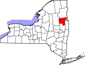 | |
| Towns | ||
| Village | ||
| CDPs | ||
| Other hamlets | ||
| Footnotes | ‡This populated place also has portions in an adjacent county or counties | |