Lago di Ledro
| Lago di Ledro | |
|---|---|
 | |
| Location | Trentino |
| Coordinates | 45°52′36″N 10°45′2″E / 45.87667°N 10.75056°ECoordinates: 45°52′36″N 10°45′2″E / 45.87667°N 10.75056°E |
| Primary inflows | Rio Sache |
| Primary outflows | Ponale |
| Basin countries | Italy |
| Surface area | 2.187 km2 (0.844 sq mi) |
| Surface elevation | 655 m (2,149 ft) |
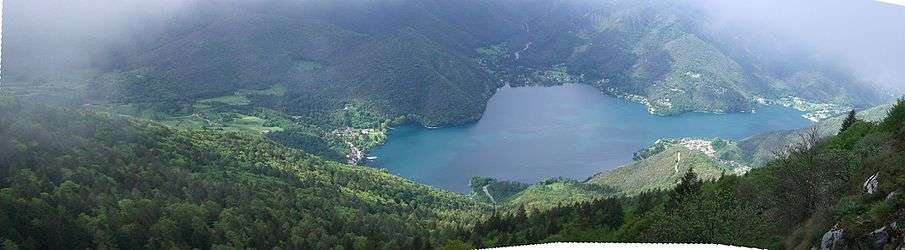
Lago di Ledro is a lake in Trentino, Italy. The lake is at an elevation of 655 metres (2,149 ft), and its surface area is 2.187 km2 (0.844 sq mi).
Lake Ledro is reputed to be one of the cleanest lakes in Trentino and during the summer it reaches a temperature of 24 °C (75 °F), which allows for swimming and relax at one of the four beaches around the lake. One of the beaches allows dogs. Available lake activities include renting a canoe or a sailing boat.
Origin and history

The origin of Lake Ledro is from a morainal bank during the fourth glacial era. Since 1929, the lake level is maintained to suit the energy requirements of the hydroelectric power station of Riva del Garda that uses the water of the lake to produce electricity.
The Lake's water sources are mainly underneath the lake. There are also the tributaries if Massangla, Assat of Pur, and Assat of Pieve, although these are dry for most of the year.
Lake Ledro is also best known for the discovery of an archaeological area situated on the east river flowing into the lake. The area was discovered when the level of the lake was lowered to supply the hydroelectric plant being built at Riva del Garda. This archaeological site is one of the most important in Europe for evidencing the extent and wealth of the manufactures of its time.
Statistics
- Lake Perimeter: 8.9 kilometres (5.5 mi)
- Maximum depth: 48 metres (157 ft),
- Average depth: 35 metres (115 ft),
- Principal tributaries: Massangla, Assat di Pieve, Assat di Pur
- Principal Outflowing: Ponale
References
External links
 Media related to Lago di Ledro at Wikimedia Commons