Lake Lalolalo
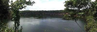
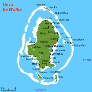
Lake Lalolalo (French: Lac Lalolalo) is a volcanic crater lake surrounded by jungle to the southwest of the island of Wallis (Uvea) in the Pacific. The largest lake on the island, it lies off Route 1 between the coastal village of Mala'etoli and Ahoa.[1] A small lake, Lake Lano, lies just to the northwest.
Background and history
The lake, almost a perfect circle and the largest of several on the island, is important to local mythology of Wallis and Futuna and to historical disputes over territory.[2] The lake was also mentioned in Father Joseph Henquel's history.[3] There is a rumor that the US military dumped equipment in the lake at the end of World War II.[4][5]
Description
Lonely Planet says of it "Lake Lalolalo is the most spectacular of the Wallis crater lakes. The eerie lake is an almost perfect circle with sheer rocky cliffs falling 30m (98ft) down to the inky, 80m (262ft) deep waters."[6] The lake is also described as "circular, with vertical red walls 30 metres high, which make the pea-green water almost inaccessible"[7] Others claim its maximum depth is a little less at 76 metres.[8]The surrounding jungle is inhabited by tropical birds and flying foxes which regularly fly low over the lake.[9] The lake has a population of eels, which many conservationists have been concerned with due to the lake's inaccessibility.[8][10]
References
- ↑ Maps (Map). Google Maps.
- ↑ Burrows, Edwin Grant (1945). Songs of Uvea and Futuna. The Museum. p. 22. Retrieved 29 April 2012.
- ↑ Bernice Pauahi Bishop Museum (1937). Bernice P. Bishop Museum bulletin. Bishop Museum Press. p. 12. Retrieved 29 April 2012.
- ↑ McKinnon, Rowan (1 August 2009). South Pacific. Lonely Planet. p. 617. ISBN 978-1-74104-786-8. Retrieved 29 April 2012.
- ↑ International Business Publications, USA (7 February 2007). Wallis & Futuna Country: Strategic Information and Developments. Int'l Business Publications. p. 175. ISBN 978-1-4330-5900-1. Retrieved 29 April 2012.
- ↑ "Lake Lalo Lalo". Lonely Planet. Retrieved 29 April 2012.
- ↑ Stanley, David (3 December 2004). Moon Handbooks South Pacific. David Stanley. p. 567. ISBN 978-1-56691-411-6. Retrieved 29 April 2012.
- 1 2 Jost, Christian (1998). The French-speaking Pacific: population, environment and development issues. Boombana Publications. ISBN 978-1-876542-02-3. Retrieved 29 April 2012.
- ↑ Stanley, David (1996). South Pacific Handbook. David Stanley. p. 483. ISBN 978-1-56691-040-8. Retrieved 29 April 2012.
- ↑ Université de Paris. Station Biologique, Roscoff (1996). Cahiers de biologie marine. Éditions de la Station Biologique de Roscoff. p. 178. Retrieved 29 April 2012.
Coordinates: 13°18′0″S 176°14′2″W / 13.30000°S 176.23389°W