Lake Forest, California
| Lake Forest, California | ||
|---|---|---|
| City | ||
| City of Lake Forest | ||
|
Aerial view of Lake Forest | ||
| ||
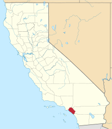
 Location of Lake Forest within Orange County, California. | ||
 Lake Forest, California Location in the United States | ||
| Coordinates: 33°38′30″N 117°41′27″W / 33.64167°N 117.69083°WCoordinates: 33°38′30″N 117°41′27″W / 33.64167°N 117.69083°W | ||
| Country |
| |
| State |
| |
| County |
| |
| Incorporated | December 20, 1991[1] | |
| Government | ||
| • Type | Council-manager[2] | |
| • Mayor | Andrew Hamilton[2] | |
| Area[3] | ||
| • Total | 17.902 sq mi (46.366 km2) | |
| • Land | 17.816 sq mi (46.143 km2) | |
| • Water | 0.086 sq mi (0.223 km2) 0.48% | |
| Elevation[4] | 489 ft (148 m) | |
| Population (2010) | ||
| • Total | 77,264 | |
| • Density | 4,300/sq mi (1,700/km2) | |
| Time zone | PST (UTC-8) | |
| • Summer (DST) | PDT (UTC-7) | |
| ZIP codes | 92609, 92610, 92630, 92679 | |
| Area code(s) | 949 | |
| FIPS code | 06-39496 | |
| GNIS feature IDs | 1656503, 2411602 | |
| Website |
www | |


Lake Forest is a city in Orange County, California. The population was 77,264 at the 2010 census.
Lake Forest incorporated as a city on December 20, 1991. Prior to incorporation, the community had been known as El Toro.[5] Following a vote in 2000, Lake Forest expanded its city limits to include the master-planned developments of Foothill Ranch and Portola Hills. This expansion brought new homes and commercial centers to the Northeastern boundary of the city. Lake Forest (along with its neighboring cities Mission Viejo and Irvine) is ranked as one of the safest cities in the country.[6]
Lake Forest has two lakes from which the city gets its name. The lakes are man-made, and condominiums and custom homes ranging from large to small line their shores. Neighborhood associations manage the lakes. Lake 1, known as the Lake Forest Beach and Tennis Club, and Lake 2, the Sun and Sail Club. Each facility features tennis courts, gyms, basketball courts, barbecue pits, volleyball courts, multiple swimming pools, saunas, hot tubs and club houses for social events.
The "forest" for which the city is also named lies in the area between Ridge Route, Jeronimo, Lake Forest and Serrano roads, and consists mostly of Eucalyptus trees. It is also man-made, and was created in the first decade of the 1900s when a local landowner, Dwight Whiting, planted 400 acres (1.6 km2) of Eucalyptus groves in the vicinity of Serrano Creek as part of a lumber operation intended to draw development to the area.[5] In the late 1960s, the Occidental Petroleum company developed a residential community in and around the Eucalyptus groves, which had long since expanded and grown much more dense.
History
From 1863, the community had been known as El Toro. In 1874 José Serrano and his family occupied eleven thousand hectares of ranch that had been granted to them by the Government of Mexico, and that eventually reached the hands of Dwight Whiting. Whiting was instrumental in bringing the Santa Fe rail line through the region.[5] The Rancho Niguel was granted to Juan B. Alvarado, Juan Avila and his sister Conception, the widow of one Pedro Sánchez. From them it passed to other owners and was divided into plots, including Yorba. In 1874 most of it was owned by Cyrus B. Rawson. Jonathan E. Bacon also owned 1600 acres. In addition to the Serranos, established in Aliso Canyon, there was a group of pioneers who lived in the foothills and several miles above El Toro, many of whom were among the first settlers of this neighborhood.
El Toro Road at the I-5 Freeway was the epicenter of the Saddleback Valley from the late 19th century to the end of the 20th century. However, the area gradually deteriorated, and most of the shops closed or moved to other cities. After years of planning, the city has worked with the property owners of some ageing strip malls and developed the "Arbor at Lake Forest" commercial district. The new center can now compete with large shopping centers in cities that surround Lake Forest.
Notable businesses and organizations
The city is home to the headquarters of eyewear manufacturer Oakley, Inc.; metals company Kaiser Aluminum, in-flight entertainment provider Panasonic Avionics; Karem Aircraft[7] an aircraft company developing UAV's with major aircraft companies; telecommunications software developer Greenlight Wireless Corp.; barbecue retailer Barbeques Galore; restaurant chains Johnny Rockets and Del Taco; medical equipment maker Apria Healthcare; and skateboarding companies Sole Technology, Inc., Etnies, and Tilly's; among others. It is also the home of the corporate headquarters for Eagle Community Credit Union, a credit union focused on serving postal and federal employees who live or work in Orange County.
However, along with Oakley, the city is probably best known as the home of Rick Warren's famed megachurch, Saddleback Church, currently the eighth-largest church in the United States.
Top employers
According to the City's 2012 Comprehensive Annual Financial Report,[8] the top employers in the city are:
| # | Employer | # of employees |
|---|---|---|
| 1 | Oakley | 2,400 |
| 2 | Panasonic Avionics Corporation | 2,370 |
| 3 | Loan Depot | 680 |
| 4 | Invensys | 547 |
| 5 | Apria Healthcare | 367 |
| 6 | Spectrum Brands[9] | 362 |
| 7 | The Home Depot | 340 |
| 8 | Walmart | 300 |
| 9 | Wet Seal | 275 |
| 10 | Saddleback Valley Unified School District | 209 |
| 11 | Dynacast | 188 |
| 12 | Sole Technology | 130 |
Parks and education
Lake Forest Sports Park and Recreation Center opened on November 1, 2014, across the street from Saddleback Church.[10] The 86.2-acre Sports Park, built with fees collected from developers for a "study" that led to the rezoning of surrounding areas, is one of the largest sports parks in Orange County.[11][12] The Recreation Center houses classrooms/activities rooms and a gymnasium, hosting many education and recreation programs that have previously been hosted at the rented City Hall facility.[10]
Lake Forest is also home to two county parks. Whiting Ranch in the eastern part of the city was the site of an infamous mountain lion mauling in 2004 that captured the attention of the West Coast news media.[13]
Heritage Hill historical park is home to some of the oldest buildings in the county, including the Serrano Adobe, the old El Toro School House, and St. Georges Episcopal Church.
Lake Forest has one high school, El Toro High School. The high school was opened in 1973. It has established itself as one of the top schools in Southern California, along with the other three comprehensive high schools in the Saddleback Valley Unified School District. The mascot is a bull and its teams are known as the Chargers. School colors are blue and gold.
Lake Forest is served by two branches of the Orange County Public Library system known as OC Public Libraries: the El Toro branch and the Foothill Ranch branch.[14]
Lake Forest also has etnies Skatepark, which is the largest public skatepark with over 40,000 square feet (3,700 m2).[15]
Geography
According to the United States Census Bureau, the city has a total area of 17.9 square miles (46 km2). 17.8 square miles (46 km2) of it is land and 0.1 square miles (0.26 km2) of it (0.48%) is water.
Lake Forest is bordered by Irvine on the west, Laguna Hills on the southwest, Mission Viejo on the southeast, Trabuco Canyon on the east, and Limestone Canyon Regional Park on the north.
El Toro/Lake Forest/Portola is located in the heart of the Saddleback Valley. It is also in the northern section of South Orange County.
It has two man-made lakes identified by the clubhouses on the lakes — the Beach and Tennis Club (Hidden Lakes, formerly Lake I) and the Sun and Sail Club (Lake II).
Demographics
| Historical population | |||
|---|---|---|---|
| Census | Pop. | %± | |
| 2000 | 58,707 | — | |
| 2010 | 77,264 | 31.6% | |
| Est. 2015 | 82,492 | [16] | 6.8% |
2010
The 2010 United States Census[18] reported that Lake Forest had a population of 77,264. The population density was 4,315.9 people per square mile (1,666.4/km²). The racial makeup of Lake Forest was 54,341 (70.3%) White (57.2% Non-Hispanic White),[19] 1,295 (1.7%) African American, 384 (0.5%) Native American, 10,115 (13.1%) Asian, 191 (0.2%) Pacific Islander, 7,267 (9.4%) from other races, and 3,671 (4.8%) from two or more races. Hispanic or Latino of any race were 19,024 persons (24.6%).
The Census reported that 76,749 people (99.3% of the population) lived in households, 299 (0.4%) lived in non-institutionalized group quarters, and 216 (0.3%) were institutionalized.
There were 26,224 households, out of which 10,407 (39.7%) had children under the age of 18 living in them, 15,603 (59.5%) were married couples, 2,710 (10.3%) had a female householder with no husband present, 1,299 (5.0%) had a male householder with no wife present. There were 1,217 (4.6%) unmarried partnerships, and 201 (0.8%)same-sex couples. 4,883 households (18.6%) were made up of individuals and 1,432 (5.5%) had someone living alone who was 65 years of age or older. The average household size was 2.93. There were 19,612 families (74.8% of all households); the average family size was 3.30.
The population was spread out with 19,115 people (24.7%) under the age of 18, 6,775 people (8.8%) aged 18 to 24, 22,099 people (28.6%) aged 25 to 44, 22,184 people (28.7%) aged 45 to 64, and 7,091 people (9.2%) who were 65 years of age or older. The median age was 37.2 years. For every 100 females there were 98.7 males. For every 100 females age 18 and over, there were 96.5 males.
There were 27,088 housing units at an average density of 1,513.1 per square mile (584.2/km²), of which 18,579 (70.8%) were owner-occupied, and 7,645 (29.2%) were occupied by renters. The homeowner vacancy rate was 1.3%; the rental vacancy rate was 4.3%. 54,082 people (70.0% of the population) lived in owner-occupied housing units and 22,667 people (29.3%) lived in rental housing units.
2000
As of the census[20] of 2000, there were 58,707 people, 20,008 households, and 14,745 families residing in the city. The population density was 4,698.8 inhabitants per square mile (1,814.8/km²). There were 20,486 housing units at an average density of 1,639.7 per square mile (633.3/km²). The racial makeup of the city was 76.02% White, 1.83% African American, 0.50% Native American, 9.70% Asian, 0.20% Pacific Islander, 7.51% from other races, and 4.24% from two or more races. Hispanic or Latino of any race were 18.59% of the population.
There were 20,008 households out of which 39.2% had children under the age of 18 living with them, 59.1% were married couples living together, 10.3% had a female householder with no husband present, and 26.3% were non-families. 19.4% of all households were made up of individuals and 5.1% had someone living alone who was 65 years of age or older. The average household size was 2.89 and the average family size was 3.31.
In the city the population was spread out with 27.0% under the age of 18, 8.0% from 18 to 24, 33.3% from 25 to 44, 23.2% from 45 to 64, and 8.6% who were 65 years of age or older. The median age was 35 years. For every 100 females there were 96.7 males. For every 100 females age 18 and over, there were 93.6 males.
According to a 2007 estimate, the median income for a household in the city was $86,285, and the median income for a family was $96,133.[21] Males had a median income of $52,019 versus $37,100 for females. The per capita income for the city was $28,583. About 3.2% of families and 5.3% of the population were below the poverty line, including 5.0% of those under age 18 and 4.4% of those age 65 or over.
Government and politics
_04.JPG)
Marine Corps Air Station El Toro was located one mile (1.6 km) from the city of Lake Forest in the city of Irvine. At one time, El Toro was considered a military town, but the city blossomed independently in the 1980s and 1990s before the base closed in 1999.
Of the 40,352 registered voters in Lake Forest; 25.8% are Democrats and 53.4% are Republicans. The remaining 20.8% either declined to state political affiliation or are registered with one of the many minor political parties. Andrew Hamilton serves as Lake Forest's Mayor and Scott Voigts serves as Mayor Pro Tem. The three other City Council members are Dr. Jim Gardner, Dwight Robinson, and Adam Nick.
State and federal representation
In the California State Legislature, Lake Forest is in the 37th Senate District, represented by Republican John Moorlach, and in the 68th Assembly District, represented by Republican Steven Choi.[22]
In the United States House of Representatives, Lake Forest is in California's 45th congressional district, represented by Republican Mimi Walters.[23]
Real estate
According to 2012 statistics, the estimated median value of a house or condo in Lake Forest is $457,600 compared to $349,400 for the state of California. The median gross rent is $1,611. Mean prices in 2011: All housing units: $485,982; Detached houses: $584,334; Townhouses or other attached units: $340,627; In 2-unit structures: $479,268; In 3-to-4-unit structures: $245,599; In 5-or-more-unit structures: $210,397; Mobile homes: $85,582 [24]
Culture
The city of Lake Forest puts on an annual summer concert[25] at Pittsford park. Other public events include the Fourth of July 5K run[26] and fireworks display over the lake at the Sun & Sail Club.[27] On Thursdays at 3 there is a farmers market at the Regal town center every week, where locals can go and buy products from the local farmers and vendors.
Notable people
Current
- Nolan Arenado, MLB All-Star, Colorado Rockies
- Brad Bufanda, actor
- Jake Ellenberger, UFC fighter in welterweight division
- Ekaterina Gordeeva, 1988 and 1994 Olympic gold medalist in pair skating (married to Ilia Kulik)
- HORSE the Band, hardcore music act
- Ilia Kulik, 1998 Olympic gold medalist in men's single skating (married to Ekaterina Gordeeva)
- Ryan Lasch, ice hockey player
- Mark Munoz, UFC fighter in middleweight division
- Brandi Passante, TV personality
- Ginger Reyes, rock bassist with the bands The Smashing Pumpkins and Halo Friendlies
- Austin Romine, catcher for El Toro High School's baseball team, drafted by New York Yankees in 2007
- Kaitlin Sandeno, Olympic swimming champion, El Toro High School grad
- Nicole Brown Simpson, deceased former wife of O.J. Simpson, laid to rest at Ascension Cemetery
- Lindsay Soto, football broadcaster
- Christine Woods, actress in ABC television show FlashForward
- Elaine Youngs, Olympic volleyball champion
Former
- Jonathan Thulin, contemporary Christian singer and recording artist.[28]
- Erin Murphy, actress on Bewitched - El Toro High School graduate
- Diane Murphy, actress on Bewitched - El Toro High School graduate
See also
References
- ↑ "California Cities by Incorporation Date" (Word). California Association of Local Agency Formation Commissions. Retrieved August 25, 2014.
- 1 2 "Elected Officials". City of Lake Forest California. Retrieved January 11, 2015.
- ↑ "2010 Census U.S. Gazetteer Files – Places – California". United States Census Bureau.
- ↑ "Lake Forest". Geographic Names Information System. United States Geological Survey. Retrieved January 27, 2015.
- 1 2 3 WHITCOMB, JANET. "El Toro's founding father meets his death". Retrieved 16 July 2016.
- ↑ "Morgan Quitno Press - Knowledge Encyclopedia". Retrieved 16 July 2016.
- ↑ "Welcome to Karem Aircraft, Inc". Retrieved 16 July 2016.
- ↑ City of Lake Forest CAFR
- ↑ Journal, State. "Spectrum Brands wraps up Stanley Black and Decker acquisition". Retrieved 16 July 2016.
- 1 2 Sarah de Crescenzo (October 24, 2014). "Grand opening slated for Lake Forest Sports Park". The Orange County Register. Retrieved November 4, 2014.
- ↑ "Sports Park and Recreation Center". City of Lake Forest, California. Retrieved November 4, 2014.
- ↑ "Lake Forest Sports Park". RJM Design Group. Retrieved November 4, 2014.
- ↑ "Mountain Lion Killed After Attack". Retrieved 16 July 2016.
- ↑ "Library Locator". OC Public Libraries. Retrieved November 4, 2014.
- ↑ "Etnies Skatepark Of Lake Forest Aerial". Retrieved 21 August 2010.
- ↑ "Annual Estimates of the Resident Population for Incorporated Places: April 1, 2010 to July 1, 2015". Retrieved July 2, 2016.
- ↑ "Census of Population and Housing". Census.gov. Retrieved June 4, 2015.
- ↑ "2010 Census Interactive Population Search: CA - Lake Forest city". U.S. Census Bureau. Retrieved July 12, 2014.
- ↑ "Population estimates, July 1, 2015, (V2015)". Retrieved 16 July 2016.
- ↑ "American FactFinder". United States Census Bureau. Retrieved 2008-01-31.
- ↑ "2007 American Community Survey 1-Year Estimate". US Census Bureau.
- ↑ "Statewide Database". UC Regents. Retrieved December 6, 2014.
- ↑ "California's 45th Congressional District - Representatives & District Map". Civic Impulse, LLC.
- ↑ "Lake Forest, California (CA 92630) profile: population, maps, real estate, averages, homes, statistics, relocation, travel, jobs, hospitals, schools, crime, moving, houses, news, sex offenders". Retrieved 16 July 2016.
- ↑ "City of Lake Forest Recreation Calendar".
- ↑ "Lake Forest Firecracker 5K Run".
- ↑ "Lake Forest II Sun & Sail. Club".
- ↑ CRESCENZO, SARAH de. "'Dead Come to Life' singer returning to where it all began". Retrieved 16 July 2016.
External links
| Wikivoyage has a travel guide for Lake Forest, California. |