Lake Carmi
| Lake Carmi | |
|---|---|
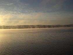 Lake Carmi at Sunrise looking east | |
| Location | Franklin County, Vermont |
| Coordinates | 44°58′N 72°52′W / 44.967°N 72.867°WCoordinates: 44°58′N 72°52′W / 44.967°N 72.867°W |
| Basin countries | United States |
| Surface area | 1,375 acres (5.56 km2) |
| Average depth | 20 ft (6.1 m) |
| Max. depth | 33 ft (10 m) |
| Surface elevation | 436 ft (133 m) |
Lake Carmi is a small and relatively shallow lake located in the town of Franklin, in the northwest corner of Vermont, United States. It is the fourth largest lake, and has a 1,375 acres (5.56 km2) surface area, an average depth of 20 ft (6.1 m) and a maximum depth of 33 ft (10 m).
Lake Carmi supports many species of fish, including northern pike and walleye. The lake drains northwards into the Pike River in Quebec. Lake Carmi was once much larger. In the thousands of years since the last ice age, the southern end of the original lake has silted in, creating wetland forests and the third largest peat bog in Vermont
At the southern end of the lake, Lake Carmi State Park offers camping facilities. Vermont Route 120 runs along the northern shoreline.
External links
- Wildernet
- "The Cottage on the Island" (PDF). Lake Carmi Association News. July 2007. pp. 7–8.
- U.S. Geological Survey Geographic Names Information System: Lake Carmi