Lake Burragorang
| Lake Burragorang | |
|---|---|
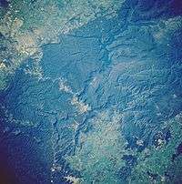
 from the air (April 2006) | |
| Coordinates | 34°0′S 150°26′E / 34.000°S 150.433°ECoordinates: 34°0′S 150°26′E / 34.000°S 150.433°E |
| Type | Man-made water supply dammed reservoir |
| Primary inflows | Coxs, Kowmung, Nattai, Wingecarribee, Wollondilly and Warragamba rivers |
| Primary outflows | Warragamba River |
| Catchment area | 9,051 km2 (3,495 sq mi) |
| Basin countries | Australia |
| Max. length | 52 km (32 mi) |
| Surface area | 75 km2 (29 sq mi) |
| Max. depth | 105 m (344 ft) |
| Water volume | 2,031 GL (4.47×10¹¹ imp gal; 5.37×10¹¹ US gal) |
| Shore length1 | 354 km (220 mi) |
| Surface elevation | 110 m (360 ft) |
| 1 Shore length is not a well-defined measure. | |

Lake Burragorang is an Australian man-made water supply dammed reservoir.
Lake Burragorang is impounded by Warragamba Dam and is located in the lower Blue Mountains of New South Wales, within the Greater Blue Mountains Area World Heritage Site. The 2,031-gigalitre (4.47×10¹¹ imp gal; 5.37×10¹¹ US gal) reservoir collects water from the converged flows of the Coxs, Kowmung, Nattai, Wingecarribee, Wollondilly, and Warragamba rivers and their associated tributaries. The reservoir is the major water storage for greater metropolitan Sydney, and its dam wall is located approximately 60 kilometres (37 mi) southwest of the Sydney central business district.
Pre-lake history
Before the construction of the dam, Burragorang Valley had been inhabited by white settlers since the 19th century, and for thousands of years before, the Burragorang valley was part of the tribal lands of the Gundungarra nation, an indigenous tribe that called the Burragorang valley, along with the Blue Mountains and Megalong Valley, their tribal land. A number of farming towns (including the town of Burragorang) and coal mines were located in the area. All of these are now underwater.[1] Construction of Warragamba dam commenced in 1948 and was completed in 1960.
Capacity
The reservoir's usable capacity is 2,027 gigalitres (4.46×10¹¹ imp gal; 5.35×10¹¹ US gal). Prior to April 2006, the usable capacity was 1,857 gigalitres (4.08×10¹¹ imp gal; 4.91×10¹¹ US gal), before the Deep Water Storage Recovery project was completed. There are fears, however, that population pressures may stretch the reservoir's ability to furnish Sydney residents with needed water well into the 21st century.[2] The city's population is rising by about 50,000 every year, and while water restrictions were imposed late in 2003, a serious drought could complicate matters.
There have been times when the reservoir has become seriously depleted. On 8 February 2007 the lake recorded an all-time low of 32.5% of capacity, although by late 2008 the water level had returned to 60% of capacity.[3] To prevent any chance of water supply failure, the NSW Government authorised the construction and operation of the Sydney Desalination Plant to augment Sydney's water supply.
The dam reached maximum capacity and spilled in March 2012, the first time it had done so in fourteen years.[4]
Public access
Lake Burragorang is surrounded by a 3 kilometres (1.9 mi) wide exclusion zone to protect the integrity of the water supply; access into this zone is restricted. There are two access corridors for bushwalkers: Coxs River to Mount Cookem and Belloon Pass to Yerranderie.[5] Limited public vehicle access is allowed on fire trail W4 from Sheahys Creek to Yerranderie.
Power station
A hydroelectric power station at Warragamba Dam begins operating once the level in the reservoir reaches to within 1 metre (3 ft 3 in) of full capacity. Its output is 50 megawatts (67,000 hp),[6] but the dam water level has not been high enough for it to operate since 1998.
Statistical overview
| Key reservoir statistics[7] | |
|---|---|
| Available storage (when full) | 2,027 gigalitres (4.46×10¹¹ imp gal; 5.35×10¹¹ US gal) |
| Total capacity (when full) | 2,031 gigalitres (4.47×10¹¹ imp gal; 5.37×10¹¹ US gal) |
| Surface area | 75 square kilometres (29 sq mi) |
| Length of lake | 52 kilometres (32 mi) |
| Length of foreshores | 354 kilometres (220 mi) |
| Deepest point | 105 metres (344 ft) |
| Catchment area | 9,051 square kilometres (3,495 sq mi) |
| Average annual rainfall | 840 millimetres (33 in) |
See also
| Wikimedia Commons has media related to Lake Burragorang. |
References
- ↑ "Natural Attractions - Burragorang Valley, Lake Burragorang" stonequarry.com.au
- ↑ ""Coxs River Carrying Capacity"" (PDF).
- ↑ "Weekly storage and supply report: 4 December 2008". Sydney Catchment Authority. 4 December 2008. Retrieved 4 December 2008.
- ↑ "Warragamba Dam to spill Friday morning: BoM". ABC News. Australia. 2 March 2012. Retrieved 2 March 2012.
- ↑ Paton, Neil (2004). Sydney and Blue Mountains Bushwalks. Sydney: Kangaroo Press. p. 339.
- ↑ "Hydro Power Stations: Warragamba". Generation Portfolio. Eraring Energy. Retrieved 3 March 2012.
- ↑ "Warragamba Dam facts". Major SCA dams: Warragamba Dam. Sydney Catchment Authority. 8 March 2011. Retrieved 6 April 2013.