Lahachok
| Lahachowk लाहाचोक | |
|---|---|
| Village Development Committee | |
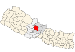
 Lahachowk Location in Nepal | |
| Coordinates: 28°19′N 83°55′E / 28.31°N 83.92°ECoordinates: 28°19′N 83°55′E / 28.31°N 83.92°E | |
| Country | Nepal |
| Zone | Gandaki Zone |
| District | Kaski District |
| Population (1991) | |
| • Total | 3,188 |
| Time zone | Nepal Time (UTC+5:45) |
Lahachowk ( Nepali : लाहाचोक ) is a village and Village Development Committee (VDC) in Kaski District in the Gandaki Zone of northern-central Nepal. According to the 2011 National Population and Housing Census, it had a population of 3,129 in 829 individual households.[1]
Lahachowk VDC is not far from Mount Machhapuchchhre, a mountain in the Annapurna Himal. The village is at the altitude of 1,200 metres (3,937 ft) above sea level. It is about 13 km (8 mi) north-west of Pokhara. The village is ethnically and culturally diverse. Major ethnic groups in the village are Brahmin (43%), Dalit (28%), Chhetri (including Thakuri) (14%), and indigenous groups such as Gurung, Newar and Magar. The society is largely based on a caste structure. Higher castes like Brahmin and Chhetri have greater access to and control over resources and means of production. The people of higher caste generally have a higher educational status. The Hindu religion predominates, followed by Buddhism and a small number of Christians. The society in Lahachowk is a patriarchal one. The major occupation in the village is agriculture, which occupies around 46.7% of the population. Next are the labourers, up to 30.9%. Around 5.3% are working abroad, and government jobs account for 4.9%. Other jobs occupy around 11.5%, while business accounts for just 0.7%.
References
- ↑ "Nepal Census 2001". Nepal's Village Development Committees. Digital Himalaya. Retrieved 30 September 2008.
National Population and Housing Census, 2011