Ladwa
| Ladwa | |
|---|---|
| Town | |
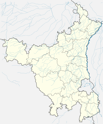 Ladwa  Ladwa Location in Haryana, India | |
| Coordinates: 29°59′45″N 77°02′24″E / 29.99583°N 77.04000°ECoordinates: 29°59′45″N 77°02′24″E / 29.99583°N 77.04000°E | |
| Country |
|
| State | Haryana |
| District | Kurukshetra |
| Elevation | 209 m (686 ft) |
| Population (2011) | |
| • Total | 28,887 |
| Languages | |
| • Official | Hindi |
| Time zone | IST (UTC+5:30) |
| PIN | 136132 |
| Telephone code | 01744 |
| Vehicle registration | HR 07 |
| Sex ratio | 1.133 males/female ♂/♀ |
| Website |
haryana |
Ladwa is a town and a municipal committee in Kurukshetra district in the Indian state of Haryana. In 2007, Ladwa legislative assembly constituency was created[1] comprising 126,704 registered voters and come under Kurukshetra (Lok Sabha constituency). The Member of Parliament is Raj Kumar Saini & Member of the Legislative Assembly (India) is Pawan Saini.
Geography
Ladwa has an average elevation of 209 m (686 ft). It is located on the Kurukshetra - Yamunanagar - Saharanpur road and is also close to the towns of Shahbad, Radaur and Indri, India. The nearest major Highway is National Highway 1 (India) known as Grand Trunk Road which is 14.5 km (9.0 mi) west direction of downtown. Ladwa has one of the best new grain markets all over Asia.
Sub-Tehsil
Ladwa is a sub-tehsil which comes under Thanesar-Tehsil and represent 53 villages, 10 Patwar circles and 1 Kanungo circle.
Villages
Antehri, Badachpur, Badarpur, Bahlolpur, Bakali, Ban, Bani, Bapda, Bapdi, Barhan, Baronda, Barondi, Barot, Barshami, Bartoli, Bhallar, Bhoot Majra, Bir Bartoli, Bir Kheri, Bir Sonti, Bodla, Budha, Chhailondi, Chhapra, Chhar Pura, Dab Khera, Dhanora Jattan, Dhiangla, Duda, Dudhi, Dugari, Gadli, Gajlana, Gangori, Gharaula, Girdhar Pura, Gobindgarh, Gudha, Gudhi, Halal Pur, Jainpur Jattan, Jandhera, Jogi Majra, Kalirano, Karami, Khaira, Kharkali, Kheri, Kheri Dabdalan, Kheri Gadian, Ladwa, Lathi Dhanora, Lohara, Mehra, Mumkar Pur, Murad Nagar, Niwarsi, Prahlad Pur, Salem Pur, Samalkha, Sonti, Sultan Pur with Patak Majra, Sura, Bir Pipli, Pipli, Untehri.HALALPUR
Demographics
According to the 2011 Census of India,[2] Ladwa has a total population of 28,887 person comprising 15345 Males and 13542 Females. Males constitute 53.1% and females 46.87% of the population. Ladwa has an average literacy rate of 72.3%, lower than the national average of 72.99%: male literacy is 76.3%, and female literacy is 67.8%. In Ladwa, 12.4% of the population lies between age group 0-6 years.
Education
Public schools
- Government Senior Secondary School
- Government Girls High School
- Jawahar Navodaya Vidyalaya
Private schools
- Hindu High School(Govt. Aided)[3]
- Guru Nanak High School(Govt. Aided)
- Sant Nischal Singh Public School
- New Janta Sr. Sec. School
- Sugni Devi Arya Girls Sr. Sec. School
- Om Parkash Garg Memorial Public School
- Doon Public School
- Unique Shiksha Niketan
- Jai Bharat High School
- Tagore High School
- Sanjay Gandhi Memorial Public School
Colleges and universities
The major center for the education is Kurukshetra University, situated in the Kurukshetra district. Indira Gandhi National College is one of the oldest degree college located in Village Dhanora. In addition, other private colleges of education, engineering, polytechnic are located in town and nearby area.
Public health care
Community Health Center and Primary Health Center is the only government infrastructure which serves local community.
Transportation
The diverse connection of rural roads and state highways provides well-connectivity to the city.
Airports
Indira Gandhi International Airport is the nearest major airport which is situated at a distance of 180 kilometres (112 mi).Chandigarh Airport is being integrated with upcoming Chandigarh International Airport; is the only commercial domestic airport situated in the proximity of approx. 106 kilometres (66 mi).
Rail
The closest Train Stations are located at Kurukshetra, Yamunanagar, Karnal and Ambala. The divisional headquarters of Northern Railway Zone (India) and major Train station are located at Ambala Cantonment in the Ambala.
Road
The road transportation is provided by Haryana Roadways which runs on all the Inter State and City routes. Moreover, Village are well-connected by Bus.
References
- ↑ http://eci.nic.in/delim/Final_Publications/Haryana/Final_Order_NOTIFICATION.pdf
- ↑ http://www.censusindia.gov.in/pca/pca.aspx. Missing or empty
|title=(help) - ↑ http://www.schooleducationharyana.gov.in/downloads_pdf/stat/06%20List%20of%20Aided%20Schools.pdf
- General references
- http://www.schooleducationharyana.gov.in/Schools.html
- http://haryana.gov.in/
- http://www.schooleducationharyana.gov.in/CBSE.html
- http://haryanahealth.nic.in/userfiles/file/pdf/Planning/DISTRICTWISE%20COMMUNITY%20%20HEALTH%20CENTRES12102012.pdf
- http://www.kurukshetra.nic.in/AtAGlance/basicstat.htm
External links
Kurukshetra district topics | ||
|---|---|---|
| History |  | |
| Cities and towns | ||
| Education | ||
| Tourist attractions | ||
| Transport | ||
| Lok Sabha constituencies | ||