La Union
| La Union | ||
|---|---|---|
| Province | ||
| Province of La Union | ||
|
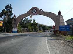
Welcome arch at the La Union-Ilocos Sur border | ||
| ||
 Location in the Philippines | ||
| Coordinates: 16°30′N 120°25′E / 16.5°N 120.42°ECoordinates: 16°30′N 120°25′E / 16.5°N 120.42°E | ||
| Country | Philippines | |
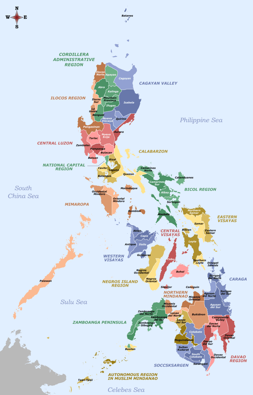
| Region | Ilocos Region (Region I) | |
| Founded | March 2, 1850 | |
| Capital | San Fernando | |
| Government | ||
| • Type | Sangguniang Panlalawigan | |
| • Governor | Manuel "Manoling" C. Ortega (NPC) | |
| • Vice Governor | Aureo Nisce (NPC) | |
| Area[1] | ||
| • Total | 1,497.7 km2 (578.3 sq mi) | |
| Area rank | 69th out of 81 | |
| Population (2015 census)[2] | ||
| • Total | 786,653 | |
| • Rank | 36th out of 81 | |
| • Density | 530/km2 (1,400/sq mi) | |
| • Density rank | 9th out of 81 | |
| Divisions | ||
| • Independent cities | 0 | |
| • Component cities | ||
| • Municipalities | ||
| • Barangays | 576 | |
| • Districts | 1st and 2nd districts of La Union | |
| Time zone | PHT (UTC+8) | |
| ZIP code | 2500–2520 | |
| ISO 3166 code | PH-LUN | |
| Languages | ||
| Website |
www | |

La Union (Ilocano: Probinsia ti La Union; Pangasinan: Luyag na La Union; Tagalog: Lalawigan ng La Union), is a province in the Philippines located in the Ilocos Region in the island of Luzon. Its capital is the city of San Fernando, which also serves as the regional center of the whole Ilocos Region.
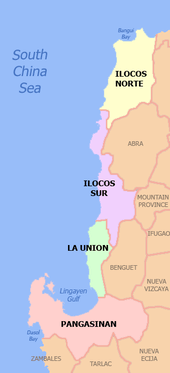
The province is bordered by Ilocos Sur to the north, Benguet to the east, Pangasinan to the south and to the west by the shores of the South China Sea (West Philippine Sea).
History
La Unión, "The Union" in Spanish, was formed in 1850 when the Spanish colonial government of Governor-General Antonio Maria Blanco merged the three southern towns of Ilocos Sur province, the nine northern towns of Pangasinan, and the western towns of Benguet to the east (Eastern Pais del Igorotes in the Cordilleras). Pangasinenses were the majority in the new province because most towns had been in the province of Pangasinan.
On October 29, 1849, Governor General Claveria issued a promovido to fuse the Pangasinan-Ilocos-Cordillera areas into La Union. On March 2, 1850, Governor General Antonio Maria Blanco signed the Superior Decreto of La Union (34th province from Cebu-1565), with Captain Toribio Ruiz de la Escalera as the first Gobernador Military y Politico. Isabella II of Spain decreed the province's creation on April 18, 1854. In 1661, Andres Malong (Pangasinan) failed to recover La Union from the Spaniards after the Battle of Agoo.[3] In 1896, the people of La Union began a revolt against the Spaniards, who had called La Union "Una Provincia Modelo" ("A Model Province"), led by Manuel Tinio Y Bondoc under Emilio Aguinaldo. The Americans collaborated with the Filipinos to end the Spanish.
Dr. Lucino Almeida became the Presidente Provincial of the American regime, followed by the election of La Union’s first Civil Governor in 1901, Don Joaquin Joaquino Ortega.[4]
On January 4, 1945, La Union was liberated by the Battle of San Fernando and Bacsil Ridge.[3]
Geography
La Union covers a total area of 1,497.7 square kilometres (578.3 sq mi)nscb occupying the central‑southern section of the Ilocos Region in Luzon. The province is bordered by Ilocos Sur to the north, Benguet to the east, Pangasinan to the south, and to the west by the South China Sea.
La Union is 273 kilometres (170 mi) north of Metro Manila and 57 kilometres (35 mi) northwest of Baguio City. The land area of the province is 149,770 hectares (370,100 acres).[5]
Like most of the Ilocos Region, the province is squeezed in by the Cordillera mountain range to the east and the South China Sea to the west. Yet, unlike other portions of Luzon and the Philippines' two other island groupings, the Visayas and Mindanao, La Union experiences a rather arid and prolonged dry season with little precipitation to be expected between the months of November and May.
|


Administrative divisions
La Union comprises 19 municipalities and 1 component city,[6] all of which are organized into two legislative districts.nscb
- † Provincial capital and component city
- Municipality
| |||||||||||||||||||||||||||||||||||||||||||||||||||||||||||||||||||||||||||||||||||||||||||||||||||||||||||||||||||||||||||||||||||||||||||||||||||||||||||||||||||||||||||||||||||||||||||||||||||||||||||||||||||||||||||||||||||||||||||||||||||||||||||||||||||||||||||||||||||||||||||||||||||||||||||||||||
Barangays
La Union has a total of 576 barangays comprising its 19 municipalities and 1 city.[6]
The most populous barangay in the province is Sevilla in the City of San Fernando with a population of 10,612 in the 2010 census. If cities are excluded, Central East (Poblacion) in the municipality of Bauang has the highest number of inhabitants, at 4,249. Caggao in Bangar has the lowest with only 170.[6]
Demographics
| Population census of La Union | ||
|---|---|---|
| Year | Pop. | ±% p.a. |
| 1990 | 548,742 | — |
| 1995 | 597,442 | +1.61% |
| 2000 | 657,945 | +2.09% |
| 2007 | 720,972 | +1.27% |
| 2010 | 741,906 | +1.05% |
| 2015 | 786,653 | +1.12% |
| Source: National Statistics Office[2][6][6] | ||
The population of La Union in the 2015 census was 786,653 people,[2] with a density of 530 inhabitants per square kilometre or 1,400 inhabitants per square mile.
The province is predominantly Ilocano (over 90% based on recent census data) and Roman Catholic. communities of Pangasinenses thrive mostly in the southwestern portion of the province while Cordillerans live in the Cordillera foothills. In September 2012, the province of La Union passed an ordinance recognizing Ilocano (Iloko) as an official provincial language, the other is Pangasinan, the second official provincial language alongside Filipino and English, as national and official languages of the Philippines, respectively. It is the first province in the Philippines to pass an ordinance protecting and revitalizing a native regional language.
Economy


La Union is known for its softbroom industry.[7] The economy is diversified with service, manufacturing, and agricultural industries spread throughout the province. The Port of San Fernando operates as an increasingly active shipping point, and the former American airbase Wallace Air Station, having been converted into a business and industrial area, helps to facilitate such commercial activity.
The major products of the province include: hand-woven blankets (Inabel), softbrooms, baskets, pottery, rice wine (tapuey), sugarcane wine (basi), sugarcane vinegar, wood craft, bamboo craft, native rice cakes, antique-finish furniture, dried fish, coconuts, sea urchins, malunggay, and pebble stones.[8]
Education
La Union has 333 public elementary schools, 56 private elementary schools, 79 public high schools, 51 private secondary schools, 20 Colleges and 5 State Universities.[9]
Provincial government and politics
Just as the national government, La Union provincial government is divided into three branches: executive, legislative and judiciary. The judicial branch is administered solely by the Supreme Court of the Philippines. The LGUs have control of the executive and legislative branch.
The executive branch is composed of the governor for the provinces, mayor for the cities and municipalities, and the barangay captain for the barangays.[10]
The legislative branch is composed of the Sangguniang Panlalawigan (provincial assembly) for the provinces, Sangguniang Panlungsod (city assembly) for the cities, Sangguniang Bayan (town assembly) for the municipalities, Sangguniang Barangay (barangay council), and the Sangguniang Kabataan for the youth sector.
The seat of Government is vested upon the Mayor and other elected officers who hold office at the City Hall of San Fernando. The Sanguniang Bayan is the center of legislation, stationed in the Speaker Pro-Tempore Francisco I. Ortega Building, the Legislative Building at the back of the Capitol.


Elected officials
La Union is governed by Manuel C. Ortega, the Chief Executive, his Vice-Governor, Aureo Augusto Nisce and 13 Board Members.[11]
Former Governors
Dr. Lucino Almeida became the Presidente Provincial of the American regime, followed by the election of La Union’s first Civil Governor in 1901, Don Joaquin Joaquino Ortega, Grandfather of Governor Manuel C. Ortega. 9 Governors succeeded Don Joaquin before World War II: Joaquin Luna, 1904-1907, Sixto Zandueta, 1908-1919, Pio Ancheta 1919-1922, 1931, Thomas De Guzman, 1922-1923, 1928-1931, Juan Lucero, 1923-1929, Mauro Ortiz, 1931-1934, Juan Rivera, 1934-1937, Francisco Nisce, 1937-1940 and Bernardo Gapuz, 1940. Gov. Bernardo Gapuz (1940), Gov. Jorge Camacho (1941-1942) and Gov. Bonifacio Tadiar (1942-1944) thereafter succeeded these 9.[12]
Agaton Yaranon, 1946-1947 was succeeded by Governors: Doroteo Aguila, 1948-1951, Juan Carbonell, 1952-1955, Bernardo Gapuz, 1956-1959, Eulogio De Guzman, 1960-1967, Juvenal Guerrero, 1968-1977, Tomas Asprer, 1977-1986, Robert V. Dulay, 1986-1987, Joaquin Ortega, 1988-1992, Justo O. Orros, 1992-2001, Victor F. Ortega, 2001-2007 and Manuel C. Ortega, 2007–present.[3]
Court system
The Supreme Court of the Philippines recognizes La Union (inter alia) regional trial courts and metropolitan or municipal trial courts within the province and towns, that have an over-all jurisdiction in the populace of the province and towns, respectively.[13]
Batas Pambansa Blg. 129, "The Judiciary Reorganization Act of 1980", as amended, created Regional, Metropolitan, Municipal Trial and Circuit Courts. The Third Judicial Region includes RTCs in La Union xxx Sec. 14. Regional Trial Courts. (a) Fifty-seven Regional Trial Judges shall be commissioned for the First Judicial Region. Nine branches (Branches XXVI to XXXIV) for the province of La Union, Branches XXVI to XXX with seats at San Fernando, Branches XXXI and XXXII at Agoo, Branch XXXIII at Bauang, and Branch XXXIV at Balaoan;
The law also created Metropolitan Trial Courts in each metropolitan area established by law, a Municipal Trial Court in each of the other cities or municipalities, and a Municipal Circuit Trial Court in each circuit comprising such cities and/or municipalities as are grouped together pursuant to law: three branches for Cabanatuan City; in every city which does not form part of a metropolitan area, there is also a Municipal Trial Court with one branch, except as provided: Two branches for San Fernando, La Union;[14]
The courts of law are stationed in Halls of Justices of the Province and towns. In La Union, the Regional Trial Court is stationed at the Bulwagan ng Katarungan or Halls of Justice in San Fernando, La Union and other Regional Trial Courts in Bauang and Agoo, La Union.
Notable people from La Union
- Diego Silang (1730–1763) — a revolutionary leader
- Magnolia Antonino (1915–2010) — Senator of the Philippines
- Camilo Osias (1889–1976) — Filipino politician, twice for a short time President of the Senate of the Philippines.
- Gloria Diaz (born 1951) — Miss Philippines 1969, Miss Universe 1969
- JB Magsaysay (born 1980) — Pinoy Big Brother (season 1) housemate; Actor, public servant and businessman
- Vice Ganda — Singer, Actor, Comedian
- Aiyanna Camille Mikiewicz (1988) — Miss Tourism World Philippines 2013, Miss Tourism World - Asia 2013
References
- ↑ "List of Provinces". PSGC Interactive. Makati City, Philippines: National Statistical Coordination Board. Retrieved 30 July 2013.
- 1 2 3 4 "Region I (ILOCOS REGION)". Census of Population (2015): Total Population by Province, City, Municipality and Barangay (Report). PSA. Retrieved 20 June 2016.
- 1 2 3 La Union Profile: La Union History - Province of La Union :: Official Website
- ↑ La Union Profile: Gallery of Governors - Province of La Union :: Official Website
- ↑
- 1 2 3 4 5 6 "Region I (ILOCOS REGION)". Census of Population and Housing (2010): Total Population by Province, City, Municipality and Barangay (Report). NSO. Retrieved 29 June 2016.
- ↑ Rudio, Israel O. "La Union Soft Brooms: The First and the Original". Provincial Government of La Union (Official Website). Retrieved 18 May 2016.
- ↑ "Business - Major Products". Provincial Government of La Union (Official Website). Retrieved 18 May 2016.
- ↑ "Education". Provincial Government of La Union. Archived from the original on 27 September 2010. Retrieved 16 April 2016.
- ↑ Local Government Code of the Philippines, Book III, Department of Interior and Local Government official website.
- ↑ "Gobierno ti La Union". Provincial Government of La Union (Official Website). Retrieved 18 May 2016.
- ↑ La Union Profile: Gallery of Governors - Province of La Union :: Official Website
- ↑ Philippine Laws, Statutes And Codes - Chan Robles Virtual Law Library
- ↑ "Batas Pambansa Bilang 129; An Act Reorganizing the Judiciary, Appropriating Funds Therefor, and for Other Purposes.". Chan Robles Virtual Law Library. 14 August 1981. Retrieved 18 May 2016.
External links
-
 Media related to La Union at Wikimedia Commons
 -
 Geographic data related to La Union at OpenStreetMap
 - Official Website of the Provincial Government of La Union
- Philippine Standard Geographic Code
 |
Ilocos Sur | | ||
| South China Sea | |
Benguet | ||
| ||||
| | ||||
| Lingayen Gulf | Pangasinan |