La Rochette, Savoie
| La Rochette | ||
|---|---|---|
|
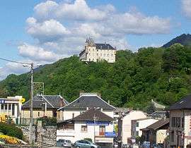
The centre of La Rochette, and the chateau | ||
| ||
 La Rochette | ||
|
Location within Auvergne-Rhône-Alpes region  La Rochette | ||
| Coordinates: 45°27′34″N 6°07′16″E / 45.4594°N 6.1211°ECoordinates: 45°27′34″N 6°07′16″E / 45.4594°N 6.1211°E | ||
| Country | France | |
| Region | Auvergne-Rhône-Alpes | |
| Department | Savoie | |
| Arrondissement | Chambéry | |
| Canton | La Rochette | |
| Intercommunality | La Rochette–Val Gelon | |
| Government | ||
| • Mayor (2008–2014) | André Durand | |
| Area1 | 4.66 km2 (1.80 sq mi) | |
| Population (2006)2 | 3,307 | |
| • Density | 710/km2 (1,800/sq mi) | |
| Time zone | CET (UTC+1) | |
| • Summer (DST) | CEST (UTC+2) | |
| INSEE/Postal code | 73215 / 73110 | |
| Elevation | 322–807 m (1,056–2,648 ft) | |
| Website | www.la-rochette.com | |
|
1 French Land Register data, which excludes lakes, ponds, glaciers > 1 km² (0.386 sq mi or 247 acres) and river estuaries. 2 Population without double counting: residents of multiple communes (e.g., students and military personnel) only counted once. | ||
.svg.png)
La Rochette is a commune in the Savoie department in the Auvergne-Rhône-Alpes region in south-eastern France.
See also
References
External links
| Wikimedia Commons has media related to La Rochette (Savoie). |
This article is issued from Wikipedia - version of the 10/28/2016. The text is available under the Creative Commons Attribution/Share Alike but additional terms may apply for the media files.