La Perrière, Savoie
| La Perrière | |
|---|---|
|
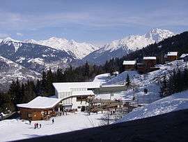
La Tania ski station, in the commune of La Perrière | |
 La Perrière | |
|
Location within Auvergne-Rhône-Alpes region  La Perrière | |
| Coordinates: 45°26′45″N 6°35′40″E / 45.4458°N 6.5944°ECoordinates: 45°26′45″N 6°35′40″E / 45.4458°N 6.5944°E | |
| Country | France |
| Region | Auvergne-Rhône-Alpes |
| Department | Savoie |
| Arrondissement | Albertville |
| Canton | Bozel |
| Government | |
| • Mayor (2014 –) | Rémy Ollivier |
| Area1 | 9.96 km2 (3.85 sq mi) |
| Population (2006)2 | 428 |
| • Density | 43/km2 (110/sq mi) |
| Time zone | CET (UTC+1) |
| • Summer (DST) | CEST (UTC+2) |
| INSEE/Postal code | 73198 / 73120 |
| Elevation | 599–2,527 m (1,965–8,291 ft) |
|
1 French Land Register data, which excludes lakes, ponds, glaciers > 1 km² (0.386 sq mi or 247 acres) and river estuaries. 2 Population without double counting: residents of multiple communes (e.g., students and military personnel) only counted once. | |
La Perrière is a commune in the Savoie department in the Auvergne-Rhône-Alpes region in south-eastern France.
See also
References
| Wikimedia Commons has media related to La Perrière (Savoie). |
This article is issued from Wikipedia - version of the 10/28/2016. The text is available under the Creative Commons Attribution/Share Alike but additional terms may apply for the media files.