La Condamine-Châtelard
| La Condamine-Châtelard | |
|---|---|
|
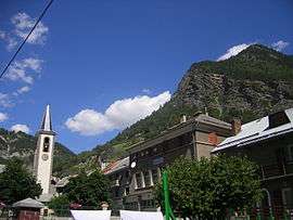
The church, school and surrounding buildings in La Condamine-Châtelard | |
 La Condamine-Châtelard | |
|
Location within Provence-A.-C.d'A. region  La Condamine-Châtelard | |
| Coordinates: 44°27′32″N 6°44′47″E / 44.4589°N 6.7464°ECoordinates: 44°27′32″N 6°44′47″E / 44.4589°N 6.7464°E | |
| Country | France |
| Region | Provence-Alpes-Côte d'Azur |
| Department | Alpes-de-Haute-Provence |
| Arrondissement | Barcelonnette |
| Canton | Barcelonnette |
| Intercommunality | Vallée de l'Ubaye |
| Government | |
| • Mayor (2008–2014) | François Honoré |
| Area1 | 56.08 km2 (21.65 sq mi) |
| Population (2008)2 | 149 |
| • Density | 2.7/km2 (6.9/sq mi) |
| Time zone | CET (UTC+1) |
| • Summer (DST) | CEST (UTC+2) |
| INSEE/Postal code | 04062 / 04530 |
| Elevation |
1,239–3,047 m (4,065–9,997 ft) (avg. 1,305 m or 4,281 ft) |
|
1 French Land Register data, which excludes lakes, ponds, glaciers > 1 km² (0.386 sq mi or 247 acres) and river estuaries. 2 Population without double counting: residents of multiple communes (e.g., students and military personnel) only counted once. | |
La Condamine-Châtelard is a commune in the Alpes-de-Haute-Provence department in southeastern France.
Population
| Historical population | ||
|---|---|---|
| Year | Pop. | ±% |
| 1765 | 703 | — |
| 1793 | 590 | −16.1% |
| 1800 | 580 | −1.7% |
| 1806 | 691 | +19.1% |
| 1821 | 602 | −12.9% |
| 1831 | 586 | −2.7% |
| 1836 | 569 | −2.9% |
| 1841 | 572 | +0.5% |
| 1846 | 612 | +7.0% |
| 1851 | 563 | −8.0% |
| 1856 | 600 | +6.6% |
| 1861 | 997 | +66.2% |
| 1866 | 600 | −39.8% |
| 1872 | 566 | −5.7% |
| 1876 | 533 | −5.8% |
| 1881 | 541 | +1.5% |
| 1886 | 996 | +84.1% |
| 1891 | 1,166 | +17.1% |
| 1896 | 1,245 | +6.8% |
| 1901 | 1,203 | −3.4% |
| 1906 | 1,191 | −1.0% |
| 1911 | 1,160 | −2.6% |
| 1921 | 409 | −64.7% |
| 1926 | 415 | +1.5% |
| 1931 | 415 | +0.0% |
| 1936 | 781 | +88.2% |
| 1946 | 98 | −87.5% |
| 1954 | 237 | +141.8% |
| 1962 | 185 | −21.9% |
| 1968 | 200 | +8.1% |
| 1975 | 195 | −2.5% |
| 1982 | 198 | +1.5% |
| 1990 | 168 | −15.2% |
| 1999 | 166 | −1.2% |
| 2008 | 149 | −10.2% |
See also
References
| Wikimedia Commons has media related to La Condamine-Châtelard. |
This article is issued from Wikipedia - version of the 2/12/2016. The text is available under the Creative Commons Attribution/Share Alike but additional terms may apply for the media files.