L'Île-Saint-Denis
| L'Île-Saint-Denis | ||
|---|---|---|
|
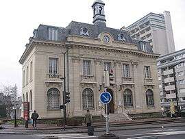
The town hall of L'Île-Saint-Denis | ||
| ||
 Paris and inner ring departments | ||
| Coordinates: 48°56′00″N 2°20′00″E / 48.9333°N 2.3333°ECoordinates: 48°56′00″N 2°20′00″E / 48.9333°N 2.3333°E | ||
| Country | France | |
| Region | Île-de-France | |
| Department | Seine-Saint-Denis | |
| Arrondissement | Saint-Denis | |
| Canton | Saint-Denis-Sud | |
| Intercommunality | Plaine Commune | |
| Government | ||
| • Mayor (2008–2014) | Michel Bourgain | |
| Area1 | 1.77 km2 (0.68 sq mi) | |
| Population (2006)2 | 7,123 | |
| • Density | 4,000/km2 (10,000/sq mi) | |
| Time zone | CET (UTC+1) | |
| • Summer (DST) | CEST (UTC+2) | |
| INSEE/Postal code | 93039 / 93450 | |
|
1 French Land Register data, which excludes lakes, ponds, glaciers > 1 km² (0.386 sq mi or 247 acres) and river estuaries. 2 Population without double counting: residents of multiple communes (e.g., students and military personnel) only counted once. | ||
L'Île-Saint-Denis (i.e. the Saint-Denis island) is a commune in the northern suburbs of Paris, France. It is located 9.4 km (5.8 mi) from the center of Paris.
The commune is entirely contained on an island of the Seine River, hence its name.
Heraldry
.svg.png) |
The arms of L'Île-Saint-Denis are blazoned : Azure, a castle argent pierced and masoned sable extended by walls argent masoned sable, open of the field, and on a chief Or, a cross gules between 4 alerions azure. |
Transport
Several transit connections are located nearby. The closest station to L'Île-Saint-Denis is Saint-Denis station, which is an interchange station on Paris RER line D and on the Transilien Paris – Nord suburban rail line. This station is located in the neighboring commune of Saint-Denis, 0.4 km (0.25 mi) from the town center of L'Île-Saint-Denis.
Tram T1 stops near Île-Saint-Denis's town hall. Bus route 237 runs along the length of the island.
Demographics
The island is the result of the reunion of several smaller islands (which helps explain its current length): L’île Saint-Denis, l’île Saint-Ouen, l’île des Vannes[1] and l'île du Châtelier.
Since the 1960s L'Île-Saint-Denis housed immigrants, mostly from North African countries. Nadir Dendoune, a local author, said that L'Île-Saint-Denis had racial and ethnic diversity in the 1980s, as the neighborhood housed various groups of poor people, including Arabs, Black people, ethnic French, and other Europeans, and that at that time half of the students in area schools were White. In 2005, according to Dendoune, few of the students were White.[2]
Education
There are three primary schools in the commune: École Samira Bellil, École Paul Langevin, and École Jean Lurçat.[3]
Collège Alfred Sisley, a junior high school, is on the island.[4]
See also
References
- ↑ Saint-Ouen au fil de l'eau
- ↑ "Ghettos shackle French Muslims." BBC. Monday 31 October 2005. Retrieved on 17 June 2010.
- ↑ "Ecoles/inscriptions." L'Île-Saint-Denis. Retrieved on September 9, 2016.
- ↑ Home. Collège Alfred Sisley. Retrieved on September 9, 2016.
External links
| Wikimedia Commons has media related to L'Île-Saint-Denis. |