L'Épine, Marne
| L'Épine | |
|---|---|
|
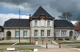
Town hall | |
 L'Épine | |
|
Location within Grand Est region  L'Épine | |
| Coordinates: 48°58′39″N 4°28′15″E / 48.9775°N 4.4708°ECoordinates: 48°58′39″N 4°28′15″E / 48.9775°N 4.4708°E | |
| Country | France |
| Region | Grand Est |
| Department | Marne |
| Arrondissement | Châlons-en-Champagne |
| Canton | Marson |
| Intercommunality | Châlons-en-Champagne |
| Government | |
| • Mayor (2001–2008) | Jean-Pierre Adam |
| Area1 | 30.51 km2 (11.78 sq mi) |
| Population (1999)2 | 648 |
| • Density | 21/km2 (55/sq mi) |
| Time zone | CET (UTC+1) |
| • Summer (DST) | CEST (UTC+2) |
| INSEE/Postal code | 51231 / 51460 |
| Elevation |
100–171 m (328–561 ft) (avg. 156 m or 512 ft) |
|
1 French Land Register data, which excludes lakes, ponds, glaciers > 1 km² (0.386 sq mi or 247 acres) and river estuaries. 2 Population without double counting: residents of multiple communes (e.g., students and military personnel) only counted once. | |
L'Épine is a commune in the Marne department in the Grand Est region of north-eastern France.
It is located 8 km (5.0 mi) east of Châlons-en-Champagne and about 45 km (28 mi) south-east of Reims, on the route nationale N3.
See also
| Wikimedia Commons has media related to L'Épine, Marne. |
This article is issued from Wikipedia - version of the 11/6/2016. The text is available under the Creative Commons Attribution/Share Alike but additional terms may apply for the media files.