Kyambogo
| Kyambogo | |
|---|---|
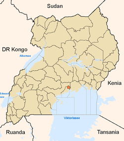
 Kyambogo Map of Uganda showing the location of Kyambogo | |
| Coordinates: 00°20′54″N 32°37′49″E / 0.34833°N 32.63028°E | |
| District | Kampala District |
| Government | |
| • Executive Director | Jennifer Musisi |
| Elevation | 1,240 m (4,070 ft) |
| Time zone | EAT (UTC+3) |
Kyambogo is a neighborhood in Kampala, Uganda. It is within Nakawa Division, an administrative borough of Kampala, Uganda's capital city.
Location
Kyambogo sits on Banda Hill, which rises to an altitude of 1,240 metres (4,070 ft), above sea level. The neighborhood is bordered by Kiwatule to the north, Banda to the east, Kinnawattaka to the southeast, Mbuya to the south, Nakawa to the southwest, Ntinda to the west and northwest. The location of the neighborhood is approximately 10 kilometres (6.2 mi), by road, east of Kampala's central business district.[1] The coordinates of Kyambogo are:0°20'54.0"N 32°37'49.0"E (Latitude:0.348334; Longitude:32.630275).[2]
History
Little is known about the history of Kyambogo prior to 1958. That year, Uganda Polytechnic Kyambogo (UPK) which had been established on Makerere Hill in 1928, was transferred to Kyambogo. Its role was to train Ugandan technicians and artisans. In 1948, the Institute of Teacher Education Kyambogo (ITEK) was established. Its first home was in Nyakasura, Kabarole District. It was subsequently moved to Mbarara and finally to Kyambogo as well. In 1988, the Uganda National Institute of Special Education (UNISE), originally a department at ITEK, was spun off as a separate institution. In 2001, the three institutions were merged to form Kyambogo University, the third public university to be established in Uganda.[3][4]
Points of interest
The points of interest in Kyambogo, include the following:
- Kyambogo University - One of the seven public universities in Uganda
- Kyambogo College School - A mixed, non-residential public secondary school
- Nabisunsa Girls Secondary School - An all-girl residential O-Level and A-Level institution of learning.
- Two branches of Crane Bank
- A branch of Stanbic Bank
See also
References
- ↑ "Road Distance Between Central Kampala And Kyambogo With Distance Indicator". Globefeed.com. Retrieved 18 June 2014.
- ↑ Google, . "Location of Kyambogo At Google Maps". Google Maps. Retrieved 18 June 2014.
- ↑ "Kyambogo University: Historical Background". Kyambogo University. Retrieved 18 June 2014.
- ↑ Kasozi, A.B.K. (30 October 2013). "Merging Kyambogo University Was A Mistake". New Vision. Retrieved 18 June 2014.
External links
Coordinates: 00°20′54″N 32°37′49″E / 0.34833°N 32.63028°E