Kusada
| Kusada | |
|---|---|
| LGA and town | |
| Motto: Kusada Garin Malamai | |
 Kusada Location in Nigeria | |
| Coordinates: 12°28′N 7°59′E / 12.467°N 7.983°ECoordinates: 12°28′N 7°59′E / 12.467°N 7.983°E | |
| Country |
|
| State | Katsina State |
| Established | 1996 |
| Government | |
| • House of Assembly | Abubakar Yahya Kusada |
| Area | |
| • Total | 390 km2 (150 sq mi) |
| Population (2006 census) | |
| • Total | 199,267 |
| Time zone | WAT (UTC+1) |
| 3-digit postal code prefix | 833 |
| ISO 3166 code | NG.KT.KD |
Kusada is a Local Government Area in Katsina State, Nigeria. Its headquarters are in the town of Kusada.
The major ethnic groups are Hausa and Fulani.
Its major Villages includes: Dudunni, Dangamau, Yashe, Mawashi, kofar, Kaikai. The people of Kusada local government are mostly farmers and herdsmen. Their standard of living is well improved as the government had since provided them with social amenities such as, Schools, Hospitals, good tarred roads, boreholes (both manual and solar system), farm boreholes, dams, well organized local markets etc.
Both Government burden and day Secondary and Primary Schools, are located in the Town and some major villages in the local government. The local government is also characterized with government residential area, beautiful jumu'at mosques, good township roads and well named and numbered streets.
It has an area of 390 km² and a population of 199,267 at the 2006 census.
The postal code of the area is 833.[1]
References
- ↑ "Post Offices- with map of LGA". NIPOST. Retrieved 2009-10-20.
State capital: Katsina | ||
| LGAs | 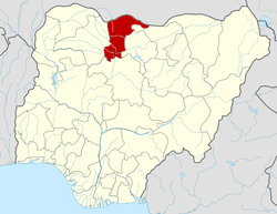 | |