Kuntur Chukuña (Cochabamba)
This article is about the mountain in the Cochabamba Department, Bolivia. For other uses, see Kuntur Chukuña.
| Kuntur Chukuña | |
|---|---|
 Kuntur Chukuña Location in Bolivia | |
| Highest point | |
| Elevation | 4,208 m (13,806 ft) [1] |
| Coordinates | 17°23′26″S 66°35′44″W / 17.39056°S 66.59556°WCoordinates: 17°23′26″S 66°35′44″W / 17.39056°S 66.59556°W |
| Geography | |
| Location |
Bolivia, Cochabamba Department |
| Parent range | Andes |
Kuntur Chukuña (Aymara kunturi condor, chukuña to squat, to cower,[2][3] 'where the condor squats', also spelled Condor Chucuna) is a 4,208-metre-high (13,806 ft) mountain in the Bolivian Andes. It is located in the Cochabamba Department, Tapacari Province.[1][4]
References
- 1 2 Bolivia 1:50,000 Cordillera Mazo Cruz 6241-I
- ↑ "Diccionario Bilingüe, Castellano - Aymara, 2002". Félix Layme Pairumani. Retrieved March 27, 2016.
- ↑ Juan Carvajal Carvajal, Arturo Hernández Sallés, Nelly Ramos Pizarro, Diccionario Ilustrado Aymara-Español-Inglés (Aymara-Spanish-English dictionary)
- ↑ "Tapacari". INE, Bolivia. Retrieved March 27, 2016.
Capital: Cochabamba | ||
| Provinces | 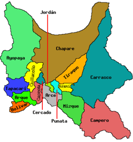 | |
| Municipalities (and seats) |
| |
This article is issued from Wikipedia - version of the 5/5/2016. The text is available under the Creative Commons Attribution/Share Alike but additional terms may apply for the media files.