Krymsk
| Krymsk (English) Крымск (Russian) | |
|---|---|
| - Town[1] - | |
|
| |
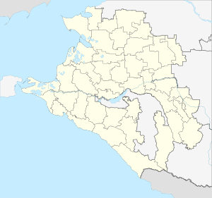
.svg.png) Location of Krasnodar Krai in Russia | |
 Krymsk | |
|
| |
_f_(1999).png) |
|
|
| |
| Administrative status (as of May 2013) | |
| Country | Russia |
| Federal subject | Krasnodar Krai[1] |
| Administratively subordinated to | Town of Krymsk[1] |
| Administrative center of | Town of Krymsk,[1] Krymsky District[1] |
| Municipal status (as of July 2010) | |
| Municipal district | Krymsky Municipal District[2] |
| Urban settlement | Krymskoye Urban Settlement[2] |
| Administrative center of | Krymsky Municipal District,[2] Krymskoye Urban Settlement[2] |
| Statistics | |
| Population (2010 Census) | 57,382 inhabitants[3] |
| - Rank in 2010 | 287th |
| Time zone | MSK (UTC+03:00)[4] |
| Founded | 1858 |
| Town status since | 1958 |
| Previous names | Krymskaya (until 1958) |
| Krymsk on Wikimedia Commons | |
Krymsk (Russian: Крымск) is a town in Krasnodar Krai, Russia. Population: 57,382 (2010 Census);[3] 56,623 (2002 Census);[5] 50,893 (1989 Census).[6]
History
It was founded in 1858 as the fortress and stanitsa of Krymskaya (Кры́мская), named after the Crimean Cossack Regiment. The stanitsa was granted town status and given its present name a century later, in 1958. The town's railway station, however, retains the name Krymskaya.
2012 floods
Krasnodar Krai experienced a flash flood on July 7, 2012 after heavy rains. There were about 275 millimeters (10.8 in) of rain over the region. State television reports that it was an equivalent of three to four months' worth of rainfall in a typical year. In the hilly area, water formed torrents that rushed into towns.[7]
One of the worst known calamities in modern times in this region, the flood killed more than 150 people; with 140 deaths occurring in Krymsk alone. Subsequently, the Russian government has declared a day of mourning on July 9, 2012.
Tsunami-like waves of several meters were reported, although the nearest sea coast (that of the Black Sea) is located about 20 kilometers (12 mi) southwest of Krymsk[8] and there are mountains between Krymsk and Sea
The Russian government has acknowledged that town authorities was aware of the rising waters at 10 P.M. Friday night but failed to notify the residents of Krymsk of the approaching flood. Russian officials admitted this failure was a major error.[9]
Administrative and municipal status
Within the framework of administrative divisions, Krymsk serves as the administrative center of Krymsky District, even though it is not a part of it.[1] As an administrative division, it is incorporated separately as the Town of Krymsk—an administrative unit with the status equal to that of the districts.[1] As a municipal division, the Town of Krymsk, together with the khutor of Verkhneadagum in Nizhnebakansky Rural Okrug of Krymsky District, is incorporated within Krymsky Municipal District as Krymskoye Urban Settlement.[2]
Climate
Krymsk has a humid subtropical climate (Köppen climate classification Cfa).[10]
| Climate data for Krymsk | |||||||||||||
|---|---|---|---|---|---|---|---|---|---|---|---|---|---|
| Month | Jan | Feb | Mar | Apr | May | Jun | Jul | Aug | Sep | Oct | Nov | Dec | Year |
| Average high °C (°F) | 5.8 (42.4) |
5.4 (41.7) |
8.4 (47.1) |
14.0 (57.2) |
18.9 (66) |
23.0 (73.4) |
26.8 (80.2) |
26.5 (79.7) |
22.0 (71.6) |
16.9 (62.4) |
11.2 (52.2) |
6.9 (44.4) |
15.5 (59.9) |
| Daily mean °C (°F) | 3.9 (39) |
3.3 (37.9) |
6.2 (43.2) |
11.4 (52.5) |
16.1 (61) |
20.4 (68.7) |
24.1 (75.4) |
23.9 (75) |
19.6 (67.3) |
14.5 (58.1) |
9.1 (48.4) |
5.0 (41) |
13.2 (55.8) |
| Average low °C (°F) | 2.1 (35.8) |
1.3 (34.3) |
3.8 (38.8) |
8.5 (47.3) |
13.0 (55.4) |
17.7 (63.9) |
21.2 (70.2) |
21.0 (69.8) |
16.9 (62.4) |
12.0 (53.6) |
7.0 (44.6) |
3.1 (37.6) |
10.6 (51.1) |
| Average precipitation mm (inches) | 98 (3.86) |
82 (3.23) |
76 (2.99) |
71 (2.8) |
71 (2.8) |
84 (3.31) |
65 (2.56) |
71 (2.8) |
80 (3.15) |
102 (4.02) |
111 (4.37) |
83 (3.27) |
994 (39.16) |
| Source: Krasnodar-meteo.ru[11] | |||||||||||||
Military
The town has an air base which is located 3.0 miles (4.8 km) to the north. The main fighter regiment at the base has gone through a series of re-organizations and re-designations:[12]
- January 9, 2001: absorbed the 562nd Fighter Aviation Regiment, and renamed 3rd Guards Fighter Aviation Regiment.
- January 12, 2009 renamed 6972nd Guards Aviation Base.
The base is now part of the 4th Air and Air Defence Forces Command.
Plant breeding
Krymsk is known for its experimental plant-breeding station, which holds important scientific collections of, among other crops, green peas, sweetcorn, tomatoes, peppers, aubergines (eggplants), cucumbers, apples, plums, peaches, pears, apricots, and strawberries. The station's stone fruit and quince collections are the largest and most important in Russia or any part of the former Soviet Union. Of the 9,000 accessions of Prunus, about 5,000 to 6,000 are wild species and forms, 500 to 1,000 local varieties, and 2,000 to 3,000 cultivars and breeding materials. The station is also known for the creation of fruit-tree rootstocks, which are named after the town + a number (e.g. Krymsk 1, Krymsk 2, etc.)
References
Notes
- 1 2 3 4 5 6 7 Reference Information #34.01-707/13-03
- 1 2 3 4 5 Law #766-KZ
- 1 2 Russian Federal State Statistics Service (2011). "Всероссийская перепись населения 2010 года. Том 1" [2010 All-Russian Population Census, vol. 1]. Всероссийская перепись населения 2010 года (2010 All-Russia Population Census) (in Russian). Federal State Statistics Service. Retrieved June 29, 2012.
- ↑ Правительство Российской Федерации. Федеральный закон №107-ФЗ от 3 июня 2011 г. «Об исчислении времени», в ред. Федерального закона №271-ФЗ от 03 июля 2016 г. «О внесении изменений в Федеральный закон "Об исчислении времени"». Вступил в силу по истечении шестидесяти дней после дня официального опубликования (6 августа 2011 г.). Опубликован: "Российская газета", №120, 6 июня 2011 г. (Government of the Russian Federation. Federal Law #107-FZ of June 31, 2011 On Calculating Time, as amended by the Federal Law #271-FZ of July 03, 2016 On Amending Federal Law "On Calculating Time". Effective as of after sixty days following the day of the official publication.).
- ↑ Russian Federal State Statistics Service (May 21, 2004). "Численность населения России, субъектов Российской Федерации в составе федеральных округов, районов, городских поселений, сельских населённых пунктов – районных центров и сельских населённых пунктов с населением 3 тысячи и более человек" [Population of Russia, Its Federal Districts, Federal Subjects, Districts, Urban Localities, Rural Localities—Administrative Centers, and Rural Localities with Population of Over 3,000] (XLS). Всероссийская перепись населения 2002 года [All-Russia Population Census of 2002] (in Russian). Retrieved August 9, 2014.
- ↑ Demoscope Weekly (1989). "Всесоюзная перепись населения 1989 г. Численность наличного населения союзных и автономных республик, автономных областей и округов, краёв, областей, районов, городских поселений и сёл-райцентров" [All Union Population Census of 1989: Present Population of Union and Autonomous Republics, Autonomous Oblasts and Okrugs, Krais, Oblasts, Districts, Urban Settlements, and Villages Serving as District Administrative Centers]. Всесоюзная перепись населения 1989 года [All-Union Population Census of 1989] (in Russian). Институт демографии Национального исследовательского университета: Высшая школа экономики [Institute of Demography at the National Research University: Higher School of Economics]. Retrieved August 9, 2014.
- ↑ Andrew Kramer,Russian deluge turns flash flooding into death trap, Sydney Morning Herald, July 9, 2012
- ↑ Russia floods toll rises to 152, The Hindu, Retrieved July 8, 2012.
- ↑ Ellen Barry (July 10, 2012). "After Russian Floods, Grief, Rage and Deep Mistrust". The New York Times. Retrieved July 11, 2012.
- ↑ "World Map of Köppen−Geiger Climate Classification" (PDF).
- ↑ "Krasnodar-meteo.ru". Retrieved July 12, 2012.
- ↑ Michael Holm, 393rd Guards Fighter Aviation Regiment, accessed December 2012.
Sources
- Управление по взаимодействию с органами местного самоуправления Администрации Краснодарского края. Справочная информация №34.01-707/13-03 от 23 мая 2013 г. «Реестр административно-территориальных единиц Краснодарского края». (Department of Cooperation with the Organs of the Local Self-Government of the Administration of Krasnodar Krai. Reference Information #34.01-707/13-03 of May 23, 2013 Registry of the Administrative-Territorial Units of Krasnodar Krai. ).
- Законодательное Собрание Краснодарского края. Закон №766-КЗ от 22 июля 2004 г. «Об установлении границ муниципального образования Крымский район, наделении его статусом муниципального района, образовании в его составе муниципальных образований — городского и сельских поселений — и установлении их границ», в ред. Закона №2053-КЗ от 28 июля 2010 г «О внесении изменений в некоторые законодательные акты Краснодарского края». Вступил в силу со дня официального опубликования. Опубликован: "Кубанские новости", №128, 10 августа 2004 г. (Legislative Assembly of Krasnodar Krai. Law #766-KZ of July 22, 2004 On the Establishment of the Borders of the Municipal Formation of Krymsky District, on Granting It the Status of a Municipal District, on the Establishment of the Municipal Formations—Urban and Rural Settlements—Within Its Structure and on the Establishment of Their Borders, as amended by the Law #2053-KZ of July 28, 2010 On Amending Several Legislative Acts of Krasnodar Krai. Effective as of the day of the official publication.).