Kribi
| Kribi | |
|---|---|
|
Kribi beach | |
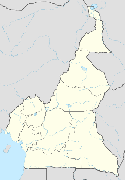 Kribi Location in Cameroon | |
| Coordinates: 02°56′06″N 09°54′36″E / 2.93500°N 9.91000°E | |
| Country |
|
| Province | South |
| Department | Océan |
| Elevation | 13 m (43 ft) |
| Population (2012)[1] | |
| • Total | 80,957 |

Kribi is a beach resort and sea port in Cameroon.
Location
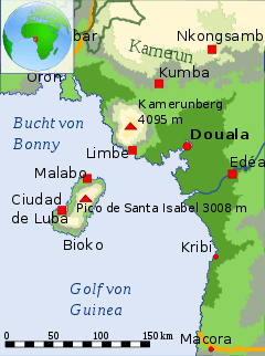
The coastal town of Kribi lies on the Gulf of Guinea, in Océan Department, South Province, at the mouth of the Kienké River. This location, lies approximately 150 kilometres (93 mi), by road, south of Douala, the largest city in Cameroon and the busiest seaport in the country.[2] The coordinates of Kribi are:2° 56' 6.00"N, 9° 54' 36.00"E (Latitude:2.9350; Longitude:9.9100)
Overview
It has an estimated population of 55401.[3] It services sea traffic in the Gulf of Guinea and also lies near the terminus of the Chad-Cameroon pipeline. The Lobé Waterfalls are nearby and there is a road inland, through the Littoral Evergreen Forest, as far as Bipindi and Lolodorf where native communities of Pygmees are found.
Kribi Power Station
Kribi Power Development Company (KPDC) is in the process of building a natural gas-powered electricity generating plant, Kribi Power Station, in the community of Mpolongwe, approximately 10 kilometres (6.2 mi), north of the Kribi central business district. The 216 MW plant that cost US$390 million (CFA:176.3 billion) to build, is expected to come on line in the first half of 2013.[4]
Port
The vicinity of Kribi is a possible location of a port for the export of iron ore from about 500 kilometres (310 mi) away. Specifically, the port could be at Grand Batanga about halfway between Kribi and the border with Equatorial Guinea, which is 80 kilometres (50 mi), by road, to the south of Kribi. Since there is no natural harbour at Kribi, the port itself would be several kilometres offshore where deepwater of at least 20 metres (66 ft) is suitable for large Capesize ships. It also the location for the Kribi lighthouse.
Iron mine
The iron ore comes from mines near Mbalam. The mine would have an output of approximately 35 million tonnes per year, with a 30-year or so lifespan.[5] An alternate site for this port is at Lolabé.
International relations
Twin towns – Sister cities
Kribi is twinned with:
 Ouistreham, France[6]
- St-Nazaire, France[7]
Climate
Due to its equatorial position, Kribi sees a short, fairly dry season and a long, very wet season. The hottest month, February, has an average high temperature of 32 C (89.6 F), and an average low of 25 C (77 F). The wettest month, September, sees a whopping 483 mm (19 in) of rain. 27 of the 30 days in September see rain. The dryest month, December, sees 59 mm (2 in) of rain. The coldest month is August, with an average high of 28 C (82.4 F), and a low of 23 C (73.4 F). Humidity remains high all year, and snow is unheard of.
| Climate data for Kribi, Cameroon | |||||||||||||
|---|---|---|---|---|---|---|---|---|---|---|---|---|---|
| Month | Jan | Feb | Mar | Apr | May | Jun | Jul | Aug | Sep | Oct | Nov | Dec | Year |
| Average high °C (°F) | 32 (90) |
32 (90) |
32 (90) |
32 (90) |
31 (88) |
30 (86) |
29 (84) |
28 (82) |
29 (84) |
30 (86) |
31 (88) |
31 (88) |
30.6 (87.2) |
| Average low °C (°F) | 24 (75) |
25 (77) |
24 (75) |
24 (75) |
24 (75) |
23 (73) |
23 (73) |
23 (73) |
23 (73) |
24 (75) |
23 (73) |
24 (75) |
23.7 (74.3) |
| Average precipitation mm (inches) | 68 (2.68) |
84 (3.31) |
194 (7.64) |
236 (9.29) |
296 (11.65) |
281 (11.06) |
240 (9.45) |
313 (12.32) |
483 (19.02) |
456 (17.95) |
160 (6.3) |
59 (2.32) |
2,870 (112.99) |
| Average rainy days | 9 | 10 | 14 | 17 | 20 | 18 | 16 | 22 | 27 | 26 | 16 | 9 | 204 |
| Source: World Meteorological Organisation (UN)[8] | |||||||||||||
Great things to do
Kribi is renowned for its popular beach locations in Ngo'e and near the Lobé Waterfalls. Kribi is equally very popular for its roasted fish. Fishermen typically come in from the sea on week-ends and sell fresh fishes that tourists can then buy and have roasted in many restaurants around the beach. The nightlife especially in places in like Big-BEN is also among some of the exciting things to do in Kribi.
See also
References
- ↑ "World Gazetteer". Archived from the original on January 11, 2013.
- ↑ Estimated Road Distance Between Douala And Kribi With Map
- ↑ Population of Kribi: 55401 People
- ↑ Kribi Power Plant To Cost US$390 Million
- ↑ Overview of Mbalam Iron Ore Project in the Republic of Cameroon
- ↑ "National Commission for Decentralised cooperation". Délégation pour l’Action Extérieure des Collectivités Territoriales (Ministère des Affaires étrangères) (in French). Retrieved 2013-12-26.
- ↑ Kribi, twinned with Saint Nazaire in France.
- ↑ "World Weather Information Service - Kribi". July 2011. Retrieved July 25, 2011.
External links
Coordinates: 02°56′06″N 09°54′36″E / 2.93500°N 9.91000°E