Krasnoperekopsk
| Krasnoperekopsk Красноперекопськ Красноперекопск | |||
|---|---|---|---|
| City | |||
|
Krasnoperekopsk railway station | |||
| |||
.svg.png) Krasnoperekopsk Location of Krasnoperekopsk within Crimea | |||
| Coordinates: 45°58′3″N 33°48′1″E / 45.96750°N 33.80028°ECoordinates: 45°58′3″N 33°48′1″E / 45.96750°N 33.80028°E | |||
| Country |
Disputed: | ||
| Republic | Crimea | ||
| Area | |||
| • Total | 22 km2 (8 sq mi) | ||
| Elevation | 5 m (16 ft) | ||
| Population (2014) | |||
| • Total | 26 268 | ||
| • Density | 1,395,45/km2 (361,420/sq mi) | ||
| Time zone | MSK (UTC+3) | ||
| Postal code | 96000 — 96005 | ||
| Area code(s) | +7-36565 | ||

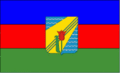

Krasnoperekopsk (Russian: Краснопереко́пск, Ukrainian: Краснопереко́пськ, Crimean Tatar: Krasnoperekopsk) is a town of regional significance in Crimea, a territory recognized by a majority of countries as part of Ukraine and incorporated by Russia as the Republic of Crimea. It also serves as the administrative center of Krasnoperekopsk Raion, although it is not a part of the raion (district). Population: 26,268 (2014 Census).[1]
It is located on the southern part of the Perekop Isthmus, on the shore of the Stare lake, and about 124 kilometres (77 mi) from the Crimean capital, Simferopol. It lies on the Dzhankoy-Kherson railroad line (one of the two railroad lines connecting the Crimea and the rest of the continent).
Historical outlook
The city was founded in 1932 as an industrial settlement for a Bromine factory located near the lake Stare. In 1936 the settlement was renamed into Krasno-Prekopsk and later simply Krasnoperekopsk (1964). In 1966, Krasnoperekopsk received the status of a city.
The city of Krasnoperekopsk should not be confused with the historic Crimean city of Perekop, which was destroyed in 1920 during the Russian Civil War, and which is located in a 25 kilometres (16 mi) range to the north of Krasnoperekopsk. Perekop was depopulated and destroyed after the Crimean peninsula was taken by a storm from the Red Army. Krasnoperekopsk was named after the perished Red Army soldiers of 1920.
Demographics
| Nationality | #Inhabitants |
|---|---|
| Russians | 16,561 |
| Ukrainians | 13,602 |
| Crimean Tatars | 1,121 |
| Total: | 31,284 |
Climate
Krasnoperekopsk's climate is mostly dry and hot in the summer, and mild in the winter. The average temperature ranges from −2.4 °C (27.7 °F) in January, to 23.3 °C (73.9 °F) in July. The average precipitation is 336 mm (13.2 in) per year.
International relations
Twin towns – Sister cities
Krasnoperekopsk is twinned with:
 Dzerzhinsk, Russia
References
- ↑ Russian Federal State Statistics Service (2014). "Таблица 1.3. Численность населения Крымского федерального округа, городских округов, муниципальных районов, городских и сельских поселений" [Table 1.3. Population of Crimean Federal District, Its Urban Okrugs, Municipal Districts, Urban and Rural Settlements]. Федеральное статистическое наблюдение «Перепись населения в Крымском федеральном округе». ("Population Census in Crimean Federal District" Federal Statistical Examination) (in Russian). Federal State Statistics Service. Retrieved January 4, 2016.
External links
| Wikimedia Commons has media related to Krasnoperekopsk. |
- Official website (Russian)
- Registration card at Verkhovna Rada
- Krasnoperekopsk travel Guide in Russian
| Raions | |||||||
|---|---|---|---|---|---|---|---|
| Municipalities | |||||||
| Cities | |||||||
| |||||||