Okny
| Okny Окни | |
|---|---|
| Urban-type settlement | |
 Okny | |
| Coordinates: UA 47°32′20″N 29°27′42″E / 47.53889°N 29.46167°ECoordinates: UA 47°32′20″N 29°27′42″E / 47.53889°N 29.46167°E | |
| Country | Ukraine |
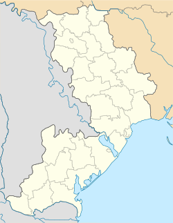
| Oblast | Odessa Oblast |
| Raion | Okny Raion |
| Population (2015) | |
| • Total | 5,340[1] |
| Time zone | EET (UTC+2) |
| • Summer (DST) | EEST (UTC+3) |
Okny (Ukrainian: Окни, Russian: Окны) is an urban-type settlement in the west of Odessa Oblast, Ukraine. It serves as the administrative center of Okny Raion. Population: 5,340 (2015 est.)[1]
Okny is located on the banks of the Yahorlik River, a left tributary of the Dniester.
History
Okny was founded in the end of the 18th century.[2] The area was settled after 1792, when the lands between the Southern Bug and the Dniester were transferred to Russia according to the Iasi Peace Treaty. The area was included in Tiraspol Uyezd, which belonged to Yekaterinoslav Viceroyalty until 1795, Voznesensk Viceroyalty until 1796, Novorossiya Governorate until 1803, and Kherson Governorate until 1920. In 1834, the area was transferred to newly established Ananyiv Uyezd. In 1919, Okny was renamed Krasni Okny.
On 16 April 1920, Odessa Governorate split off, and Ananyivsky Uyezd was moved to Odessa Governorate, where it was abolished in 1921. In 1923, uyezds in Ukrainian Soviet Socialist Republic were abolished, and the governorates were divided into okruhas. Krasni Okny was included into Balta Okruha. On 3 July 1923 Alexiivka Raion with the administrative center in Krasni Okny was established. On 26 November 1924, Balta Okruha was abolished, and the area was transferred into newly established Moldavian Autonomous Soviet Socialist Republic. The raion was later renamed Krasni Okny. In 1940, Krasni Okny Raion was transferred to Odessa Oblast.[3]
On 19 May 2016, Verkhovna Rada adopted decision to rename Krasni Okny to Okny and Krasni Okny Raion to Okny Raion conform to the law prohibiting names of Communist origin.[4]
Economy
Transportation
Okny is on the M13 highway which connects it with Kropyvnytskyi in the northeast and with the state border with the Republic of Moldova in the southwest. Beyond the border, the road crosses the unrecognized republic of Transnistria and via Dubăsari continues to Chișinău. Another road proceeds southeast via Zakharivka and Velyka Mykhailivka with a connection to Odessa.
References
- 1 2 "Чисельність наявного населення України (Actual population of Ukraine)" (PDF) (in Ukrainian). State Statistics Service of Ukraine. Retrieved 1 July 2016.
- ↑ "Красные Окны - райцентр в Одесской области" (in Russian). Чисто Одесский сайт. Retrieved 21 May 2016.
- ↑ "Молдавская Автономная Советская Социалистическая Республика" (in Russian). Краевед. Retrieved 23 May 2016.
- ↑ "Парламентарии переименовали два района в Одесской области" (in Russian). Одесса-медиа. 19 May 2016. Retrieved 4 June 2016.
| Raions | |||||||
|---|---|---|---|---|---|---|---|
| Cities |
| ||||||
| |||||||