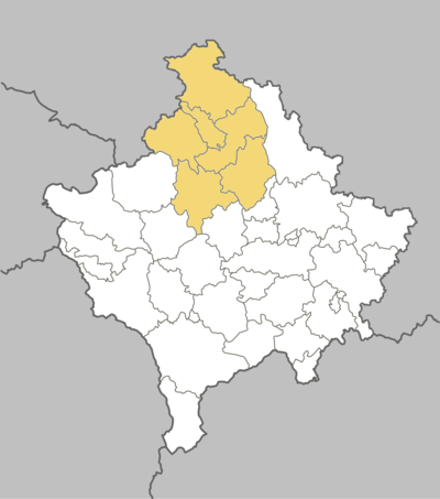
District of Mitrovica
| Rajoni i Mitrovicës Косовскомитровачки округ | |
|---|---|
| District of Kosovo | |
 Location of Mitrovica District in Kosovo | |
| Country |
|
| Capital | Mitrovica |
| Area | |
| • Total | 2,077 km2 (802 sq mi) |
| Population (2011 census) | |
| • Total | 232,833 |
| • Estimate (2014[b]) | 272,247 |
| • Rank | 3rd |
| • Density | 110/km2 (290/sq mi) |
| Postal code | 40000 |
| Vehicle registration | 02 |
| Municipalities | 6 |
| Settlements[1] | 267 |
Mitrovica District (Albanian: Rajoni i Mitrovicës, Serbian Cyrillic: Косовскомитровачки округ) is one of the seven districts of Kosovo.[a] Its administrative center and the largest city is Mitrovica. The district borders on the District of Peć the south-west, District of Pristina in the south-east and east, and Serbia in the north.
History
The first human habitations here can be traced back to the Prehistoric period. Some Neolithic sites have been discovered in the Mitrovica District, for example in Runik, Zhitkoc and Karagac, Vallac and Fafos. This region was populated by Dardanians, an Illyrian tribe that lived in the territory of today's Kosovo.
By the end of the 1st century BC, the Romans invaded the region. At the time, one of the most important centres in the region was Municipium Dardanorum, localized in the village of Socanica, Municipality of Leposavic. Archeological sites from the Roman period were also found in the territory of Vushtrri (Vicianum), for example the ruins in the village Pestova and the Rashan Fortress.

After the Romans, the territory of Mitrovica Region was occupied by Byzantium. During the Justinian I period (527-565), the Old Fortress in Vushtrri was built, which remains the city center today.[2][3] By the end of the 9th century, the Region of Mitrovica became part of the Bulgarian state of Samuel.[4][5] The area was conquered by the Nemanjić dynasty in 1185. During the Serbian rule, the region and Kosovo in general became a political and spiritual centre of the Serbian Kingdom. The Ottomans came to the region in the 14th century and stayed until the 17th century. During the Ottoman invasion, Islam spread in this area and many mosques, Turkish baths, madrasah, bridges and Ottoman houses were built. The cities of Vushtrri, Mitrovica and Zvecan became some of the largest cities in the region and some of the most important in the Ottoman Empire. In 1912, after the Ottoman capitulation, Serbia conquered the territory of Kosovo. In the first World War, the region was part of the Austro-Hungarian Empire (1915–18), then part of the Kingdom of Serbs, Croats and Slovenes. In World War II, Germany conquered most of territory of the Mitrovica Region, while the Skenderaj were under Italians. After World War II, under Yugoslavia the economy in the Mitrovica region was on its culmination.
Geography
Relief
The terrain of the Mitrovica District is rugged and mountainous, comprising the south portion of Kopaonik mountain on the north-east, with the highest point Pančić's Peak 2,017 meters above sea level (the northernmost extremity of Kosovo). The mountain ranges of Rogozna and Mokra Gora extend on the north-west by Zubin Potok with the peak of Berim, 1,731 meters (5,679 ft). The northern part of Drenica and Qyqavica mountain occupies the south-west part of region, while in the south east the boundary extends on the Plain of Kosovo. In the center of the region is the Ibar valley, where Mitrovica lies.
Hydrography

Regarding hydrography, Mitrovica District constitutes one of the richest regions in Kosovo. While a mountainous area, there are many small river sources in the region, and two of the most important rivers in Kosovo, Ibar and Sitnica, flow here.
Ibar originates in Rožaje, eastern Montenegro, passes through Sandžak and enters Kosovo by the town of Zubin Potok. Near this town, the river is dammed by the Gazivoda Dam, creating the artificial Lake Gazivode.

As the largest lake in Kosovo (area 11.9 km2 or 4.6 sq mi, altitude 693 m or 2,274 ft, depth 105 m or 344 ft), Gazivoda Lake represents one of the most important assets of Kosovo's economy. Below Gazivode, another reservoir is created, Lake Pridvorice. In Mitrovica, the Ibar receives Lushta river and Sitnica, which consist of the longest river in Kosovo. Sitnica passes through the town of Vushtrri what makes an important element for agriculture in this area. In Mitrovica it receives Trepça river which originates from Bajgora mountains, of Kopaonik range.
Demographics
Population
According to the results of 2011 census and Kosovo Agency of Statistics 2008-2009 data for the municipalities with Serbian majority : Zveçan, Leposaviç, Zubin Potok and North part of Mitrovica, in this region live approximately 232,833 inhabitants or 13.38% of total population of Kosovo.[6]
| City | Municipal area | Urban area | ||
|---|---|---|---|---|
| 2011 pop. | Rank | 2011 pop. | Rank | |
| Mitrovicë / Kosovska Mitrovica | 84,235 | 46,230 | ||
| Vushtrri / Vučitrn | 69,870 | 26,964 | ||
| Skenderaj / Srbica | 50,858 | 6,612 | ||
| Leposaviq / Leposavić | 13,773 | 3,702 | ||
| Zveçan / Zvečan | 7,481 | 1,297 | ||
| Zubin Potok | 6,616 | 1,724 | ||
Note:Northern part of Mitrovica is also included into Mitrovica.
Ethnicities
The municipalities of Mitrovica, Vučitrn and Skenderaj have an Albanian majority, whilst the municipalities of Zubin Potok, Zvečan and Leposavić have an ethnic Serb majority. Serbs also form the majority of population in the northern part of Mitrovica, which is their cultural and political center in Kosovo.
Population by ethnicity
Data on municipalities of Mitrovica, Vushtrri and Skenderaj according to 2011 population census.[7]
| Municipality | Total | Ethnicity | ||||||||||
|---|---|---|---|---|---|---|---|---|---|---|---|---|
| Albanian | Serbian | Turkish | Bosnian | Roma | Ashkali | Egyptian | Gorani | Others | Prefer not
to Answer |
Not Available | ||
| South Mitrovica | 71,909 | 69,497 | 14 | 518 | 416 | 528 | 647 | 6 | 23 | 47 | 61 | 152 |
| Vushtrri | 69,870 | 68,840 | 384 | 278 | 33 | 68 | 143 | 1 | 3 | 50 | 17 | 53 |
| Skenderaj | 50,858 | 50,685 | 50 | 1 | 42 | - | 10 | 1 | - | 5 | 4 | 60 |
As it is known, municipalities with Serbian majority: Zveçan, Leposaviç, Zubin Potok and North part of Mitrovica did not participate in population census conducted in April, 2011. For this part-municipalities the data is taken from the update 2008-2009.[8]
| Municipality | Total | Ethnicity | ||||||||||
|---|---|---|---|---|---|---|---|---|---|---|---|---|
| Albanian | Serbian and Others | |||||||||||
| Leposaviç | 13,773 | 323 | 13,450 | |||||||||
| Zubin Potok | 6,616 | 995 | 5,621 | |||||||||
| Zveçan | 7,481 | 386 | 7,095 | |||||||||
| North Mitrovica | 12,326 | 867 | 11,459 | |||||||||
Official languages
In the municipalities of Mitrovica Region, Albanian and Serbian languages are official languages, while in Mitrovica and Vushtrri, Turkish is recognized as a language in official use.[9]
Administrative divisions
Municipalities
Until 2012 Mitrovica region was divided into six municipalities. In 2013, after November elections in Kosovo, North Mitrovica officially became a separate municipality. The largest city is Mitrovica (46,230 inhabitants) and municipality of South Mitrovica (71,909 inhabitants).[10]
| Municipality | Population (2011) | Area (km2) | Density (km2) | Settlements |
|---|---|---|---|---|
| Mitrovica | 71,909 | 350 | 205.5 | |
| Vushtrri | 69,870 | 344 | 203.1 | |
| Skenderaj | 50,858 | 378 | 134.5 | |
| North Mitrovica | 29,460[b] | 11 | 2,678.2 | |
| Leposavić | 18,600[b] | 539 | 34.5 | |
| Zvečan | 16,650[b] | 122 | 136.5 | |
| Zubin Potok | 14,900[b] | 333 | 44.7 | |
| Mitrovica District | 272,247 | 2,077 | 131.1 | 267 |
Settlements in Mitrovica District
This is the list of 48 settlements in the municipality of Mitrovica.
|
|
This is the list of 67 settlements in the municipality of Vushtrri.
|
|
|
|
Gallery
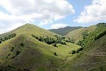
 Landscape near Vushtrri
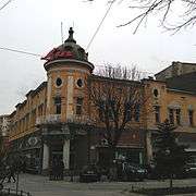 Hotel Jadran building in Mitrovica
 Orthodox Church and Zvecan lead smelter chimney
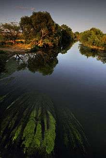
 Ibar River in Mitrovica
 City of Vushtrri
 Hotel Jadran building in Mitrovica
 Cerajë village
 City of Vushtrri at night
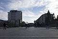 "Adem Jashari" square in Skenderaj
 Adem Jashari memorial in Donje Prekaze
 Adem Jashari memorial in Prekaz
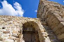
 The fortress of Vushtrri
 Old Stone Bridge in Vushtrri
 Forests near Vushtrri
 Old Hamam in Vushtrri
 City of Vushtrri
.jpg) The Building of the Old Hamam in Mitrovica
The Building of the Old Hamam in Mitrovica.jpg)
 Holy Trinity Church, Zubin Potok
 Sitnica river from the bridge
 The miners monument in Northern Mitrovica
 The main bridge above Ibar River in Mitrovica
 Bayram Pasa Mosque in the center of Mitrovica
See also
| Wikimedia Commons has media related to District of Mitrovica. |
Notes and references
Notes:
| a. | ^ Kosovo is the subject of a territorial dispute between the Republic of Kosovo and the Republic of Serbia. The Republic of Kosovo unilaterally declared independence on 17 February 2008, but Serbia continues to claim it as part of its own sovereign territory. The two governments began to normalise relations in 2013, as part of the Brussels Agreement. Kosovo has received recognition as an independent state from 110 out of 193 United Nations member states. |
| b. | ^ Due to the boycott by most municipalities in the north in the 2011 Kosovo census, the exact number of the population is unknown. Estimates are taken according to a 2014 OSCE report.[11][12][13][14] |
References:
- ↑ "Komunat në rajonin e Mitrovicës".
- ↑ http://www.invest-ks.org/repository/docs/Invest_in_Vushtrri_618202.pdf
- ↑ http://www.kosovoguide.com/?cid=1,197,1210&view=all
- ↑ https://kk.rks-gov.net/mitrovice/City-guide/History.aspx
- ↑ http://www.informatat.com/index.php?id=16&page=2
- ↑ "TË DHËNAT DEMOGRAFIKE SIPAS KOMUNAVE" (PDF). Agjencia e statistikave te Kosoves. Retrieved 8 March 2014.
- ↑ https://esk.rks-gov.net/rekos2011/repository/docs/Population%20by%20gender,%20ethnicity%20at%20settlement%20level.pdf
- ↑ Census. "Population by ethnicity" (PDF). Retrieved 8 March 2014.
- ↑ http://www.osce.org/kosovo/32762
- ↑ "Census 2011". http://pop-stat.mashke.org/kosovo-census-ks.htm. Retrieved 14 September 2014. External link in
|website=(help) - ↑ "OSCE Leposavic estimates". OSCE.
- ↑ "OSCE Mitrovica North estimate". OSCE.
- ↑ "OSCE Zubin Potok estimate". OSCE.
- ↑ "OSCE Zvecan estimates". OSCE.
Coordinates: 42°53′24″N 20°52′12″E / 42.89000°N 20.87000°E
Kosovo articles | |||||||||||||||||||||
|---|---|---|---|---|---|---|---|---|---|---|---|---|---|---|---|---|---|---|---|---|---|
| History | |||||||||||||||||||||
| Geography |
| ||||||||||||||||||||
| Politics | |||||||||||||||||||||
| Economy | |||||||||||||||||||||
| Society |
| ||||||||||||||||||||
| |||||||||||||||||||||