Korean Peninsula
| Korean Peninsula | |
| Korean: 조선반도 (Hanja: 朝鮮半島; MR: Chosŏn Pando) in North Korea, Japan and China, Korean: 한반도 (Hanja: 韓半島; RR: Han Bando) in South Korea | |
| Peninsulas of Asia | |
 The Korean Peninsula shown in Dark Green | |
| Country | |
|---|---|
| Borders on | China, Russia, Sea of Japan, East China Sea, Yellow Sea, Korea Strait |
| Highest point | Paektu Mountain |
| - elevation | 2,744 m (9,003 ft) |
| Lowest point | sea level |
| Length | 1,100 km (684 mi), north to south |
| Area | 220,847 km2 (85,270 sq mi) |
| Population | 74,461,933 (2012[1]) |
| Density | 337/km2 (873/sq mi) |
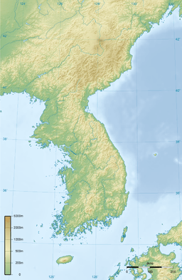 | |
The Korean Peninsula is a peninsula in East Asia. It extends southwards for about 1,100 km (680 mi) from continental Asia into the Pacific Ocean and is surrounded by the Sea of Japan (East Sea) to the east, and the Yellow Sea (West Sea) to the west, the Korea Strait connecting the first two bodies of water.
History
Until the end of World War II, Korea was a single political entity whose territory roughly coincided with the Korean Peninsula. Since the Armistice Agreement ended the Korean War in 1953, the northern division of the peninsula has been governed by the Democratic People's Republic of Korea, while the southern portion has been governed by the Republic of Korea.
The northern boundaries for the Korean Peninsula are commonly (and tacitly) taken to coincide with today's political borders between North Korea and its northern neighbors, China (1,416 km (880 mi) along the provinces of Jilin and Liaoning) and Russia (19 km (12 mi)). These borders are formed naturally by the rivers Yalu/Amnok and Tumen/Tuman/Duman. Taking this definition, the Korean Peninsula (including its islands) has an area of 220,847 km2 (85,270 sq mi).
The peninsula's names in Chosonmal, Chinese and Japanese all have the same origin, that being Joseon, the old name of Korea under the Joseon Dynasty and Gojoseon even longer before that. In North Korea's Chosonmal, the peninsula is called Chosŏn Pando (Chosongul: 조선반도 / Hanja: 朝鮮半島), while in China it is called Cháoxiǎn Bàndǎo (朝鲜半岛/朝鮮半島) and in Japan it is Chōsenhantō (Kanji: 朝鮮半島 / Hiragana: ちょうせんはんとう). In South Korea, meanwhile it is called Han Bando (Hangeul- Korean Word: 한반도 / Hanja: 韓半島), referring to the Samhan. They both use "Korea" as part of their official English names, which is a name that comes from the Goryeo (or Koryŏ, in North Korea) dynasty (고려/高麗).
Summarized comparison of the two countries on the Korean Peninsula
| Indicator | North Korea | South Korea |
|---|---|---|
| Capital | Pyongyang | Seoul |
| Official languages | Korean | |
| Official scripts | Chosŏn'gŭl | Hangul |
| Government | Juche single-party state under a hereditary totalitarian dictatorship | Constitutional liberal democracy |
| Formal declaration | 9 September 1948 | 15 August 1948 |
| Area | 120,540 km2 | 100,210 km2 |
| Population (2014/2013 est.) | 24,851,627 | 50,219,669 |
| GDP total (2011/2014 est.) | $40 billion | $1.755 trillion |
| GDP/capita (2011/2014 est.) | $1,800 | $34,777 |
| Currency | North Korean won (sign: ₩, ISO: KPW) | South Korean won (₩, KRW) |
| Calling code | +850 | +82 |
| Internet TLD | .kp | .kr |
| Drives on the | right | |
| Active military personnel | 1,106,000 | 639,000 |
| Military expenditure (2010/2012) | $10 billion | $30 billion |
See also
Notes
References
Further reading
- KOIS (Korea Overseas Information Service) (2003). Handbook of Korea, 11th ed. Seoul: Hollym. ISBN 1-56591-212-8.
External links
| Wikimedia Commons has media related to Korean Peninsula. |
- Location of the Korean Peninsula—The official Korean Tourism guide website
| ||||||||||
| ||||||||||
Coordinates: 37°30′N 127°00′E / 37.500°N 127.000°E