Kombolcha
| Kombolcha ኮምቦልቻ | |
|---|---|
 | |
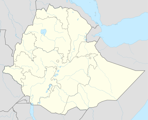 Kombolcha Location in Ethiopia | |
| Coordinates: 11°5′12″N 39°44′12″E / 11.08667°N 39.73667°ECoordinates: 11°5′12″N 39°44′12″E / 11.08667°N 39.73667°E | |
| Country | Ethiopia |
| Region | Amhara Region |
| Zone | Debub Wollo Zone |
| Elevation | 1,842 m (6,043 ft) |
| Population (2007) | |
| • Total | 108,667 |
| Time zone | EAT (UTC+3) |

Kombolcha is a city and woreda in north-central Ethiopia. Located in the Debub Wollo Zone of the Amhara Region, it has a latitude and longitude of 11°5′N 39°44′E / 11.083°N 39.733°E with an elevation between 1842 and 1915 meters above sea level. Some guide books describe Kombolcha as the twin city of Dessie which lies some 13 km to the northwest. Kombolcha is connected with Dessie through Ethiopian Highway 2.
This city shares Combolcha Airport with neighbouring Dessie. It is also home to Kombolcha Steel products, a metalworking factory that is part of MIDROC, a conglomerate owned by businessman Sheikh Mohammed Al Amoudi.[1] Another industry in this town is the Kombolcha Textile Factory (KTF), which announced 9 March 2009 that it was beginning a 190 million Birr modernization project to improve the quality of its projects. At the time of the announcement, the KTF exported its goods to Italy, Sweden, Belgium and China.[2]
History
Tadesse Tamrat records that archeologists discovered "some remains of Christian settlements", dated to the late first millennium of the current era.[3]
When the missionary Johann Ludwig Krapf was led as a prisoner from Adare Bille's capital to the Teledere House of the Wollo Oromo in April 1843 he passed Kombolcha, which he described as a village near the source of the Borkana River.[4]
Kombolcha was described during the Italian occupation as having postal and telephone service, a clinic, a spaccio ("tobacco shop"), barrack village of the A.A.S.S. as well as other improvements intended for Italians.[5]
Kombolcha was used as a base by the United Nations relief organization and other humanitarian groups during the 1984 famine. On 19 November 1989 the Tigrayan People's Liberation Front (TPLF) claimed to have captured Kombolcha. However, the highway from Kombolcha to Assab was not fully brought under TPLF control until the Derg was expelled from Tigray later that year.[5]
Demographics
Based on the 2007 national census conducted by the Central Statistical Agency of Ethiopia (CSA), Kombolcha woreda has a total population of 85,367, of whom 41,968 are men and 43,399 women; 58,667 or 68.72% are urban inhabitants living in town of Kombolcha, the rest of population is living at rural kebeles around Kombolcha. The majority of the inhabitants were Muslim, with 73.92% reporting that as their religion, while 23.44% of the population said they practiced Ethiopian Orthodox Christianity and 2.32% were Protestants.[6]
The 1994 national census reported a total population for Kombolcha of 39,466 in 8,643 households, of whom 18,995 were men and 20,471 were women. The three largest ethnic groups reported in this town were the Amhara (91.34%), Tigrayan (5.85%), and the Oromo (1.29%); all other ethnic groups made up 1.52% of the population. Amharic was spoken as a first language by 93.02%, 5.2% Tigrinya, and 1.11% spoke Oromiffa; the remaining 0.67% spoke all other primary languages reported. The majority of the inhabitants were Muslim, with 57.42% of the population having reported they practiced that belief, while 41.71% of the population said they professed Ethiopian Orthodox Christianity.[7]
Education
Wollo University, Kombolcha Institute of Technology is established at Kombolcha and offering engineering courses at undergraduate level. KIOT is offering Mechanical Engineering, Textile Engineering, Electrical & Computer Engineering, Civil Engineering,Chemical Engineering, Computer and Information Science courses etc.
Notes
- ↑ "Kombolcha Steel Industry Goes into Production" (Addis Tribune, last accessed 26 October 2007)
- ↑ "Factory executing 190 mln birr modernizing project", Walta Information Center (accessed 13 March 2009)
- ↑ Taddesse Tamrat, Church and State in Ethiopia (Oxford: Clarendon Press, 1972), p. 37 n. 4
- ↑ Journals of the Rev. Messrs. Isenberg and Krapf, Missionaries of the Church Missionary Society, Detailing their proceedings in the kingdom of Shoa, and journeys in other parts of Abyssinia, in the years 1839, 1840, 1841 and 1842, (London, 1843), p. 390
- 1 2 "Local History in Ethiopia" The Nordic Africa Institute website (accessed 23 February 2008)
- ↑ Census 2007 Tables: Amhara Region Archived November 14, 2010, at the Wayback Machine., Tables 2.1, 2.4, 2.5, 3.1, 3.2 and 3.4.
- ↑ 1994 Population and Housing Census of Ethiopia: Results for Amhara Region, Vol. 1, part 1 Archived November 15, 2010, at the Wayback Machine., Tables 2.1, 2.7, 2.10, 2.13, 2.17, Annex II.2 (accessed 9 April 2009)
.