Kolnes
| Kolnes | |
|---|---|
| Village | |
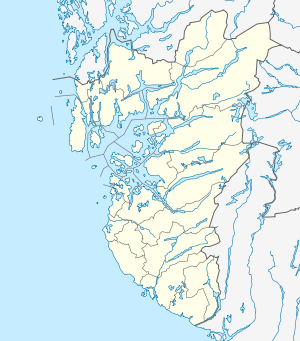 Kolnes  Kolnes Location in Rogaland county | |
| Coordinates: 59°23′10″N 05°22′20″E / 59.38611°N 5.37222°ECoordinates: 59°23′10″N 05°22′20″E / 59.38611°N 5.37222°E | |
| Country | Norway |
| Region | Western Norway |
| County | Rogaland |
| District | Haugaland |
| Municipality | Karmøy |
| Elevation[1] | 30 m (100 ft) |
| Time zone | CET (UTC+01:00) |
| • Summer (DST) | CEST (UTC+02:00) |
| Post Code | 5541 Kolnes |
Kolnes is a village in Karmøy municipality in Rogaland county, Norway. The residential village is located on the west side of the Førresfjorden, south of the village of Førre and east of the village of Norheim.
Kolnes has experienced rapid growth. Between 1970 and 2013 the population has increased by 87%.[2] The municipality is planning further growth in the area by opening up 1700 sites for residential housing that is expected to increase the population from 1500 to 4500 between 2012 and 2027.[3]
Rogaland Norwegian county road 832 is the main route through Kolnes, running between the villages of Aksnes in the south and Eike and Skre in the north where it meets the European route E134 highway. The community is served by Kolumbus bus line 24 six days a week.
References
- ↑ "Kolnes, Karmøy (Rogaland)" (in Norwegian). yr.no. Retrieved 2015-11-11.
- ↑ Eide, Anders L. (21 March 2013). "Mulighet å komme til sjøen" (in Norwegian). Karmøy municipality. Retrieved 23 March 2013.
- ↑ Olaisen, Arnstein (7 March 2012). "Fra søvnig bygd til het potet" (in Norwegian). Haugesunds Avis. Retrieved 23 March 2013.