Kohren-Sahlis
| Kohren-Sahlis | ||
|---|---|---|
| ||
 Kohren-Sahlis | ||
Location of Kohren-Sahlis within Leipzig district 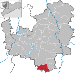
 | ||
| Coordinates: 51°1′7″N 12°36′16″E / 51.01861°N 12.60444°ECoordinates: 51°1′7″N 12°36′16″E / 51.01861°N 12.60444°E | ||
| Country | Germany | |
| State | Saxony | |
| District | Leipzig | |
| Government | ||
| • Mayor | Siegmund Mohaupt | |
| Area | ||
| • Total | 36.72 km2 (14.18 sq mi) | |
| Population (2015-12-31)[1] | ||
| • Total | 2,611 | |
| • Density | 71/km2 (180/sq mi) | |
| Time zone | CET/CEST (UTC+1/+2) | |
| Postal codes | 04655 | |
| Dialling codes | 034344 | |
| Vehicle registration | L | |
| Website | www.kohren-sahlis.de | |

Kohren-Sahlis is a town in the Leipzig district, in the Free State of Saxony, Germany. It is situated 14 km southeast of Borna, and 31 km northwest of Chemnitz.
History
The first documented mention of Kohren-Sahlis was in 974.
Nazi Era
From 1 November 1942 to 14 April 1945 the children's home "Sonnenwiese" (Sunny Meadow), which was operated by the SS Lebensborn organization, was located in Kohren-Salis. Primarily children abducted from Norway were placed here before they were passed on for adoption to families loyal to the Nazi system .[2][3][4]
Religion

Kohren-Sahlis is situated in a traditional Lutheran area. The Saint Gangulphus Church in Kohren-Sahlis, the Christ Church in Rüdigsdorf, the Village Churches in Altmörbitz and Gnandstein as well as the Chapel of Gnandstein Castle all belong to the Kohren Region Parish of the Evangelical-Lutheran Church of Saxony.
The few Catholics in Kohren-Sahlis belong to St. Joseph's Parish of Borna, Bishopric of Dresden-Meissen.
Culture and Attractions

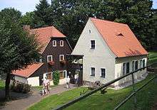

Museums
- Pottery museum
- Hoffmann’sche Collection Museum
- Gnandstein Castle Museum
Monuments and Buildings
- Ceramic fountain by Kurt Feuerriegel of (Frohburg), Market Square
- Ruins of Kohren Castle
- St. Gangolphus's Church in Kohren with rectory
- Gnandstein Castle
References
- ↑ "Aktuelle Einwohnerzahlen nach Gemeinden 2015] (Einwohnerzahlen auf Grundlage des Zensus 2011)" (PDF). Statistisches Landesamt des Freistaates Sachsen (in German). July 2016.
- ↑ Lebensbornheime in Deutschland, gesichtet am 2. Januar 2013.
- ↑ Das ist wirklich bodenlos, Von Mascolo, Georg und Schumacher, Hajo, in SPIEGEL, Heft 25/1997.
- ↑ Staatsarchiv Leipzig, Eintrag 20050 - Kinderheim Sonnenwiese, Kohren-Sahlis.