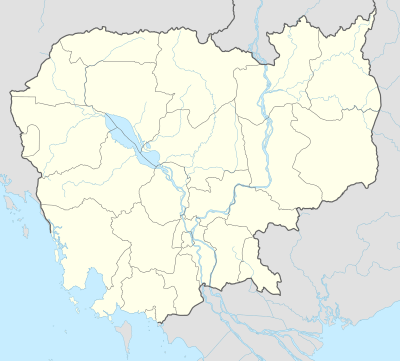
Koh Ta Kiev
| Native name: <span class="nickname" ">កោះរ៉ុង | |
|---|---|
 Koh Ta Kiev | |
| Geography | |
| Location | Cambodia - South East Asia - Gulf of Thailand |
| Coordinates | 10°29′31″N 103°35′42″E / 10.492°N 103.595°ECoordinates: 10°29′31″N 103°35′42″E / 10.492°N 103.595°E |
| Area | 6.7 km2 (2.6 sq mi) |
| Length | 4.4 km (2.73 mi) |
| Width | 1.4–2.9 km (0.87–1.80 mi) |
| Coastline | 13.4 km (8.33 mi) |
| Highest elevation | 1 m (3 ft) |
| Administration | |
|
Cambodia | |
| Province | Sihanoukville |
| Demographics | |
| Ethnic groups | Khmer |
Koh Ta Kiev (Khmer: កោះតាគៀវ, “Ancestor Kiev’s Island” – named "Ile de la Baie" during the French colonial period) is the biggest of a small group of Cambodian islands, situated 4 km off Otres beach, Sihanoukville City and just 1 km off the coast of Ream National Park, Sihanoukville Province. Its predominantly forested area of 6.70 km2 (3 sq mi) is without any noticeable elevation.[1]
The inhabitants of two villages run a Mango plantation. Apart from the Cambodian Navy, who maintains a small base with a port, no infrastructure exists.
Several beaches attract travelers and tourists. After many years of individual visitors, large scale resort development is in progress.
The island is accessible by ferry or speed-boat from Otres beach.[2]
See also
References
- ↑ "list of islands". Cambodia islands – Island Species Cambodia. Retrieved 5 May 2016.
- ↑ "Koh Rong Island". Koh Rong Island OFFICIAL WEBSITE. Retrieved 5 May 2016.
This article is issued from Wikipedia - version of the 11/17/2016. The text is available under the Creative Commons Attribution/Share Alike but additional terms may apply for the media files.