Kobozha River
Coordinates: 58°51′42″N 36°17′10″E / 58.86167°N 36.28611°E
| Kobozha Russian: Кобожа | |
|---|---|
| Country | Russia |
| Basin | |
| Main source | Lake Velikoye |
| River mouth | Mologa |
| Basin size | 2,660 km2 (1,030 sq mi)[1] |
| Physical characteristics | |
| Length | 184 km (114 mi)[1] |
| Discharge |
|
The Kobozha (Russian: Кобожа) is a river in Moshenskoy and Khvoyninsky Districts of Novgorod Oblast and in Chagodoshchensky and Ustyuzhensky Districts of Vologda Oblast in Russia. It is a left tributary of the Mologa River. It is 184 kilometres (114 mi) long, and the area of its basin 2,660 square kilometres (1,030 sq mi).
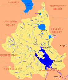
The source of the Kobozha is in Lake Velikoye in the eastern part of Moshenskoy District, in the east of the Valday Hills. The river flows in the northern direction, crosses Khvoyninsky District, passing the railway station of Kabozha, and enters Vologda Oblast, where it turns northeast, smoothly turns southeast, and enters Ustyuzhensky District. The mouth of the Kobozha is in the village of Sofrontsevo.
The river basin of the Kobozha comprises the eastern parts of Moshenskoy and Khvoyninsky Districts, as well as the southern part of Chagodoshchensky District and minor areas in Ustyuzhensky District. The areas to the west of the basin belong to the river basin of the Msta and thus to the basins of the Baltic Sea and the Atlantic Ocean. The Kobozha belongs to the basin of the Caspian Sea.
Until the 1990s, the Kobozha was used for timber rafting.[1]
References
External links
- Река Кобожа (in Russian). State Water Register of Russia. Retrieved 12 December 2011.