Klentnice
| Klentnice | ||
| Village | ||
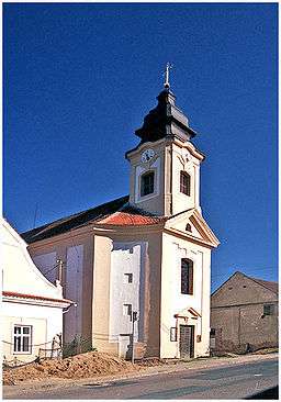 Baroque church of St George in Klentnice. | ||
|
||
| Country | Czech Republic | |
|---|---|---|
| Region | South Moravian | |
| District | Břeclav | |
| Municipality | Klentnice | |
| Timezone | CET (UTC+1) | |
| - summer (DST) | CEST (UTC+2) | |
| Wikimedia Commons: Klentnice | ||

Klentnice (German: Klentnitz) is a village in the South Moravian Region (Jihomoravský kraj) in the Czech Republic. It lies 20 kilometres north west of Břeclav (German “Lundenburg”) and belongs to the okres Břeclav.
Geography
Klentnice is a so-called "Straßendorf" (village built along a main road) in the Palava mountains. It is situated on the eastern slope of the Stolove hora (458 m) and is overtopped by the ruins of the castle Sirotci Hradek (German "Waisenstein" or "Rosenburg"). In the north there are the Devin (549 m) and its foothill Palava (461 m). Neighbouring places are Horni Vestonice and Dolny Vestonice to the north, Pavlov to the north-east, Milovice to the east, Mikulov to the south, Bavory to the south-east and Perna to the west.
History
Grave findings of the La-Tene culture are documents of an early settlement. The first written document of the town dates back to a royal certificate from the 11 March 1332 and was owned by the House of Liechtenstein and the Abbey of Kanitz. Because of several wars, especially the invasion of the Hussites in 1426, the town was left desolate. At the beginning of the 16th century there began a new colonization. When in 1514 the possession of Nikolsburg was divided among the members of the House of Liechtenstein, tributary payments from Klentnitz are mentioned. The town was sold in 1560 and in 1572 returned to Maximillian II. Together with the possession of Nikolsburg, but was sold again in 1575 to Adam of Dietrichstein. The name of the town changed from "Glemtitz" (1332) and “Glewetitz” (1351) to “Glennticz” (1504) and "Glenginitz" (1583) and from “Glendnitz” (1650) to Klentnitz. Until 1775 Klentnice belonged to the parish of Nikolsburg.
1805 and 1809 it was occupied and looted by the French. The warm and balanced climate makes the area a fertile producing region for wine, fruits and vegetables with a high quality. Apart from all sorts of corn, there grow sweet corn, poppy seed and canola as well. Apart from agriculture the inhabitants of Klentnitz got their money by working in chalk-pits, brickworks and other manufacturing firms. The seal of Klentnitz has in its centre a renaissance shield bent over on both sides. In it there are two diverged coulters with the year 1560 above them. This townseal, which was developed relatively early, refers to the importance of the town in the area of possession of Nikolsburg during these times. Of a second seal, which originates from 1561, still exists the original typar and in the second half of the 19th century a simple pictureless seal with words was created. There have been parish registers since 1785 and land registration since 1743. The first school was built in 1796 and the new building for two classes was finished in 1901.
After World War I the multi-ethnic state Austria–Hungary was split up. By the Treaty of Saint-Germain-en-Laye Klentnitz became part of the new Czechoslovakian Republic. Following the Munich Agreement German troops marched into the town in October 1938. From that time onward the town belonged to the Gau Niederdonau until 1945. After the end of World War II the town fell back to Czechoslovakia. In order to escape the following tribulations 58 families fled to Austria even before the Potsdam Agreement. As a result of the Beneš decrees the expropriation and the expulsion of the remaining people to Germany followed. The town was recolonized.
Population development
| Census year | Population | Ethnicity of inhabitants | ||
| year | German | Czechs | other | |
| 1793 | 405 | - | - | - |
| 1836 | 437 | - | - | - |
| 1869 | 434 | - | - | - |
| 1880 | 494 | 494 | 0 | 0 |
| 1890 | 446 | 436 | 8 | 2 |
| 1900 | 525 | 523 | 2 | 0 |
| 1910 | 609 | 607 | 2 | 0 |
| 1921 | 630 | 615 | 2 | 13 |
| 1930 | 556 | 552 | 0 | 4 |
References
- German literature
- Josef Freising: Die Rosenburg bei Klentnitz und ihre Geschichte. 1936
- Franz Seidel, Josef Freising: Heimatbuch der Gemeinde Klentnitz. 1956
- Alfred Schickel, Gerald Frodl: Geschichte Südmährens. Bd.3, Klentnitz: Seite 226, 411, 417, 573
- Bruno Kaukal: Wappen und Siege 1992, Klentnitz S. 113
Footnotes
- ↑ Historický místopis Moravy a Slezska v letech 1848–1960, sv.9. 1984
External links
| Wikimedia Commons has media related to Klentnice. |
Coordinates: 48°51′N 16°39′E / 48.850°N 16.650°E