Klamath County, Oregon
| Klamath County, Oregon | |
|---|---|
 Klamath County Courthouse in Klamath Falls | |
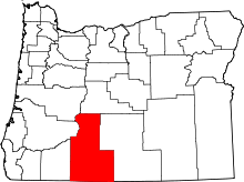 Location in the U.S. state of Oregon | |
 Oregon's location in the U.S. | |
| Founded | October 17, 1882 |
| Named for | Klamath Indians |
| Seat | Klamath Falls |
| Largest city | Klamath Falls |
| Area | |
| • Total | 6,136 sq mi (15,892 km2) |
| • Land | 5,941 sq mi (15,387 km2) |
| • Water | 194 sq mi (502 km2), 3.2% |
| Population (est.) | |
| • (2015) | 66,016 |
| • Density | 11/sq mi (4/km²) |
| Congressional district | 2nd |
| Time zone | Pacific: UTC-8/-7 |
| Website |
www |
Klamath County (/ˈklæməθ/ KLAM-əth) is a county located in the U.S. state of Oregon. As of the 2010 census, the population was 66,380.[1] The county seat is Klamath Falls.[2] The county was named for the Klamath,[3] the tribe of Native Americans living in the area at the time the first European explorers entered the region.
Klamath County comprises the Klamath Falls, OR Micropolitan Statistical Area.
History
The Klamath or Clamitte tribe of Indians, for which Klamath County was named, are the descendants of varying cultures of indigenous peoples, who have lived in the area for more than 10,000 years.
When European-Americans began to travel through the area in 1846 along the Applegate Trail, they competed with the Klamath for game and water, which precipitated clashes between the peoples. This was exacerbated by European-American settlers, who cleared the land to farm and encroached on hunting territory. They were successful in demanding the removal of American Indians to reservations.
The Modoc people, having been removed to Oregon to share a reservation with the Klamath, traditional rivals, wanted a reservation created on Lost River, near present-day Merrill, Oregon. Captain Jack led his band back to Lost River, but the US Army, accompanied by militia and citizens of Linkville (present-day Klamath Falls) arrived and convinced Captain Jack to return. An argument broke out, shots were fired, and the Modoc War began as the Modoc fled to Captain Jack's Stronghold in northern California.
A treaty was signed with the Klamath on October 14, 1864, which led to the establishment of the Klamath Reservation. At various times over the next 40 years, different individuals of the Modoc tribe were settled within the reservation.
Because of the extensive tracts of forest, the Klamath were very well off as a people until the termination of the reservation by the U.S. government in 1954. Much of the money received after the termination was lost due to squandering, theft or criminal deception, resulting in increased poverty and loss of tribal identity.
A few of the Klamath refused to accept the buyout money, most notably Edison Chiloquin (1924–2003). Instead of cash, he insisted on receiving the title to ancestral land along the Sprague River where he lived. On December 5, 1980, the Chiloquin Act was signed into law, giving him title to the properties he wanted.[4]
Geography

According to the U.S. Census Bureau, the county has a total area of 6,136 square miles (15,890 km2), of which 5,941 square miles (15,390 km2) is land and 194 square miles (500 km2) (3.2%) is water.[5] It is the fourth-largest county in Oregon.
Adjacent counties
- Jackson County (west)
- Douglas County (northwest)
- Lane County (northwest)
- Deschutes County (north)
- Lake County (east)
- Siskiyou County, California (south)
- Modoc County, California (south)
National protected areas
- Bear Valley National Wildlife Refuge
- Crater Lake National Park (part)
- Deschutes National Forest (part)
- Fremont National Forest (part)
- Klamath Marsh National Wildlife Refuge
- Lower Klamath National Wildlife Refuge (part)
- Rogue River – Siskiyou National Forest (part)
- Upper Klamath National Wildlife Refuge
- Winema National Forest (part)
Demographics
| Historical population | |||
|---|---|---|---|
| Census | Pop. | %± | |
| 1890 | 2,444 | — | |
| 1900 | 3,970 | 62.4% | |
| 1910 | 8,554 | 115.5% | |
| 1920 | 11,413 | 33.4% | |
| 1930 | 32,407 | 183.9% | |
| 1940 | 40,497 | 25.0% | |
| 1950 | 42,150 | 4.1% | |
| 1960 | 47,475 | 12.6% | |
| 1970 | 50,021 | 5.4% | |
| 1980 | 59,117 | 18.2% | |
| 1990 | 57,702 | −2.4% | |
| 2000 | 63,775 | 10.5% | |
| 2010 | 66,380 | 4.1% | |
| Est. 2015 | 66,016 | [6] | −0.5% |
| U.S. Decennial Census[7] 1790-1960[8] 1900-1990[9] 1990-2000[10] 2010-2015[1] | |||
2000 census
As of the census[11] of 2000, there were 63,775 people, 25,205 households, and 17,290 families residing in the county. The population density was 11 people per square mile (4/km²). There were 28,883 housing units at an average density of 5 per square mile (2/km²). The racial makeup of the county was 87.33% White, 0.63% Black or African American, 4.19% Native American, 0.80% Asian, 0.12% Pacific Islander, 3.45% from other races, and 3.47% from two or more races. 7.78% of the population were Hispanic or Latino of any race. 16.7% were of German, 10.8% Irish, 10.7% English and 9.8% United States or American ancestry. 92.6% spoke English and 6.1% Spanish as their first language.
There were 25,205 households out of which 30.30% had children under the age of 18 living with them, 54.20% were married couples living together, 10.00% had a female householder with no husband present, and 31.40% were non-families. 25.30% of all households were made up of individuals and 10.40% had someone living alone who was 65 years of age or older. The average household size was 2.49 and the average family size was 2.95.
In the county, the population was spread out with 25.80% under the age of 18, 8.60% from 18 to 24, 25.50% from 25 to 44, 25.20% from 45 to 64, and 14.90% who were 65 years of age or older. The median age was 38 years. For every 100 females there were 100.10 males. For every 100 females age 18 and over, there were 97.30 males.
The median income for a household in the county was $31,537, and the median income for a family was $38,171. Males had a median income of $32,052 versus $22,382 for females. The per capita income for the county was $16,719. About 12.00% of families and 16.80% of the population were below the poverty line, including 22.40% of those under age 18 and 7.70% of those age 65 or over.
2010 census
As of the 2010 United States Census, there were 66,380 people, 27,280 households, and 17,831 families residing in the county.[12] The population density was 11.2 inhabitants per square mile (4.3/km2). There were 32,774 housing units at an average density of 5.5 per square mile (2.1/km2).[13] The racial makeup of the county was 85.9% white, 4.1% American Indian, 0.9% Asian, 0.7% black or African American, 0.1% Pacific islander, 4.1% from other races, and 4.1% from two or more races. Those of Hispanic or Latino origin made up 10.4% of the population.[12] In terms of ancestry, 20.0% were German, 14.7% were Irish, 11.9% were English, and 5.5% were American.[14]
Of the 27,280 households, 28.4% had children under the age of 18 living with them, 49.7% were married couples living together, 10.7% had a female householder with no husband present, 34.6% were non-families, and 27.3% of all households were made up of individuals. The average household size was 2.40 and the average family size was 2.88. The median age was 41.7 years.[12]
The median income for a household in the county was $41,818 and the median income for a family was $51,596. Males had a median income of $42,215 versus $30,413 for females. The per capita income for the county was $22,081. About 12.7% of families and 16.6% of the population were below the poverty line, including 21.8% of those under age 18 and 9.1% of those age 65 or over.[15]
Government
| Year | Republicans | |
|---|---|---|
| 2012 | 67.8% 18,654 | 29.6% 8,140 |
| 2008 | 65.0% 19,113 | 31.9% 9,370 |
| 2004 | 72.1% 22,733 | 26.2% 8,264 |
| 2000 | 67.7% 18,855 | 27.1% 7,541 |
| 1996 | 54.2% 12,116 | 32.2% 7,207 |
| 1992 | 44.6% 11,864 | 29.8% 7,918 |
| 1988 | 60.0% 13,484 | 37.5% 8,429 |
| 1984 | 69.8% 17,686 | 29.9% 7,575 |
| 1980 | 62.8% 16,060 | 28.8% 7,371 |
| 1976 | 50.8% 10,726 | 42.9% 9,061 |
| 1972 | 58.9% 11,169 | 30.2% 5,719 |
| 1968 | 56.4% 9,604 | 33.1% 5,629 |
| 1964 | 48.5% 8,530 | 51.5% 9,066 |
| 1960 | 50.5% 9,095 | 49.5% 8,928 |
Politics
Klamath County is represented in the Oregon House of Representatives by two Republicans, Bill Garrard and Mike McLane, and in the Oregon State Senate by Republican Doug Whitsett. Federally, Greg Walden, a Republican, is Klamath County's representative in the United States House. The county has reliably given a majority of its votes to Republican politicians for years; the last time a Democratic candidate for US president carried Klamath County was in 1964, when Lyndon Johnson won by a landslide nationwide against Barry Goldwater — but only by three percentage points in Klamath County.
Economy
Historically, Klamath County's economy was based on timber and agriculture, and although these natural resource industries now contribute only a small fraction to the region's current economic activity and employment, their legacy lives on in local politics, community identity, and landscape. Euro-American settlement in the area was spurred in the early 20th century with the coming of the railroad. In addition, the government-subsidized federal reclamation project, the Klamath Irrigation Project, dammed upper tributaries and drained much of the 128 square miles (331.5 km2) Lower Klamath and Tule lakes to convert 188,000 acres (760 km2) of former lakebed and wetlands into farmland, to be supported by irrigation.
Today the Sky Lakes Medical Center is the largest employer in the area, followed by Klamath County School District and Jeld-Wen, a manufacturer of doors and windows. The area is currently experiencing a boom in housing construction, as its proximity to California brings waves of retirees from population centers to the south. Outdoor recreation, such as hiking, hunting, and world-class trout fishing, as well as Oregon's only National Park at Crater Lake, contribute to the economy of the area. A complex of six National Wildlife Refuges—Klamath Basin National Wildlife Refuges Complex—seasonally draw some of the largest concentrations of waterfowl in North America. The area is world-renowned as a birdwatcher's paradise. Natural geothermal hot wells provide heat for many homes, businesses, and the Oregon Institute of Technology campus. The full potential of this energy resource continues to be studied.
Education
Colleges and universities
Communities
Cities
- Bonanza
- Chiloquin
- Klamath Falls (county seat)
- Malin
- Merrill
Census-designated place
Unincorporated communities
- Ady
- Algoma
- Beatty
- Beaver Marsh
- Bly
- Cascade Summit
- Chemult
- Crescent
- Dairy
- Fairhaven
- Falcon Heights
- Fort Klamath
- Gilchrist
- Hager
- Hatfield (part)
- Haynesville
- Henley
- Hildebrand
- Hot Springs
- Keno
- Kirk
- Klamath Agency
- Lake of the Woods
- Langell Valley
- Lenz
- Lorella
- Malone
- Midland
- Modoc Point
- Odell Lake
- Odessa
- Olene
- Pelican City
- Pine Grove
- Rocky Point
- Shevlin
- Sprague River
- Stewart Lenox
- Terminal City
- Worden
- Yonna
See also
- National Register of Historic Places listings in Klamath County, Oregon
- List of parks in Klamath Falls, Oregon
References
- 1 2 "State & County QuickFacts". United States Census Bureau. Retrieved November 15, 2013.
- ↑ "Find a County". National Association of Counties. Retrieved 2011-06-07.
- ↑ Gannett, Henry (1905). The Origin of Certain Place Names in the United States. Government Printing Office. p. 177.
- ↑ http://www.oregonencyclopedia.org/articles/chiloquin_edison_1923_2003_/#.VUMTqvnF_To
- ↑ "2010 Census Gazetteer Files". United States Census Bureau. August 22, 2012. Retrieved February 26, 2015.
- ↑ "County Totals Dataset: Population, Population Change and Estimated Components of Population Change: April 1, 2010 to July 1, 2015". Retrieved July 2, 2016.
- ↑ "U.S. Decennial Census". United States Census Bureau. Retrieved February 26, 2015.
- ↑ "Historical Census Browser". University of Virginia Library. Retrieved February 26, 2015.
- ↑ Forstall, Richard L., ed. (March 27, 1995). "Population of Counties by Decennial Census: 1900 to 1990". United States Census Bureau. Retrieved February 26, 2015.
- ↑ "Census 2000 PHC-T-4. Ranking Tables for Counties: 1990 and 2000" (PDF). United States Census Bureau. April 2, 2001. Retrieved February 26, 2015.
- ↑ "American FactFinder". United States Census Bureau. Retrieved 2008-01-31.
- 1 2 3 "DP-1 Profile of General Population and Housing Characteristics: 2010 Demographic Profile Data". United States Census Bureau. Retrieved 2016-02-23.
- ↑ "Population, Housing Units, Area, and Density: 2010 - County". United States Census Bureau. Retrieved 2016-02-23.
- ↑ "DP02 SELECTED SOCIAL CHARACTERISTICS IN THE UNITED STATES – 2006-2010 American Community Survey 5-Year Estimates". United States Census Bureau. Retrieved 2016-02-23.
- ↑ "DP03 SELECTED ECONOMIC CHARACTERISTICS – 2006-2010 American Community Survey 5-Year Estimates". United States Census Bureau. Retrieved 2016-02-23.
External links
![]() Media related to Klamath County, Oregon at Wikimedia Commons
Media related to Klamath County, Oregon at Wikimedia Commons
- Klamath County, Oregon (official website)
- Klamath County Chamber of Commerce
- Klamath Visitor & Convention Bureau
- Klamath County Economic Development
Coordinates: 42°41′N 121°39′W / 42.68°N 121.65°W
 |
Douglas County and Lane County | Deschutes County | | |
| Jackson County | |
Lake County | ||
| ||||
| | ||||
| Siskiyou County, California and Modoc County, California |
Municipalities and communities of Klamath County, Oregon, United States | ||
|---|---|---|
| Cities | | |
| CDP | ||
| Unincorporated communities | ||