Kitcharao, Agusan del Norte
| Kitcharao | ||
|---|---|---|
| Municipality | ||
|
Lake Mainit, located partly within Kitcharao | ||
| ||
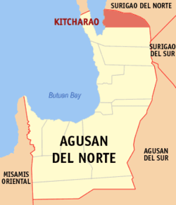 Location within Agusan del Norte province | ||
.svg.png) Kitcharao Location within the Philippines | ||
| Coordinates: 9°28′N 125°35′E / 9.46°N 125.58°ECoordinates: 9°28′N 125°35′E / 9.46°N 125.58°E | ||
| Country | Philippines | |
| Region | Caraga (Region XIII) | |
| Province | Agusan del Norte | |
| District | 2nd district of Agusan del Norte | |
| Founded | August 29, 1963 | |
| Barangays | 11 (see Barangays) | |
| Government [1] | ||
| • Type | Sangguniang Bayan | |
| • Mayor | Aristotle E. Montante | |
| Area[2] | ||
| • Total | 171.92 km2 (66.38 sq mi) | |
| Population (2015 census)[3] | ||
| • Total | 18,659 | |
| • Density | 110/km2 (280/sq mi) | |
| • Voter (2016)[4] | 10,769 | |
| Time zone | PST (UTC+8) | |
| ZIP code | 8609 | |
| IDD : area code | +63 (0)85 | |
| Income class | 4th class | |
| PSGC | 160206000 | |
| Website |
www | |


Kitcharao, officially the Municipality of Kitcharao (Filipino: Bayan ng Kitcharao), is a municipality in the province of Agusan del Norte in the Caraga (Region XIII) of the Philippines. The population was 18,659 at the 2015 census.[3] In the 2016 election, it had 10,769 registered voters.[4]
History
Kitcharao, as a municipality, was created on June 22, 1963 under Republic Act No. 3842,[5] sponsored by Congressman Guillermo R. Sánchez. It was once a barrio of Jabonga. Through the initiative of the then Vice Mayor Francisco M. Tuozo of Jabonga, a resolution was sponsored petitioning Congress for the creation of the Municipality of Kitcharao.
The inhabitants of the municipality came from various regions in Luzon and the Visayas, hence the presence of Ilocanos, Tagalogs, Leyteños, Ilonggos, Warays, Cebuanos, Boholanos, and a few indigenous groups known as the Mamanwa.
On August 29, 1963, the first Municipal Officials were inducted to the office by then Governor Democrito O. Plaza. Félix Q. Basadre, Sr. was the appointed Mayor, Marceliano Morada as Vice Mayor and all the councillors were: Mariano M. Napalan, Sr., Gaudencio Pojas, Pencionico Bermúdez, Juan Tidalgo, Agustín Patagan and Uldarico Atuel.
The same set of Municipal Officials was elected in the ensuing regular election on November 1963.[6]
In 2005, Barangays Crossing and Songkoy were created.[7]
Geography
Kitcharao is located at 9°28′N 125°35′E / 9.46°N 125.58°E.
According to the Philippine Statistics Authority, the municipality has a land area of 171.92 square kilometres (66.38 sq mi)[2] constituting 6.30% of the 2,730.24-square-kilometre- (1,054.15 sq mi) total area of Agusan del Norte.
Barangays
Kitcharao is politically subdivided into 11 barangays.[8]
| PSGC | Barangay | Population | ±% p.a. | ||
|---|---|---|---|---|---|
| 2015[3] | 2010[9] | ||||
| 160206001 | Bangayan | 6.7% | 1,254 | 1,134 | +1.93% |
| 160206002 | Canaway | 6.7% | 1,259 | 1,183 | +1.19% |
| 160206010 | Crossing | 17.5% | 3,274 | 3,103 | +1.03% |
| 160206003 | Hinimbangan | 1.6% | 299 | 458 | −7.80% |
| 160206004 | Jaliobong | 8.3% | 1,551 | 1,755 | −2.33% |
| 160206005 | Mahayahay | 14.1% | 2,632 | 2,290 | +2.69% |
| 160206006 | Poblacion | 11.8% | 2,198 | 1,882 | +3.00% |
| 160206007 | San Isidro | 6.6% | 1,227 | 1,067 | +2.70% |
| 160206008 | San Roque | 10.4% | 1,947 | 1,785 | +1.67% |
| 160206009 | Sangay | 5.6% | 1,038 | 903 | +2.69% |
| 160206011 | Songkoy | 10.6% | 1,980 | 1,817 | +1.65% |
| Total | 18,659 | 17,377 | +1.36% | ||
Demographics
| Population census of Kitcharao | |||||||||||||||||||||||||
|---|---|---|---|---|---|---|---|---|---|---|---|---|---|---|---|---|---|---|---|---|---|---|---|---|---|
|
| ||||||||||||||||||||||||
| Source: PSA[3][9][10] | |||||||||||||||||||||||||
In the 2015 census, Kitcharao had a population of 18,659.[3] The population density was 110 inhabitants per square kilometre (280/sq mi).
In the 2016 election, it had 10,769 registered voters.[4]
References
- ↑ "Municipality". Quezon City, Philippines: Department of the Interior and Local Government. Retrieved 31 May 2013.
- 1 2 "Province: Agusan del Norte". PSGC Interactive. Makati City, Philippines: Philippine Statistics Authority. Retrieved 28 October 2016.
- 1 2 3 4 5 "CARAGA". Census of Population (2015): Total Population by Province, City, Municipality and Barangay (Report). PSA. Retrieved 20 June 2016.
- 1 2 3 "2016 National and Local Elections Statistics". Commission on Elections. 2016.
- ↑ "Republic Act No. 3842 - An Act Creating the Municipality of Kitcharao in the Province of Agusan". Chan Robles Virtual Law Library. 22 June 1963. Archived from the original on 19 May 2014. Retrieved 16 October 2016.
- ↑ Municipality of Kitcharao (2010-09-13). "History of Kitcharao". Retrieved 2010-09-13.
- ↑ National Statistical Coordination Board (2006-02-27). "2006 Factsheet". Retrieved 2006-06-24.
- ↑ "Municipal: Kitcharao, Agusan del Norte". PSGC Interactive. Quezon City, Philippines: Philippine Statistics Authority. Retrieved 8 January 2016.
- 1 2 "CARAGA". Census of Population and Housing (2010): Total Population by Province, City, Municipality and Barangay (Report). NSO. Retrieved 29 June 2016.
- ↑ "CARAGA". Census of Population (1995, 2000 and 2007): Total Population by Province, City and Municipality (Report). NSO. Archived from the original on 11 November 2011.
External links
 |
Alegria, Surigao del Norte / Gigaquit, Surigao del Norte | | ||
| Lake Mainit | |
Claver, Surigao del Norte | ||
| ||||
| | ||||
| Jabonga |
Cabadbaran (capital) | |
| Municipalities | |
| Component city | |
| Highly urbanized city |
|