Kitaakita District, Akita
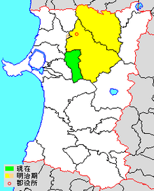
green - current
yellow - former extent in early Meiji period
1. - Odate
2. - Kitaakita
Kitaakita District (北秋田郡 Kitaakita-gun) is a rural district located in Akita Prefecture, Japan.
As of June 2013, the district consists of only the village of Kamikoani with an estimated population of 2,521 and an area of 256.82 km². All of the cities of Kitaakita and Ōdate, and part of the city of Noshiro were formerly part of Kitaakita District.
Towns and villages
History
The area of Kitaakita District was formerly part of Dewa Province. Dewa Province was divided into the provinces of Ugo Province and Uzen Province following the Meiji restoration on January 19, 1869, with the area of Kitaakita becoming part of Ugo Province. At the time, the area consisted of two towns (Ōdate and Junishō) and 117 villages formerly under the control of Kubota Domain. Akita Prefecture was founded on December 13, 1871.

Purple - Ōdate-shi
2. Ōdate
3. Ogita
4. Junishō
11. Hayaguchi
12. Yamase
13. Shimokawasoe
14. Kamikawasoe
15. Nagaki
16. Shakanai
17.Hanaoka
18.Yatate
19. Ōkuzo
20. Higashidate
21. Nishidate
22. Niida
23. Manaka
Light Blue - part of Noshiro-shi
9. Nanakura (southwest portion)
Pink - Kitaakiya-shi
1. Takanosu
5. Yonaizawa
6. Aniai
7. Sakae
8. Bōsawa
9. Nanakura (northeast portion)
10. Tsuzureko
24. Sawaguchi
25. Nanukaichi
26. Ōno
27. Ochiai
28. Shimokoani
30. Maeda
31. Arasei
Blue - Kamikoani-mura
29. Kamikoani
History
With the establishment of the municipality system on April 1, 1889, modern Kitaakita District, with two towns (Ōdate and Junishō) and 29 villages was established.
- 1896 - Ogita was elevated to town status.
- 1897 - Aniai was elevated to town status.
- 1900 - Takanosu was elevated to town status.
- 1902 - Yonaizawa was elevated to town status.
- 1932 - Hanaoka was elevated to town status.
- 1947 - Hayaguchi was elevated to town status.
- 1951 - Ōdate was elevated to city status.
- 1955 - Hanaoka was renamed Hanaya, Ogita was renamed Hinai, the town of Aikawa was established by the consolidation of four villages, and the town of Junisho was merged into Ōdate.
- 1956 - Hayaguchi was renamed Tashiro, and Yonaizawa became Moriyoshi.
- 1967 - The town of Hanaya was absorbed into Ōdate.
- On March 22, 2005 - the towns of Aikawa, Ani, Moriyoshi and Takanosu were merged to create the city of Kitaakita.
- On June 20, 2005 - the towns of Hinai and Tashiro were merged into the expanded city of Ōdate. Following this merger, Kitaakita District was left with only the village of Kamikoani.
| Core city | ||
|---|---|---|
| Cities | ||
| Kazuno District | ||
| Kitaakita District | ||
| Minamiakita District | ||
| Ogachi District | ||
| Semboku District | ||
| Yamamoto District | ||
Coordinates: 39°57′36″N 140°19′16″E / 39.960°N 140.321°E