Kingston, Oklahoma
| Kingston, Oklahoma | |
|---|---|
| Town | |
|
Main Street | |
 Location of Kingston, Oklahoma | |
| Coordinates: 34°0′1″N 96°43′16″W / 34.00028°N 96.72111°WCoordinates: 34°0′1″N 96°43′16″W / 34.00028°N 96.72111°W | |
| Country | United States |
| State | Oklahoma |
| County | Marshall |
| Area | |
| • Total | 1.8 sq mi (4.5 km2) |
| • Land | 1.8 sq mi (4.5 km2) |
| • Water | 0.0 sq mi (0.0 km2) |
| Elevation | 810 ft (247 m) |
| Population (2000) | |
| • Total | 1,601 |
| • Density | 889/sq mi (355/km2) |
| Time zone | Central (CST) (UTC-6) |
| • Summer (DST) | CDT (UTC-5) |
| ZIP code | 73439 |
| Area code(s) | 580 |
| FIPS code | 40-39900[1] |
| GNIS feature ID | 1102958[2] |

Kingston is a town in Marshall County, Oklahoma, United States. The population was 1,601 at the 2010 census.
Geography
Kingston is located at 34°0′1″N 96°43′16″W / 34.00028°N 96.72111°W (34.000146, -96.721133).[3]
According to the United States Census Bureau, the town has a total area of 1.8 square miles (4.7 km2), all of it land. Kingston, the home of the Kingston Redskins, is proud of its High School Alumni Association, which is the oldest active alumni association in the state of Oklahoma (since 1911). Each year graduates of Kingston High School are given the opportunity to join the association. The association, through donations and fund raisers, helps to send students to college
Demographics
| Historical population | |||
|---|---|---|---|
| Census | Pop. | %± | |
| 1910 | 439 | — | |
| 1920 | 767 | 74.7% | |
| 1930 | 552 | −28.0% | |
| 1940 | 481 | −12.9% | |
| 1950 | 677 | 40.7% | |
| 1960 | 639 | −5.6% | |
| 1970 | 710 | 11.1% | |
| 1980 | 1,171 | 64.9% | |
| 1990 | 1,237 | 5.6% | |
| 2000 | 1,390 | 12.4% | |
| 2010 | 1,601 | 15.2% | |
| Est. 2015 | 1,632 | [4] | 1.9% |
As of the census[1] of 2000, there were 1,390 people, 552 households, and 381 families residing in the town. The population density was 791.8 people per square mile (304.9/km²). There were 629 housing units at an average density of 358.3 per square mile (138.0/km²). The racial makeup of the town was 78.56% White, 0.14% African American, 14.68% Native American, 0.95% Asian, 1.80% from other races, and 4.75% from two or more races. Hispanic or Latino of any race were 4.39% of the population.
Kingston and the surrounding area (towns of Madill and Oakland) has a large Hispanic community due to a large influx of immigration attracted to the area's manufacturing jobs. But the United States Hispanic Chamber of Commerce places a new estimate at over 10 percent.
There were 552 households out of which 35.0% had children under the age of 18 living with them, 51.6% were married couples living together, 12.9% had a female householder with no husband present, and 30.8% were non-families. 27.7% of all households were made up of individuals and 15.4% had someone living alone who was 65 years of age or older. The average household size was 2.45 and the average family size was 2.94.
In the town the population was spread out with 27.3% under the age of 18, 7.4% from 18 to 24, 27.0% from 25 to 44, 21.7% from 45 to 64, and 16.6% who were 65 years of age or older. The median age was 36 years. For every 100 females there were 93.3 males. For every 100 females age 18 and over, there were 84.5 males.
The median income for a household in the town was $22,429, and the median income for a family was $30,259. Males had a median income of $25,278 versus $18,403 for females. The per capita income for the town was $11,850. About 18.1% of families and 22.8% of the population were below the poverty line, including 22.6% of those under age 18 and 26.0% of those age 65 or over.
History
Much of Kingston's history is unknown, but it is home to the oldest alumni program in the state of Oklahoma. Heather Wofford, the wife of the great BK Wofford, once rode thru town on the back of BK's motorcycle. There used to be several older buildings in Kingston, but they were torn down in the late 80s to make way for the new hardware store and lumberyard. Kingston also has a new multipurpose activity building to the community; it is located on the high school campus. The oldest building in Kingston, which used to serve as the town's bank in the early days, now houses Dee's Creative Corner.
References
- 1 2 "American FactFinder". United States Census Bureau. Retrieved 2008-01-31.
- ↑ "US Board on Geographic Names". United States Geological Survey. 2007-10-25. Retrieved 2008-01-31.
- ↑ "US Gazetteer files: 2010, 2000, and 1990". United States Census Bureau. 2011-02-12. Retrieved 2011-04-23.
- ↑ "Annual Estimates of the Resident Population for Incorporated Places: April 1, 2010 to July 1, 2015". Retrieved July 2, 2016.
- ↑ "Census of Population and Housing". Census.gov. Retrieved June 4, 2015.
Municipalities and communities of Marshall County, Oklahoma, United States | ||
|---|---|---|
| City | 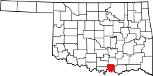 | |
| Towns | ||
| CDP | ||
| Other unincorporated communities |
| |