Kingston, Minnesota
| Kingston, Minnesota | |
|---|---|
| City | |
 Location of Kingston within Meeker County, Minnesota | |
| Coordinates: 45°12′N 94°19′W / 45.200°N 94.317°W | |
| Country | United States |
| State | Minnesota |
| County | Meeker |
| Area[1] | |
| • Total | 0.56 sq mi (1.45 km2) |
| • Land | 0.56 sq mi (1.45 km2) |
| • Water | 0 sq mi (0 km2) |
| Elevation | 1,033 ft (315 m) |
| Population (2010)[2] | |
| • Total | 161 |
| • Estimate (2012[3]) | 159 |
| • Density | 287.5/sq mi (111.0/km2) |
| Time zone | Central (CST) (UTC-6) |
| • Summer (DST) | CDT (UTC-5) |
| ZIP code | 55325 |
| Area code(s) | 320 |
| FIPS code | 27-33344[4] |
| GNIS feature ID | 0646171[5] |
Kingston is a city in Meeker County, Minnesota, along the North Fork of the Crow River. The population was 161 at the 2010 census.[6]
History
Kingston was platted in 1857.[7] A post office was established at Kingston in 1857, and remained in operation until 1907.[8]
Geography
According to the United States Census Bureau, the city has a total area of 0.56 square miles (1.45 km2), all of it land.[1]
Minnesota State Highway 15 serves as a main route in the community, and Minnesota State Highway 24 is nearby.
Demographics
| Historical population | |||
|---|---|---|---|
| Census | Pop. | %± | |
| 1870 | 56 | — | |
| 1970 | 115 | — | |
| 1980 | 141 | 22.6% | |
| 1990 | 131 | −7.1% | |
| 2000 | 120 | −8.4% | |
| 2010 | 161 | 34.2% | |
| Est. 2015 | 159 | [9] | −1.2% |
2010 census
As of the census[2] of 2010, there were 161 people, 61 households, and 42 families residing in the city. The population density was 287.5 inhabitants per square mile (111.0/km2). There were 70 housing units at an average density of 125.0 per square mile (48.3/km2). The racial makeup of the city was 96.9% White, 0.6% Native American, 0.6% Asian, and 1.9% from two or more races. Hispanic or Latino of any race were 1.9% of the population.
There were 61 households of which 36.1% had children under the age of 18 living with them, 60.7% were married couples living together, 6.6% had a female householder with no husband present, 1.6% had a male householder with no wife present, and 31.1% were non-families. 21.3% of all households were made up of individuals and 4.9% had someone living alone who was 65 years of age or older. The average household size was 2.64 and the average family size was 3.10.
The median age in the city was 30.4 years. 29.2% of residents were under the age of 18; 8% were between the ages of 18 and 24; 29.2% were from 25 to 44; 22.3% were from 45 to 64; and 11.2% were 65 years of age or older. The gender makeup of the city was 55.3% male and 44.7% female.
2000 census
As of the census of 2000,[4] there were 120 people, 48 households, and 33 families residing in the city. The population density was 244.0 people per square mile (94.6/km²). There were 53 housing units at an average density of 107.8 per square mile (41.8/km²). The racial makeup of the city was 100.00% White. 34.8% were of German, 28.4% Finnish, 11.3% Swedish, 9.2% Norwegian, 7.8% Irish, and 5.0% French ancestry.
There were 48 households out of which 31.3% had children under the age of 18 living with them, 64.6% were married couples living together, 4.2% had a female householder with no husband present, and 29.2% were non-families. 25.0% of all households were made up of individuals and 12.5% had someone living alone who was 65 years of age or older. The average household size was 2.50 and the average family size was 3.00.
In the city the population was spread out with 23.3% under the age of 18, 14.2% from 18 to 24, 29.2% from 25 to 44, 22.5% from 45 to 64, and 10.8% who were 65 years of age or older. The median age was 37 years. For every 100 females there were 140.0 males. For every 100 females age 18 and over, there were 109.1 males.
The median income for a household in the city was $39,375, and the median income for a family was $45,417. Males had a median income of $30,750 versus $19,107 for females. The per capita income for the city was $13,525. There were no families and 2.5% of the population living below the poverty line, including no under eighteens and 33.3% of those over 64.
References
- 1 2 "US Gazetteer files 2010". United States Census Bureau. Retrieved 2012-11-13.
- 1 2 "American FactFinder". United States Census Bureau. Retrieved 2012-11-13.
- ↑ "Population Estimates". United States Census Bureau. Retrieved 2013-05-28.
- 1 2 "American FactFinder". United States Census Bureau. Retrieved 2008-01-31.
- ↑ "US Board on Geographic Names". United States Geological Survey. 2007-10-25. Retrieved 2008-01-31.
- ↑ "2010 Census Redistricting Data (Public Law 94-171) Summary File". American FactFinder. U.S. Census Bureau, 2010 Census. Retrieved 23 April 2011.
- ↑ Upham, Warren (1920). Minnesota Geographic Names: Their Origin and Historic Significance. Minnesota Historical Society. p. 340.
- ↑ "Meeker County". Jim Forte Postal History. Retrieved 21 July 2015.
- ↑ "Annual Estimates of the Resident Population for Incorporated Places: April 1, 2010 to July 1, 2015". Retrieved July 2, 2016.
- ↑ "Census of Population and Housing". Census.gov. Retrieved June 4, 2015.
Municipalities and communities of Meeker County, Minnesota, United States | ||
|---|---|---|
| Cities | 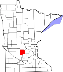 | |
| Townships | ||
| Unincorporated communities | ||
| Footnotes | ‡This populated place also has portions in an adjacent county or counties | |
Coordinates: 45°12′N 94°19′W / 45.200°N 94.317°W