King George V Memorial Park, Kowloon
| King George V Memorial Park | |
|---|---|
| 九龍佐治五世紀念公園 | |
 | |
| Location | Kwun Chung, Kowloon |
| Area | 1.5 hectares |
| Opened | 1941 |
| Operated by | Leisure and Cultural Services Department |
| Public transit access |
Austin Station (70 m) Jordan Station (310 m) |
King George V Memorial Park, Kowloon is a park in Jordan, Kowloon, Hong Kong, located beside Canton Road. There are two parks of this name in Hong Kong. The other one is in Sai Ying Pun, Hong Kong Island.
History
The park was built in 1940. As the governor was ill, administrator Norman Lockhart Smith hosted the park's opening ceremony on 11 June 1941.[1] The park was centred on a statue of King George V. During the Japanese occupation, some facilities were destroyed and the park was used as a rubbish dump.[1]
Following the war, the Urban Council endeavored to rebuild the derelict park to a new layout. Three Chinese styled kiosks were built. The northern end of the park was designed to cater for the comfort of the elderly.[1] The redesigned park was reopened on 21 March 1954 by the Hon. K. M. A. Barnett, chairman of the Urban Council.[1] The immediate vicinity of the park was once a major centre for commerce and transport in Yau Ma Tei, home to the Jordan Road Ferry Pier, the bustling Kwun Chung Market, and the Canton Road Government Offices (all since demolished, although the market has been reprovisioned in the Kwun Chung Municipal Services Building). As part of the Airport Core Programme the adjacent sea was reclaimed in the early 1990s and the park is no longer next to Victoria Harbour.
In 1957, the Urban Council agreed to a proposal to house small libraries at selected playgrounds, to be managed by the Boys' and Girls' Club Association.[2] On 13 December 1967 a children's playground and library were opened at the park by Urban Councillor Elsie Elliott.[3] In 1980, in light of the 1971 opening of the better-equipped Yau Ma Tei Public Library nearby, the council considered closing the smaller library at King George V Memorial Park.[2] The library was finally demolished with the 1990s redesign of the park (see below).[4]
After the adjacent Canton Road was realigned in the 1970s to meet Ferry Street, King George V Memorial Park was significantly expanded to the west. The extension incorporates an earthen berm to help shield the park from the noise of the roadway.
The Urban Council Kwun Chung Complex (now the Kwun Chung Municipal Services Building) was completed in September 1990 and opened on 1 January 1991 on the site of the former football pitch. A new football pitch and basketball courts were built on the site of the old Kwun Chung Market, and the market was moved into the new Urban Council complex. The complex also houses a cooked food centre and an indoor games hall. It was the first Urban Council Complex in the district and cost $410 million.[5][6] Other changes made to the park at this time included the demolition and reprovisioning of the public toilet, the demolition of the children's library, construction of a new children's playground, and general improvements and redesign to other areas of the park.[4]
Facilities
- Basketball court
- Children's playground
- Chinese pavilion
- Football pitch (7-a-side)
- Kwun Chung Municipal Services Building
- Public toilet
Gallery
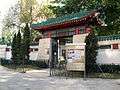 Entrance gate
 Children's playground and municipal complex
 Chinese pavilion
 Aerial view
 Entrance plaque
See also
References
| Wikimedia Commons has media related to King George V Memorial Park, Kowloon. |
- 1 2 3 4 "King George V Park: Re-Opened By Chairman Of Urban Council". South China Morning Post. 22 March 1954. p. 5.
- 1 2 "Provision of Additional Recreation Facilities in King George V Memorial Park, Kowloon". Urban Council. Recreation and Amenities Select Committee. 8 January 1980.
- ↑ "New Playground Opened". South China Morning Post. 14 December 1967. p. 5.
- 1 2 "263CR - Reprovisioning of Football and Basketball Pitches for the King George V Menmorian Park (Kowloon) and Redevelopment Adjacent Park Areas". Urban Council. 6 December 1991.
- ↑ "Laying of Salt Water Main through King George V Memorial Park, Kowloon". Urban Council. Recreation and Amenities Select Committee. 14 March 1977.
- ↑ "Monthly Report". Urban Council. Capital Works Select Committee. 9 February 1991.
Coordinates: 22°18′19″N 114°10′05″E / 22.30522°N 114.16807°E