King, North Carolina
| King, North Carolina | |
|---|---|
| City | |
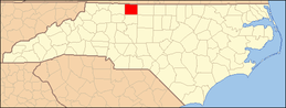
 Location of King, North Carolina | |
| Coordinates: 36°16′25″N 80°21′12″W / 36.27361°N 80.35333°WCoordinates: 36°16′25″N 80°21′12″W / 36.27361°N 80.35333°W | |
| Country | United States |
| State | North Carolina |
| Counties | Stokes |
| Government | |
| • Type | Democracy |
| • Mayor | Jack Warren |
| Area | |
| • Total | 5.89 sq mi (15.26 km2) |
| • Land | 5.84 sq mi (15.12 km2) |
| • Water | 0.05 sq mi (0.14 km2) |
| Elevation | 1,142 ft (348 m) |
| Population (2010) | |
| • Total | 6,904 |
| • Density | 1,183/sq mi (456.7/km2) |
| Time zone | Eastern (EST) (UTC-5) |
| • Summer (DST) | EDT (UTC-4) |
| ZIP code | 27021 |
| Area code(s) | 336 |
| FIPS code | 37-35760[1] |
| GNIS feature ID | 1021043[2] |
| Website |
www |
King is a city in Stokes and Forsyth counties, North Carolina, United States. The population was 6,904 at the 2010 census.[3]
King is part of the Piedmont Triad metropolitan area, located northwest of Winston-Salem.
The city has two large public parks: Recreation Acres and Central Park.
Geography
King is located in southern Stokes County, with parts of the city limits extending south into Forsyth County. U.S. Route 52, a four-lane freeway, passes through the city south and west of the center, with access from Exit 123. Downtown Winston-Salem is 16 miles (26 km) southeast via US 52, and Mount Airy is 21 miles (34 km) to the northwest. Hanging Rock State Park is 16 miles (26 km) to the north.
According to the United States Census Bureau, the city has a total area of 5.9 square miles (15.3 km2), of which 5.8 square miles (15.1 km2) is land and 0.04 square miles (0.1 km2), or 0.93%, is water.[3]
History
The town was originally called "King's Cabin". Charles and Francis King lived in a cabin owned by Francis's father for a short time in the 1830s. Being Quakers and against slavery, the King family moved to the free North. According to television journalist and historian Chad Tucker's book Images of America, King (2006), after the King family left their home it was used by locals as a landmark or reference point in giving directions. Several decades later when a post office was established in 1888 it was named for that reference point, King's Cabin. The railroad laid tracks a few years later and shortened the name to "King" in its business transactions, and to eliminate confusion the post office followed on September 26, 1894. Charles and Francis King never returned to Stokes County and never knew their former home became the namesake of a town.
According to Tucker, the community grew into an unincorporated town of schools and businesses. With the first automobile arriving by train in October 1911, new highways followed. With new roads, the town's proximity to Winston-Salem, and a new four-lane Highway 52 built in the 1960s, King opened its doors to growth, turning farmland into subdivisions. Community groups acted as an unofficial town council, providing services such as a fire department, water and sewer. On September 13, 1983, King became an incorporated city, 95 years after the King's Cabin post office opened.[4]
The King Historic District and Rock House are listed on the National Register of Historic Places.[5]
Professional bowler Tom Baker lives in King.
King is home to the 2011 North Carolina 2AA championship football team the West Stokes Wildcats.
Demographics
| Historical population | |||
|---|---|---|---|
| Census | Pop. | %± | |
| 1990 | 4,059 | — | |
| 2000 | 5,952 | 46.6% | |
| 2010 | 6,904 | 16.0% | |
| Est. 2015 | 7,059 | [6] | 2.2% |
As of the census[1] of 2010, there were 6904 people, and 2503 households, residing in the city. The population density The racial makeup of the city was 97.73% White, 2.59% African American, 0.13% Native American, 0.57% Asian, 0.02% Pacific Islander, 0.34% from other races, and 0.62% from two or more races. Hispanic or Latino of any race were 2.05% of the population.
References
- 1 2 "American FactFinder". United States Census Bureau. Retrieved 2008-01-31.
- ↑ "US Board on Geographic Names". United States Geological Survey. 2007-10-25. Retrieved 2008-01-31.
- 1 2 "Geographic Identifiers: 2010 Census Summary File 1 (G001), King city, North Carolina". American FactFinder. U.S. Census Bureau. Retrieved June 27, 2016.
- ↑ Tucker, Chad. Images of America, King. Charleston, SC: Arcadia Publishing, 2006.
- ↑ National Park Service (2010-07-09). "National Register Information System". National Register of Historic Places. National Park Service.
- ↑ "Annual Estimates of the Resident Population for Incorporated Places: April 1, 2010 to July 1, 2015". Retrieved July 2, 2016.
- ↑ "Census of Population and Housing". Census.gov. Retrieved June 4, 2015.
External links
- City of King official website
- King Chamber of Commerce
- King, NC, at City-Data.com
- American Towns Features King, NC
- Atlantic & Yadkin Railway
Municipalities and communities of Forsyth County, North Carolina, United States | ||
|---|---|---|
| Cities | 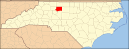 | |
| Towns | ||
| Villages | ||
| CDP | ||
| Unincorporated communities | ||
| Footnotes | ‡This populated place also has portions in an adjacent county or counties | |
Municipalities and communities of Stokes County, North Carolina, United States | ||
|---|---|---|
| City |
|  |
| Towns | ||
| Village | ||
| CDPs | ||
| Other unincorporated communities |
| |
| Footnotes | ‡This populated place also has portions in an adjacent county or counties. | |