Khulo
| Khulo ხულო | |
|---|---|
| Borough | |
 | |
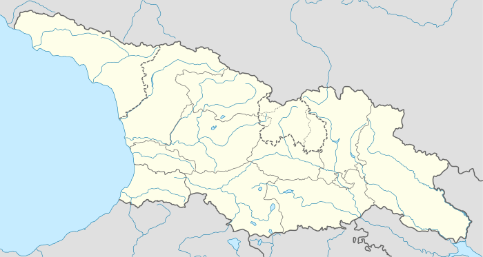 Khulo Location of Khulo in Georgia | |
| Coordinates: 41°38′00″N 42°19′00″E / 41.63333°N 42.31667°E | |
| Country |
|
| Autonomous Republic | Adjara |
| Daba from | 1964 |
| Population (2014) | |
| • Total | 1,007[1] |
| Time zone | Georgian Time (UTC+4) |
Khulo (Georgian: ხულო [xulɔ]) is a townlet (daba) in Adjara, an autonomous republic in southwest Georgia, 88 km east of the regional capital Batumi, in the upper valley of Adjaris-tsqali. The town and adjoining 78 villages form the mountainous Khulo District (Rayon). Area – 710 km2; population – 23,327.[1]
The town, formerly known as Khula and Hulo, was a merchant place located on a medieval road that linked Samtskhe-Javakheti to the Black Sea coast. During Ottoman times, Khulo was a chief settlement of Upper Adjara governed by the Khimshiashvili family. In 1829, it was briefly occupied by the Russian force of General Osten-Sacken who sacked the Khimshiashvili residence before withdrawal.[2] Khulo's population, largely Islamized under the Ottomans, diminished dramatically under the Russian oppression of Islam in the 1870s. A series of floods and avalanches in the 1990s-2000s induced another wave of migration from the mountainous villages of the rayon.
In the district are medieval historical monuments - Khikhani Fortress (10th century) where rebel against Ottoman Empire Selim Beg Khimshiashvili was defending himself until he was captured and beheaded in 1785.[3] On the way to Khikhani fortress there is an active Monastery of Skhalta cathedral (13th century).
Besides historical monuments there are many other interesting tourist sights in Khulo district such as Beshumi Resort and Green Lake located near Goderdzi pass as well as Khulo Cable Cars which is used for daily means of transportation by the locals from Khulo to Tago village.[4]
References
- 1 2 "Population Census 2014". www.geostat.ge. National Statistics Office of Georgia. November 2014. Retrieved 2 June 2016.
- ↑ Allen, William Edward David & Muratov, Pavel Pavlovich (1953), Caucasian battlefields: a history of the wars on the Turco-Caucasian border, 1828-1921, p. 42. Cambridge University Press
- ↑ "Khikhani Fortress, Mountains of Adjara - Georgian Tour Magazine". Georgian Tour Magazine. 2016-02-27. Retrieved 2016-05-10.
- ↑ "Khulo Cable cars, Ghorjomi village and Adjarian Yaylas - Roadtrip to Mountain Adjara - Georgian Tour Magazine". Georgian Tour Magazine. 2016-05-01. Retrieved 2016-05-10.
Coordinates: 41°39′N 42°19′E / 41.650°N 42.317°E
| Autonomous Republic of Abkhazia |   | |
|---|---|---|
| Autonomous Republic of Adjara | ||
| Guria |
| |
| Imereti | ||
| Kakheti | ||
| Mtskheta-Mtianeti | ||
| Samegrelo-Zemo Svaneti | ||
| Samtskhe-Javakheti |
| |
| Racha-Lechkhumi and Kvemo Svaneti |
| |
| Kvemo Kartli | ||
| Shida Kartli | ||
| Cities with local government | ||
| Capital city | ||