Kevil, Kentucky
| Kevil, Kentucky | |
|---|---|
| City | |
 Location of Kevil, Kentucky | |
| Coordinates: 37°5′2″N 88°53′2″W / 37.08389°N 88.88389°WCoordinates: 37°5′2″N 88°53′2″W / 37.08389°N 88.88389°W | |
| Country | United States |
| State | Kentucky |
| County | Ballard |
| Incorporated | 1910 |
| Named for | a local landowner[1] |
| Area | |
| • Total | 0.4 sq mi (1.1 km2) |
| • Land | 0.4 sq mi (1.1 km2) |
| • Water | 0.0 sq mi (0.0 km2) |
| Elevation | 430 ft (131 m) |
| Population (2010) | |
| • Total | 376 |
| • Density | 888/sq mi (342.8/km2) |
| Time zone | Central (CST) (UTC-6) |
| • Summer (DST) | CDT (UTC-5) |
| Area code(s) | 270 & 364 |
| FIPS code | 21-42292 |
| GNIS feature ID | 0495707 |
Kevil is a 6th-class city in Ballard County, Kentucky, United States. The population was 376 at the 2010 census,[2] down from 574 in 2000. It is part of the Paducah micropolitan area.
Founded for its position on the Illinois Central Railroad, the town received its post office in 1903 and was named for local landowner R.U. Kevil.[1] It was formally incorporated by the state assembly in 1910.[3]
Geography
Kevil is located in eastern Ballard County at 37°5′2″N 88°53′2″W / 37.08389°N 88.88389°W (37.083999, -88.883993),[4] along U.S. Route 60. It is 17 miles (27 km) west of Paducah and 16 miles (26 km) northeast of Wickliffe, the Ballard County seat located on the Mississippi River.
According to the United States Census Bureau, Kevil has a total area of 0.42 square miles (1.1 km2), all land.[2]
Demographics
| Historical population | |||
|---|---|---|---|
| Census | Pop. | %± | |
| 1910 | 304 | — | |
| 1920 | 261 | −14.1% | |
| 1930 | 236 | −9.6% | |
| 1940 | 209 | −11.4% | |
| 1950 | 202 | −3.3% | |
| 1960 | 231 | 14.4% | |
| 1970 | 274 | 18.6% | |
| 1980 | 382 | 39.4% | |
| 1990 | 337 | −11.8% | |
| 2000 | 574 | 70.3% | |
| 2010 | 376 | −34.5% | |
| Est. 2015 | 620 | [5] | 64.9% |
As of the census[7] of 2000, there were 574 people, 245 households, and 169 families residing in the city. The population density was 894.8 people per square mile (346.3/km²). There were 266 housing units at an average density of 414.7 per square mile (160.5/km²). The racial makeup of the city was 98.95% White, 0.17% African American, 0.35% from other races, and 0.52% from two or more races. Hispanic or Latino of any race were 0.52% of the population.
There were 245 households out of which 30.6% had children under the age of 18 living with them, 57.1% were married couples living together, 9.4% had a female householder with no husband present, and 31.0% were non-families. 28.6% of all households were made up of individuals and 16.3% had someone living alone who was 65 years of age or older. The average household size was 2.31 and the average family size was 2.82.
In the city the population was spread out with 24.6% under the age of 18, 3.3% from 18 to 24, 29.1% from 25 to 44, 25.6% from 45 to 64, and 17.4% who were 65 years of age or older. The median age was 40 years. For every 100 females there were 93.3 males. For every 100 females age 18 and over, there were 83.5 males.
The median income for a household in the city was $32,417, and the median income for a family was $44,688. Males had a median income of $35,625 versus $24,688 for females. The per capita income for the city was $16,974. About 9.6% of families and 15.1% of the population were below the poverty line, including 21.1% of those under age 18 and 14.4% of those age 65 or over.
References
- 1 2 Rennick, Robert. Kentucky Place Names, p. 159. University Press of Kentucky (Lexington), 1987. Accessed 1 Aug 2013.
- 1 2 "Geographic Identifiers: 2010 Demographic Profile Data (G001): Kevil city, Kentucky". U.S. Census Bureau, American Factfinder. Retrieved November 18, 2013.
- ↑ Commonwealth of Kentucky. Office of the Secretary of State. Land Office. "Kevil, Kentucky". Accessed 1 Aug 2013.
- ↑ "US Gazetteer files: 2010, 2000, and 1990". United States Census Bureau. 2011-02-12. Retrieved 2011-04-23.
- ↑ "Annual Estimates of the Resident Population for Incorporated Places: April 1, 2010 to July 1, 2015". Retrieved July 2, 2016.
- ↑ "Census of Population and Housing". Census.gov. Retrieved June 4, 2015.
- ↑ "American FactFinder". United States Census Bureau. Retrieved 2008-01-31.
Municipalities and communities of Ballard County, Kentucky, United States | ||
|---|---|---|
| Cities | 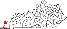 | |
| CDPs | ||
| Unincorporated communities | ||