Kestilä
| Kestilä | ||
|---|---|---|
| Former municipality | ||
| Kestilän kunta | ||
| ||
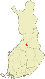 Location of Kestilä in Finland | ||
| Coordinates: 64°21′N 026°17′E / 64.350°N 26.283°ECoordinates: 64°21′N 026°17′E / 64.350°N 26.283°E | ||
| Country | Finland | |
| Region | Northern Ostrobothnia | |
| Sub-region | Siikalatva sub-region | |
| Charter | 1867 | |
| Consolidated | 2009 | |
| Area[1] | ||
| • Total | 606.53 km2 (234.18 sq mi) | |
| • Land | 601.44 km2 (232.22 sq mi) | |
| • Water | 5.09 km2 (1.97 sq mi) | |
| Population (2008-12-31)[2] | ||
| • Total | 1,574 | |
| • Density | 2.62/km2 (6.8/sq mi) | |
| Time zone | EET (UTC+2) | |
| • Summer (DST) | EEST (UTC+3) | |

Kestilä is a former municipality of Finland. It is located in the province of Oulu and is part of the Northern Ostrobothnia region.
Established in 1867, the population was 1,574 as of 31 December 2008.[2] The municipality covered an area of 606.53 km2 (234.18 sq mi) of which 5.09 km2 (1.97 sq mi) is water.[1] The population density was 2.62 inhabitants per square kilometre (6.8/sq mi).
The municipality was unilingually Finnish.
The municipality was consolidated with Piippola, Pulkkila and Rantsila on 2009-01-01 to form a new municipality of Siikalatva.[3]
References
- 1 2 "Area by municipality as of 1 January 2008" (PDF) (in Finnish and Swedish). Land Survey of Finland. Retrieved 27 March 2010.
- 1 2 "Population by municipality as of 31 December 2008". Population Information System (in Finnish and Swedish). Population Register Center of Finland. Retrieved 27 March 2010.
- ↑ "Pohjois-Pohjanmaalle tulee uusi Siikalatvan kunta". YLE Uutiset (YLE News) (in Finnish). Yleisradio Oy. 2008-02-25. Retrieved 2008-08-03.
External links
![]() Media related to Kestilä at Wikimedia Commons
Media related to Kestilä at Wikimedia Commons
- Municipality of Kestilä – official site
| Municipalities |  | |
|---|---|---|
| Former | ||
This article is issued from Wikipedia - version of the 4/21/2015. The text is available under the Creative Commons Attribution/Share Alike but additional terms may apply for the media files.