Kerry, Queensland
| Kerry Queensland | |||||||||||||
|---|---|---|---|---|---|---|---|---|---|---|---|---|---|
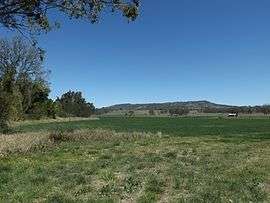 Fields along Albert River, 2014 | |||||||||||||
 Kerry | |||||||||||||
| Coordinates | 28°6′S 153°1′E / 28.100°S 153.017°ECoordinates: 28°6′S 153°1′E / 28.100°S 153.017°E | ||||||||||||
| Population | 433 (2011 census)[1] | ||||||||||||
| Postcode(s) | 4285 | ||||||||||||
| LGA(s) | Scenic Rim Region | ||||||||||||
| State electorate(s) | Beaudesert | ||||||||||||
| Federal Division(s) | Wright | ||||||||||||
| |||||||||||||
Kerry is a locality in the Scenic Rim Region of South East Queensland, Australia. At the 2011 Australian Census Kerry recorded a population of 433.[1]
History
Kerry Post Office opened on 1 July 1927 and closed in 1939.[2]
Heritage listings
Kerry has the following heritage-listed sites:
- 1823 Kerry Road: St John’s Catholic Church and Cemetery [3]
Notable people

- Bernard O'Reilly, the bushman and author is buried in St John's Catholic Church cemetery
Demographics
In the 2011 census, Kerry recorded a population of 433 people, 48.7% female and 51.3% male.[1] The median age of the Kerry population was 44 years, 7 years above the national median of 37. 87.9% of people living in Kerry were born in Australia. The other top responses for country of birth were England 2.1%, New Zealand 1.2%, Germany 0.7%, Ireland 0.7%, Belgium 0.7%. 93.5% of people spoke only English at home; the next most common languages were 0.7% Indonesian, 0.7% Spanish.[1]
References
- 1 2 3 4 Australian Bureau of Statistics (31 October 2012). "Kerry (State Suburb)". 2011 Census QuickStats. Retrieved 17 August 2014.
- ↑ Premier Postal History. "Post Office List". Premier Postal Auctions. Retrieved 10 May 2014.
- ↑ "Local Heritage Register" (PDF). Scenic Rim Regional Council. Retrieved 9 February 2015.
External links
![]() Media related to Kerry, Queensland at Wikimedia Commons
Media related to Kerry, Queensland at Wikimedia Commons