Keokuk, Iowa
| Keokuk, Iowa | |
|---|---|
| City | |
|
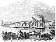
Main Street (January 2009) | |
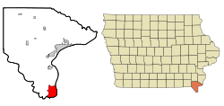 Location within Lee County and Iowa | |
| Coordinates: 40°24′9″N 91°23′40″W / 40.40250°N 91.39444°WCoordinates: 40°24′9″N 91°23′40″W / 40.40250°N 91.39444°W | |
| Country |
|
| State |
|
| County | Lee |
| Incorporated | December 13, 1848[1] |
| Area[2] | |
| • Total | 10.58 sq mi (27.41 km2) |
| • Land | 9.13 sq mi (23.65 km2) |
| • Water | 1.45 sq mi (3.76 km2) |
| Elevation | 571 ft (174 m) |
| Population (2010)[3] | |
| • Total | 10,780 |
| • Estimate (2012[4]) | 10,732 |
| • Density | 1,000/sq mi (390/km2) |
| Time zone | Central (CST) (UTC-6) |
| • Summer (DST) | CDT (UTC-5) |
| ZIP code | 52632 |
| Area code | 319 |
| FIPS code | 19-40845 |
| GNIS feature ID | 0458054 |
| Website | City of Keokuk, Iowa |

Keokuk /ˈkiːəkʌk/ is a city and a county seat of Lee County, Iowa, United States,[5] along with Fort Madison. It is also the most southerly city in Iowa. The population was 10,780 at the 2010 census. The city is named after the Sauk chief Keokuk, who is thought to be buried in Rand Park. It is located in the extreme southeast corner of Iowa where the Des Moines River meets with the Mississippi. It is located at the junction of U.S. Routes 61, 136 and 218. Just across the rivers are the towns of Hamilton and Warsaw, Illinois, and Alexandria, Missouri.
Keokuk, along with the city of Fort Madison, is a principal city of the Fort Madison-Keokuk micropolitan area, which includes all of Lee County, Iowa and Clark County, Missouri.
History
Situated between the Des Moines and Mississippi rivers, the area that became Keokuk had access to a large trading area and was an ideal location for settlers. In 1820, the US Army prohibited soldiers stationed along the Mississippi River from having wives who were Native American.[6] Dr. Samuel C. Muir, a surgeon stationed at Fort Edwards (near present-day Warsaw, Illinois), instead resigned his commission rather than leave his Indian wife and crossed the river to resettle. He built a log cabin for them at the bottom of the bluff, and became the area’s first white settler.
As steamboat traffic on the Mississippi increased, more European Americans began to settle here. Around 1827, John Jacob Astor established a post of his American Fur Company at the foot of the bluff. Five buildings were erected to house workers and the business. This area became known as the “Rat Row.”
One of the earliest descriptions of Keokuk was by Caleb Atwater in 1829:
| “ | The village is a small one containing twenty families perhaps. The American Fur Company have a store here and there is a tavern. Many Indians were fishing and their lights on the rapids in a dark night were darting about appearing and disappearing like so many fire flies; the constant roaring of the waters, on the rapids the occasional Indian yell, the lights of their fires on the shore, and the boisterous mirth of the people at the doggery attracted my attention occasionally while we were lying here. Fish were caught here in abundance.[7] | ” |
The settlement was part of the land designated in 1824 as a Half-Breed Tract by the United States Government for allotting land to mixed-race descendants of the Sauk and Fox tribes.[8] Typically children of European or British men (fur traders and trappers) and Native women, they were often excluded from tribal communal lands because their fathers were not tribal members. Native Americans considered the settlement a neutral ground.[9] Rules for the tract prohibited individual sale of the land, but the US Congress ended this provision in 1837, creating a land rush and instability.[8]
Centering on the riverboat trade, the settlement continued to grow. The village became known as Keokuk shortly after the Blackhawk War in 1832. Why residents named it after the Sauk chief is unknown. Keokuk was incorporated on December 13, 1847.
In 1853, Keokuk was one of the centers for outfitting Mormon pioneers for their journey west; more than 2,000 Mormons passed through the city.[10]
Keokuk was the longtime home of Orion Clemens, brother of Samuel Clemens, better known as Mark Twain. Samuel's visits to his brother's home led him to write of the beauty of Keokuk and southeastern Iowa in Life on the Mississippi.[11]
During the American Civil War, Keokuk became an embarking point for Union troops heading to fight in southern battles. Injured soldiers were returned to Keokuk for treatment, so several hospitals were established. A national cemetery was designated for those who did not survive. After the war was over, Keokuk continued its expansion. A medical college was founded, along with a major-league baseball team, the Keokuk Westerns, in 1875.
In 1913, Lock and Dam No. 19 was completed nearby on the Mississippi River. The population of Keokuk reached 15,106 by 1930.[12] During the last half of the twentieth century, Keokuk has become less engaged in Mississippi River trade and more dependent on jobs in local factories. The town celebrated 150 years in 1997.
Keokuk has deep baseball history that started in 1875 when the Keokuk Westerns played in the National Association. On May 4, 1875, the Westerns and the Chicago White Stockings (today's Chicago Cubs) played the first professional baseball game in Iowa.[13] The Keokuk Indians minor league team played in the Iowa State League (1904-1907), Central Association (1908-1915), Mississippi Valley League (1929-1933) and Western League (1935). After the Indians (1904-1915, 1929-1933, 1935), Keokuk was home to the Keokuk Pirates (1947-1949), Keokuk Kernels (1952-1957), Keokuk Cardinals (1958-1961) and the Keokuk Dodgers (1962).[14] The team was an affiliate of the St. Louis Cardinals, Pittsburgh Pirates, Cleveland Indians and the Los Angeles Dodgers.[15] Notable players included baseball pioneer Bud Fowler, 1961 Home Run Record Holder Roger Maris and Player/Announcer Tim McCarver.[16]
Geography
Keokuk is located at 40°24′9″N 91°23′40″W / 40.40250°N 91.39444°W (40.402525, -91.394372).[17] According to the United States Census Bureau, the city has a total area of 10.58 square miles (27.40 km2), of which, 9.13 square miles (23.65 km2) of it is land and 1.45 square miles (3.76 km2) is water.[2] The lowest point in the state of Iowa is 480 feet (150 m) located at the confluence of the Des Moines River with the Mississippi just southwest of Keokuk.
Climate
Keokuk has a humid continental climate. Keokuk is also known for having recorded the highest temperature ever in the state of Iowa with a temperature of 118 °F (48 °C) recorded here on July 20, 1934.[18]
| Climate data for Keokuk, IA | |||||||||||||
|---|---|---|---|---|---|---|---|---|---|---|---|---|---|
| Month | Jan | Feb | Mar | Apr | May | Jun | Jul | Aug | Sep | Oct | Nov | Dec | Year |
| Record high °F (°C) | 70 (21) |
75 (24) |
87 (31) |
92 (33) |
102 (39) |
104 (40) |
118 (48) |
110 (43) |
100 (38) |
94 (34) |
82 (28) |
70 (21) |
118 (48) |
| Average high °F (°C) | 32 (0) |
38 (3) |
50 (10) |
62 (17) |
73 (23) |
82 (28) |
87 (31) |
85 (29) |
77 (25) |
66 (19) |
50 (10) |
37 (3) |
62 (17) |
| Average low °F (°C) | 15 (−9) |
20 (−7) |
30 (−1) |
42 (6) |
52 (11) |
62 (17) |
67 (19) |
65 (18) |
56 (13) |
45 (7) |
33 (1) |
21 (−6) |
42 (6) |
| Record low °F (°C) | −22 (−30) |
−19 (−28) |
−11 (−24) |
15 (−9) |
33 (1) |
44 (7) |
50 (10) |
44 (7) |
32 (0) |
20 (−7) |
−3 (−19) |
−20 (−29) |
−22 (−30) |
| Average precipitation inches (mm) | 1.29 (32.8) |
1.42 (36.1) |
2.65 (67.3) |
3.61 (91.7) |
5.38 (136.7) |
3.92 (99.6) |
3.99 (101.3) |
3.20 (81.3) |
3.94 (100.1) |
3.04 (77.2) |
2.98 (75.7) |
1.99 (50.5) |
37.41 (950.3) |
| Average snowfall inches (cm) | 6.00 (15.24) |
4.80 (12.19) |
2.90 (7.37) |
1.00 (2.54) |
0 (0) |
0 (0) |
0 (0) |
0 (0) |
0 (0) |
0 (0) |
1.30 (3.3) |
4.90 (12.45) |
20.90 (53.09) |
| Source: http://www.intellicast.com/Local/History.aspx?location=USIA0434 | |||||||||||||
Demographics
| Historical population | |||
|---|---|---|---|
| Census | Pop. | %± | |
| 1850 | 2,478 | — | |
| 1860 | 8,136 | 228.3% | |
| 1870 | 12,766 | 56.9% | |
| 1880 | 12,117 | −5.1% | |
| 1890 | 14,101 | 16.4% | |
| 1900 | 14,641 | 3.8% | |
| 1910 | 14,008 | −4.3% | |
| 1920 | 14,423 | 3.0% | |
| 1930 | 15,106 | 4.7% | |
| 1940 | 15,076 | −0.2% | |
| 1950 | 16,144 | 7.1% | |
| 1960 | 16,316 | 1.1% | |
| 1970 | 14,631 | −10.3% | |
| 1980 | 13,536 | −7.5% | |
| 1990 | 12,451 | −8.0% | |
| 2000 | 11,427 | −8.2% | |
| 2010 | 10,780 | −5.7% | |
| Est. 2015 | 10,609 | [19] | −1.6% |
2010 census
As of the census[21] of 2010, there are 10,780 people, 4,482 households, and 2,818 families residing in the city. The population density is 1,170 people per square mile (452/km²). There are 5,199 housing units at an average density of 565 per square mile (218/km²). The racial makeup of the city is 91.9% White, 4.0% African American, 0.2% Native American, 0.8% Asian, < 0.1% Pacific Islander, 0.3% from other races, and 2.8% from two or more races. 1.8% of the population are Hispanic or Latino of any race.
There are 4,482 households out of which 31.1% have children under the age of 18 living with them, 43.3% are married couples living together, 14.4% have a female householder with no husband present, and 37.1% are non-families. 32.1% of all households are made up of individuals and 15.9% have someone living alone who is 65 years of age or older. The average household size is 2.36 and the average family size is 2.94.
Population spread: 24.4% under the age of 18, 8.3% from 18 to 24, 23.1% from 25 to 44, 26.7% from 45 to 64, and 17.4% who are 65 years of age or older. The median age is 40 years. For every 100 females there are 88.4 males. For every 100 females age 18 and over, there are 86.6 males.
2000 census
As of the census[21] of 2000, there are 11,427 people, 4,773 households, and 3,021 families residing in the city. The population density is 1,247.5 people per square mile (481.7/km²). There are 5,327 housing units at an average density of 581.6 per square mile (224.5/km²). The racial makeup of the city is 92.87% White, 3.90% African American, 0.27% Native American, 0.52% Asian, 0.01% Pacific Islander, 0.45% from other races, and 1.99% from two or more races. 1.09% of the population are Hispanic or Latino of any race.
There are 4,773 households out of which 29.9% have children under the age of 18 living with them, 46.8% are married couples living together, 13.2% have a female householder with no husband present, and 36.7% are non-families. 32.4% of all households are made up of individuals and 16.2% have someone living alone who is 65 years of age or older. The average household size is 2.35 and the average family size is 2.97.
Population spread: 25.4% under the age of 18, 8.6% from 18 to 24, 25.5% from 25 to 44, 22.9% from 45 to 64, and 17.7% who are 65 years of age or older. The median age is 38 years. For every 100 females there are 88.4 males. For every 100 females age 18 and over, there are 83.9 males.
The median income for a household in the city is $31,586, and the median income for a family is $39,574. Males have a median income of $31,213 versus $21,420 for females. The per capita income for the city is $17,144. 11.9% of the population and 8.1% of families are below the poverty line. Out of the total population, 15.7% of those under the age of 18 and 13.4% of those 65 and older are living below the poverty line.
Education
The Keokuk Community School District has two elementary schools (George Washington, and Hawthorne), Keokuk Middle School, and Keokuk High School. Several additional elementary schools have been closed over the years (Torrence, Lincoln, Garfield,Wells Carey, and Jefferson). The middle school was damaged by a fire in 2001[22] and replaced by a new school on a lot next to the high school.
Private education is provided by Keokuk Catholic Schools and Keokuk Christian Academy.
Keokuk is also home to a campus of Southeastern Community College (Iowa).
A few miles north of Keokuk is the Galland School, a replica of the first schoolhouse constructed in Iowa.
Arts and culture
Attractions
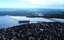
The Mississippi River lock and dam along with the hydroelectric power plant were built in 1913. They still use most of the original equipment. When the plant began operation in August 1913, it was the largest single powerhouse electric generating plant in the world.[23] It is part of the Keokuk Lock & Dam, both of which are visible from a park at the foot of the commercial district. Built in 1913, the old lock was too small to serve the newer, larger barges. It was replaced in 1957 with a 1200' x 110' lock. At the time of construction in 1913, this was the longest dam in the world, with the longest transmission line and the highest voltage in the world. The Chief Engineer was Hugh L. Cooper.
Designed by Merle F. Baker, the Grand Theatre was constructed on the foundation of the Keokuk Opera House (c. 1880), which burned down in 1923. Modeled after theaters in Chicago, it was praised as one of the finest theaters in the country at the time. The Grand Theatre is owned by the city of Keokuk and used as a performing arts center. The theatre has housed many historically important performers over the years, including John Philip Sousa and Maynard Ferguson.
The Iowa Water Council has ranked the tap water produced at the Keokuk Waterworks Plant as the "Best Tasting Water In Iowa".
Keokuk is home to the Keokuk National Cemetery, the Keokuk Veteran's Memorial, the Miller House Museum, an annual American Civil War reenactment, and the George M. Verity River Museum.
Music
Each summer Keokuk is home to "Rollin' on the River," a local blues festival that attracts hundreds to Victory Park.
The Irish-themed McNamara's Band is a community concert band that has performed for decades. It regularly performs throughout the area.
Once a month the jazz big band, "Craig Bullis and Friends," performs at the local Hawkeye restaurant. The band is made up of area jazz musicians, as well as both collegiate-level students and professors of music. The band has featured such guest artists as Reggie Watkins, former lead trombone and music arranger for Maynard Ferguson and Big Bop Nouveau.
The notable garage band Gonn is from Keokuk
Theatre
Keokuk is home to the Great River Players, a thespian troupe that strives "to provide quality amateur theatrical productions for the tri-state area by encouraging members of the surrounding communities to express their creative abilities in all aspects of live theatre." The troupe performs a season of three shows, usually two plays and one musical.
Notable people
- Edward P. Alexander, author, historian, and educator
- William H. Clagett, politician
- Orion Clemens, first and only secretary of Nevada Territory and brother of Mark Twain
- Samuel Curtis, military officer
- Samuel Freeman Miller, Supreme Court justice
- Bud Fowler, first professional African American baseball player
- Jerry Harrington, baseball player
- Llyod Steel Lourie, American orthodontist
- James B. Howell, newspaper editor and U.S. Senator, resided in Keokuk[24]
- Howard Hughes, iconic aviator, engineer, industrialist, film producer, film director, and philanthropist
- Howard R. Hughes, Sr., businessman and inventor, father of famous billionaire Howard Hughes
- Rupert Hughes, novelist, screenwriter, film director, historian, uncle of Howard Hughes
- John N. Irwin, Governor of Idaho Territory (1883) and Governor of Arizona Territory (1890–1892)
- Edward Kimball, actor
- Elsa Maxwell, gossip columnist, socialite
- Edward Joseph McManus, United States federal judge and Lieutenant Governor of Iowa (1959 – 1961)
- Grace Medes, biochemist
- Dave Merrick, artist
- Craig Moore, bandleader of Gonn
- Conrad Nagel, actor
- Richard Page, lead vocalist and bass player for the band Mr. Mister
- George Pomutz, general and diplomat
- Mike Pyle, NFL player
- Palmer Pyle, NFL player[25]
- John M. Rankin, Iowa state legislator and judge
- Hugh T. Reid, Union general
- Jeremy Soule composer, notably video game soundtracks E.G Elder Scrolls IV: Oblivion, Harry Potter, and Star Wars[26]
- Frank Steunenberg, Governor of Idaho (1897–1901), assassinated in 1905.
- Ramo Stott, stock car driver
- James Vandenberg, quarterback for the Iowa Hawkeyes
- Don White, stock car driver
- Verner Moore White, noted artist, painted oil of Keokuk presented to President Theodore Roosevelt
- Annie Turner Wittenmyer, social reformer and relief worker
See also
- Local landmarks
- Church of All Saints
- Gen. William Worth Belknap House
- Gen. Samuel R. Curtis House
- E. H. Harrison House
- Hotel Iowa
- John N. and Mary L. (Rankin) Irwin House
- C. R. Joy House
- Keokuk National Cemetery
- Keokuk Rail Bridge
- Keokuk-Hamilton Bridge
- Keokuk Young Women's Christian Association Building
- Lock and Dam No. 19
- Justice Samuel Freeman Miller House
- St. John's Episcopal Church
- Hugh W. and Sarah Sample House
- The Park Place-Grand Avenue Residential District
- U.S. Post Office and Courthouse
- Alois and Annie Weber House
- Frank J. Weess House
References
- ↑ "Keokuk, Iowa". City-Data. Retrieved May 10, 2011.
- 1 2 "US Gazetteer files 2010". United States Census Bureau. Retrieved 2012-05-11.
- ↑ "American FactFinder". United States Census Bureau. Retrieved 2012-05-11.
- ↑ "Population Estimates". United States Census Bureau. Retrieved 2013-05-23.
- ↑ "Find a County". National Association of Counties. Retrieved 2011-06-07.
- ↑ Sloat, Jerry. “Lee County, Iowa”.
- ↑ Caleb Atwater (1831) Remarks made on a tour to Prairie du Chien: thence to Washington City, in 1829. p. 58-59. Columbus, Ohio: Issac Whiting
- 1 2 "The Half-Breed Tract", Lee County History. Retrieved 1/28/08.
- ↑ Sloat, Jerry. “Lee County, Iowa”. p. 44
- ↑ Jenson, Andrew. Encyclopedia History of The Church of Jesus Christ of Latter-day Saints, p. 398
- ↑ Life on the Mississippi. Mark Twain. Ch. 57
- ↑ Jensen. Encyclopedic History, p. 398
- ↑ http://www.dailygate.com/article_68204216-111d-11e5-b5ee-73529d33ab75.html
- ↑ http://www.baseball-reference.com/register/team.cgi?city=Keokuk&state=IA&country=US&empty=0
- ↑ http://www.baseball-reference.com/register/team.cgi?city=Keokuk&state=IA&country=US&empty=0
- ↑ http://www.keokuk.net/baseball/#1931
- ↑ "US Gazetteer files: 2010, 2000, and 1990". United States Census Bureau. 2011-02-12. Retrieved 2011-04-23.
- ↑ National Climatic Data Center. "State Climate Extremes Committee (SCEC)". Retrieved 2015-02-14.
- ↑ "Annual Estimates of the Resident Population for Incorporated Places: April 1, 2010 to July 1, 2015". Retrieved July 2, 2016.
- ↑ "Census of Population and Housing". Census.gov. Retrieved June 4, 2015.
- 1 2 "American FactFinder". United States Census Bureau. Retrieved 2008-01-31.
- ↑ Radio Iowa: Fire damages Keokuk school, arson could be cause
- ↑ Shaw, Albert (October 1913). "Dedicating the Great Keokuk Dam". The American Review of Reviews. New York: The Review of Reviews Company. XLVIII (4): 407
- ↑ "James B. Howell," National Cyclopaedia of American Biography: Volume 9. New York: James T. White and Company, 1899; pg. 450.
- ↑ "Palmer Pyle". NFL. Retrieved 2011-01-16.
- ↑ "Jeremy Soule". Giant Bomb. Retrieved 2011-01-16.
Further reading
For a depiction of Keokuk during its early boom years see: Michael A. Ross, “Cases of Shattered Dreams: Justice Samuel Freeman Miller and the Rise and Fall of a Mississippi River Town,” Annals of Iowa, 57 (Summer 1998): 201-239.
External links
| Wikimedia Commons has media related to Keokuk, Iowa. |
- City of Keokuk
- "National Register Properties", Keokuk Tourism Website
- Keokuk.com A portal into what is available in Keokuk Iowa
- "History of Keokuk", Keokuk Web site
- George M. Verity Riverboat Museum
- HAER - Mississippi River 9-Foot Channel, Lock & Dam No. 19, Upper Mississippi River, Keokuk, Lee County, IA, Library of Congress
- Keokuk, Iowa at DMOZ
- City Data Comprehensive Statistical Data and more about Keokuk
Municipalities and communities of Lee County, Iowa, United States | ||
|---|---|---|
| Cities | 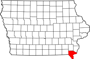 | |
| Townships | ||
| CDP | ||
| Other unincorporated communities | ||