Kenyon, Minnesota
| Kenyon, Minnesota | |
|---|---|
| City | |
|
Downtown Kenyon | |
| Motto: "Boulevard Of Roses" | |
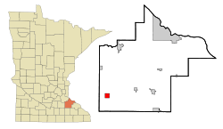 Location of Kenyon, Minnesota | |
| Coordinates: 44°16′17″N 92°59′10″W / 44.27139°N 92.98611°W | |
| Country | United States |
| State | Minnesota |
| County | Goodhue |
| Area[1] | |
| • Total | 2.35 sq mi (6.09 km2) |
| • Land | 2.34 sq mi (6.06 km2) |
| • Water | 0.01 sq mi (0.03 km2) |
| Elevation | 1,155 ft (352 m) |
| Population (2010)[2] | |
| • Total | 1,815 |
| • Estimate (2012[3]) | 1,817 |
| • Density | 775.6/sq mi (299.5/km2) |
| Time zone | Central (CST) (UTC-6) |
| • Summer (DST) | CDT (UTC-5) |
| ZIP code | 55946 |
| Area code(s) | 507 |
| FIPS code | 27-32840[4] |
| GNIS feature ID | 0646112[5] |
| Website | www.cityofkenyon.com |

Kenyon is a city in Goodhue County, Minnesota, United States, located along the North Fork of the Zumbro River. It was founded in 1856 and named in honor of Kenyon College.[6] The population was 1,815 at the 2010 census.[7]
Geography
According to the United States Census Bureau, the city has a total area of 2.35 square miles (6.09 km2), of which 2.34 square miles (6.06 km2) is land and 0.01 square miles (0.03 km2) is water.[1]
Minnesota State Highways 56 and 60 are two of the main routes in the city. Minnesota State Highway 246 is immediately north of Kenyon.
Demographics
| Historical population | |||
|---|---|---|---|
| Census | Pop. | %± | |
| 1890 | 666 | — | |
| 1900 | 1,202 | 80.5% | |
| 1910 | 1,237 | 2.9% | |
| 1920 | 1,362 | 10.1% | |
| 1930 | 1,382 | 1.5% | |
| 1940 | 1,530 | 10.7% | |
| 1950 | 1,651 | 7.9% | |
| 1960 | 1,624 | −1.6% | |
| 1970 | 1,575 | −3.0% | |
| 1980 | 1,529 | −2.9% | |
| 1990 | 1,552 | 1.5% | |
| 2000 | 1,661 | 7.0% | |
| 2010 | 1,815 | 9.3% | |
| Est. 2015 | 1,814 | [8] | −0.1% |
2010 census
As of the census[2] of 2010, there were 1,815 people, 755 households, and 465 families residing in the city. The population density was 775.6 inhabitants per square mile (299.5/km2). There were 841 housing units at an average density of 359.4 per square mile (138.8/km2). The racial makeup of the city was 94.9% White, 0.2% African American, 0.2% Native American, 0.2% Asian, 3.8% from other races, and 0.8% from two or more races. Hispanic or Latino of any race were 8.7% of the population.
There were 755 households of which 29.7% had children under the age of 18 living with them, 49.4% were married couples living together, 8.1% had a female householder with no husband present, 4.1% had a male householder with no wife present, and 38.4% were non-families. 31.7% of all households were made up of individuals and 15.1% had someone living alone who was 65 years of age or older. The average household size was 2.34 and the average family size was 2.92.
The median age in the city was 41.3 years. 23.7% of residents were under the age of 18; 7.6% were between the ages of 18 and 24; 24.4% were from 25 to 44; 23.7% were from 45 to 64; and 20.6% were 65 years of age or older. The gender makeup of the city was 49.4% male and 50.6% female.
2000 census
As of the census[4] of 2000, there were 1,661 people, 677 households, and 440 families residing in the city. The population density was 736.6 people per square mile (285.0/km²). There were 719 housing units at an average density of 318.9 per square mile (123.4/km²). The racial makeup of the city was 96.21% White, 0.12% African American, 0.18% Native American, 1.02% Asian, 1.93% from other races, and 0.54% from two or more races. Hispanic or Latino of any race were 2.77% of the population.
There were 677 households out of which 30.6% had children under the age of 18 living with them, 54.4% were married couples living together, 7.4% had a female householder with no husband present, and 34.9% were non-families. 29.8% of all households were made up of individuals and 15.1% had someone living alone who was 65 years of age or older. The average household size was 2.37 and the average family size was 2.94.
In the city the population was spread out with 23.9% under the age of 18, 7.3% from 18 to 24, 27.5% from 25 to 44, 19.7% from 45 to 64, and 21.6% who were 65 years of age or older. The median age was 39 years. For every 100 females there were 93.1 males. For every 100 females age 18 and over, there were 86.7 males.
The median income for a household in the city was $41,786, and the median income for a family was $50,000. Males had a median income of $34,000 versus $22,255 for females. The per capita income for the city was $19,569. About 2.3% of families and 5.2% of the population were below the poverty line, including 5.9% of those under age 18 and 7.0% of those age 65 or over.
Notable natives and residents
- C. L. Brusletten, legislator and businessman
- Stephanie Edwards
- Mark Rein·Hagen - Game designer & author, founder of White Wolf Publishing
- Clifford L. Hilton - Minnesota Supreme Court justice
- Steve Sviggum - 55th Speaker of the Minnesota House of Representatives
- Luke Redfield - Singer/songwriter
- Andrew Volstead - Politician known for the Volstead Act
See also
References
- 1 2 "US Gazetteer files 2010". United States Census Bureau. Retrieved 2012-11-13.
- 1 2 "American FactFinder". United States Census Bureau. Retrieved 2012-11-13.
- ↑ "Population Estimates". United States Census Bureau. Retrieved 2013-05-28.
- 1 2 "American FactFinder". United States Census Bureau. Retrieved 2008-01-31.
- ↑ "US Board on Geographic Names". United States Geological Survey. 2007-10-25. Retrieved 2008-01-31.
- ↑ City of Kenyon - Welcome to the City of Kenyon...A Great Place to Grow - History
- ↑ "2010 Census Redistricting Data (Public Law 94-171) Summary File". American FactFinder. United States Census Bureau. Retrieved 27 April 2011.
- ↑ "Annual Estimates of the Resident Population for Incorporated Places: April 1, 2010 to July 1, 2015". Retrieved July 2, 2016.
- ↑ "Census of Population and Housing". Census.gov. Retrieved June 4, 2015.
External links
Municipalities and communities of Goodhue County, Minnesota, United States | ||
|---|---|---|
| Cities | 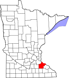 | |
| Townships | ||
| CDP | ||
| Unincorporated communities | ||
| Indian reservation | ||
| Footnotes | ‡This populated place also has portions in an adjacent county or counties | |
Coordinates: 44°16′20″N 92°59′08″W / 44.27222°N 92.98556°W