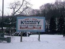
Kennedy Township, Allegheny County, Pennsylvania
| Kennedy Township | |
|---|---|
| Township | |
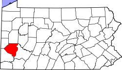
 Location in Allegheny County and state of Pennsylvania | |
| Coordinates: 40°28′45″N 80°6′23″W / 40.47917°N 80.10639°WCoordinates: 40°28′45″N 80°6′23″W / 40.47917°N 80.10639°W | |
| Country | United States |
| State | Pennsylvania |
| County | Allegheny |
| Area | |
| • Total | 5.5 sq mi (14.2 km2) |
| • Land | 5.4 sq mi (14.1 km2) |
| • Water | 0.04 sq mi (0.1 km2) |
| Population (2010) | |
| • Total | 7,672 |
| • Density | 1,400/sq mi (540/km2) |
| Time zone | Eastern (EST) (UTC-5) |
| • Summer (DST) | EDT (UTC-4) |
| ZIP code | 15136 |
| Area code(s) | 412 |
Kennedy Township is a township in Allegheny County, Pennsylvania, United States. It is a suburb of Pittsburgh. The population was 7,672 at the 2010 census.[1]
Institutions
Kennedy Township is part of the Montour School District. Montour's David E. Williams Middle School is located there, and elementary students attend either J.W. Burkett Elementary, or Forest Grove Elementary Schools in Montour.
St. Malachy Catholic School is also located in Kennedy Township.
Kennedy is home to several churches: St. Malachy Catholic Church, Kenmawr United Presbyterian, and Kennedy First Alliance.


The first restaurant located in Kennedy Township was the Stroll Inn, which is still in operation.
Geography
Kennedy Township is located at 40°28′45″N 80°6′23″W / 40.47917°N 80.10639°W (40.479292, -80.106395).[2]
According to the United States Census Bureau, the township has a total area of 5.5 square miles (14 km2), of which 5.4 square miles (14 km2) is land and 0.1 square miles (0.26 km2), or 0.91%, is water.
Surrounding communities
Kennedy Township is bordered by the borough of McKees Rocks to the east, the Windgap and Fairywood neighborhoods within the city of Pittsburgh to the southeast, Robinson Township to the south and west, Neville Township on an island in the Ohio River to the north, and Stowe Township to the northeast.
Demographics
As of the census[3] of 2000, there were 7,504 people, 2,917 households, and 2,190 families residing in the township. The population density was 1,378.3 people per square mile (532.6/km²). There were 2,980 housing units at an average density of 547.3/sq mi (211.5/km²). The racial makeup of the township was 98.64% White, 0.51% African American, 0.01% Native American, 0.48% Asian, 0.03% Pacific Islander, 0.04% from other races, and 0.29% from two or more races. 0.29% of the population were Hispanic or Latino of any race.

There were 2,917 households, out of which 27.6% had children under the age of 18 living with them, 62.6% were married couples living together, 9.1% had a female householder with no husband present, and 24.9% were non-families. 22.9% of all households were made up of individuals, and 13.0% had someone living alone who was 65 years of age or older. The average household size was 2.49 and the average family size was 2.93.

In the township the population was spread out, with 20.5% under the age of 18, 5.5% from 18 to 24, 24.9% from 25 to 44, 26.0% from 45 to 64, and 23.1% who were 65 years of age or older. The median age was 44 years. For every 100 females there were 91.4 males. For every 100 females age 18 and over, there were 86.7 males.

The median income for a household in the township was $48,057, and the median income for a family was $56,339. Males had a median income of $41,062 versus $28,125 for females. The per capita income for the township was $22,148. About 2.0% of families and 3.8% of the population were below the poverty line, including 1.3% of those under age 18 and 4.8% of those age 65 or over.
References
- ↑ "Race, Hispanic or Latino, Age, and Housing Occupancy: 2010 Census Redistricting Data (Public Law 94-171) Summary File (QT-PL), Kennedy township, Allegheny County, Pennsylvania". U.S. Census Bureau, American FactFinder 2. Retrieved September 27, 2011.
- ↑ "US Gazetteer files: 2010, 2000, and 1990". United States Census Bureau. 2011-02-12. Retrieved 2011-04-23.
- ↑ "American FactFinder". United States Census Bureau. Retrieved 2008-01-31.
External links
- Kennedy Township official website
- Ken Mawr United Presbyterian Church
- Saint Malachy Church
- Saint Malachy School
| Counties |  Map of the Pittsburgh Tri-State with green counties in the metropolitan area and yellow counties in the combined area. | |
|---|---|---|
| Major cities | ||
| Cities and towns 15k-50k (in 2010) | ||
| Airports | ||
| Topics | ||
| ||