Kemin District
| Kemin | |
|---|---|
| Raion | |
| Кемин району | |
 | |
| Country | Kyrgyzstan |
| Province | Chuy Province |
| Kemin District | 1936 |
| Capital | Kemin |
| Area | |
| • Total | 3,533 km2 (1,364 sq mi) |
| Population (2009)[1] | |
| • Total | 41,924 |
| enumerated de facto population | |
| Time zone | GMT +5 (UTC+5) |
Kemin is the northeast panhandle raion (district) of Chuy Province in northern Kyrgyzstan. Its administrative headquarters is at Kemin.[2] The district is located in the Chong-Kemin Valley, the Kichi-Kemin Valley and the eastern part of the Chuy Valley. It borders with Kazakhstan in the north, Chuy District in the west, and Issyk-Kul Province in the south and east. The area of Kemin District amounts to 3533 km2, which is the largest among the districts of Chuy Province.
Topography
The western part of the district is flat with altitudes 1000 - 1600 msl, and the eastern part in mountainous.
Climate
The climate is sharply continental with cold winters and cool summers; January temperatures averaging -5°C - -10°C, July +17°C - +18°C. Average precipitation is from 200 mm in flatlands, and up to 600–700 mm in mountains.[3]
Hydrology
Large rivers in the district include Chu River, Chong-Kemin River, Kichi-Kemin River and so on. There are also several small lakes: Chong-Kelter, Chelek, Kosh-Kel, etc.
Demographics
As of 2009, Kemin District included 4 urban-type settlements, and 33 villages. Its population, according to the Population and Housing Census of 2009, was 41,924 which is second lowest among districts of the Chuy Province. Average density is 14.2 people per square kilometer. Some 36% of population lives in urban areas, and 64% in rural ones.[3]
| Historical populations in Kemin District | ||
|---|---|---|
| Year | Pop. | ±% |
| 1970 | 53,370 | — |
| 1979 | 57,068 | +6.9% |
| 1989 | 63,156 | +10.7% |
| 1999 | 52,722 | −16.5% |
| 2009 | 41,924 | −20.5% |
| Note: enumerated de facto population; Source:[1] | ||
Ethnic composition
According to the 2009 Census, the ethnic composition (de jure population) of the Kemin District was:[1]
| Ethnic group | Population | Proportion of Kemin District population |
|---|---|---|
| Kyrgyzs | 37,724 | 85.5% |
| Russians | 4,785 | 10.8% |
| Kazakhs | 550 | 1.2% |
| Dungans | 170 | 0.4% |
| Ukrainians | 170 | 0.4% |
| Tatars | 157 | 0.4% |
| Uzbeks | 133 | 0.3% |
| other groups | 429 | 1% |
Towns, rural communities, and villages
The urban-type settlements, rural communities and villages in the Kemin District are:[4]
- urban-type settlement Ak-Tuz
- urban-type settlement Orlovka
- urban-type settlement Kemin
- urban-type settlement Bordunskiy
- Almaluu aiyl okmotu (center village Kyzyl-Suu, and also villages Almaluu and Bordu)
- Boroldoy aiyl okmotu (center - village Boroldoy)
- Chong-Kemin aiyl okmotu (cener - village Shabdan, and also villages Kalmak-Ashuu, Kyzyl-Bayrak, Tar-Suu, Tort-Kul)
- Chym-Korgon aiyl okmotu (center - village Chym-Korgon, and also villages Novomikhaylovka, Samansur)
- Duisheev aiyl okmotu (center - village Kichi-Kemin)
- Ilich aiyl okmotu (center - village Imeni Il'icha, and also villages Jany-Jol and Sovetskoe)
- Jany-Alysh aiyl okmotu (center - village Jany-Alysh)
- Kara-Bulak aiyl okmotu (center - village Kara-Bulak, and also villages Beysheke, Altymysh, and Chuyskoe)
- Kok-Oyrok aiyl okmotu (center - village Kayyngdy and also villages Karool-Dobo, and Tegirmenty)
- Kyzyl-Oktyabr aiyl okmotu (center - village Kyzyl-Oktyabr, and also villages Belyy Piket, Djel'-Aryk, Dorozhnoe, Kashkelen, Kyz-Kiya, Sasyk-Bulak, Udarnik, Cholok)
References
- 1 2 3 Population and Housing Census 2009. Book 3 (in tables). Provinces of Kyrgyzstan: Chuy Province (Перепись населения и жилищного фонда Кыргызской Республики 2009. Книга 3 (в таблицах). Регионы Кыргызстана: Чуйская область (PDF), Bishkek: National Committee on Statistics, 2010
- ↑ Enrin.grida.no
- 1 2 Web-page of Kemin District at Chuy Province web-site (in Russian)
- ↑ List of Rural Communities of Kyrgyzstan
Capital: Bishkek (also four raions: Lenin, Oktyabr, Pervomay, Sverdlov) | ||
| Batken Region | 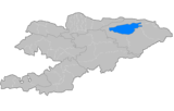 | |
| Chuy Region | ||
| Issyk Kul Region | ||
| Jalal-Abad Region | ||
| Naryn Region | ||
| Osh Region | ||
| Talas Region | ||
Coordinates: 42°47′N 75°41′E / 42.783°N 75.683°E