Keilor Park, Victoria
| Keilor Park Melbourne, Victoria | |||||||||||||
|---|---|---|---|---|---|---|---|---|---|---|---|---|---|
 Keilor Park 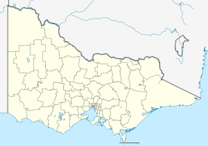 Keilor Park  Keilor Park | |||||||||||||
| Coordinates | 37°43′08″S 144°51′04″E / 37.719°S 144.851°ECoordinates: 37°43′08″S 144°51′04″E / 37.719°S 144.851°E | ||||||||||||
| Population | 2,540 (2011 census)[1] | ||||||||||||
| • Density | 770/km2 (1,990/sq mi) | ||||||||||||
| Postcode(s) | 3042 | ||||||||||||
| Area | 3.3 km2 (1.3 sq mi) | ||||||||||||
| Location | 17 km (11 mi) from Melbourne | ||||||||||||
| LGA(s) | City of Brimbank | ||||||||||||
| State electorate(s) | Niddrie | ||||||||||||
| Federal Division(s) | Calwell | ||||||||||||
| |||||||||||||
Keilor Park is a suburb 17 km north-west of Melbourne, Victoria, Australia. Its local government area is the City of Brimbank. At the 2011 Census, Keilor Park had a population of 2,540.
Keilor Park is bounded in the west by the Maribyrnong River, Tullamarine & Melbourne Airport in the north, in the east by Steele Creek, and in the south by the Calder Freeway.
According to the 2001 ABS Census, 39% of the population is of Italian or Greek descent. The median age of the area is 37, though more of the population is below 35 or in their 50s. The most common sector of employment for men is manufacturing (25% of men) and for women retail (21% of women).
The suburb contains the Keilor Botanic Gardens.
Transport
- 465 Essendon – Keilor Park via Buckley Street, Milleara SC, Keilor East (every day). Operated by Ryan Brothers Bus Service.
- 476 Moonee Ponds – Hillside via Essendon RS, Keilor, Watergardens SC, Watergardens RS (every day). Operated by Kastoria Bus Lines.
Sport
Keilor Park has a number of ovals and sports located in its area. Sports include cricket, football, softball, athletics, tennis, soccer, basketball.
Keilor Park Football Club, an Australian Rules football team, competes in the Essendon District Football League.[2]
See also
- City of Keilor - the former local government area of which Keilor Park was a part
References
- ↑ Australian Bureau of Statistics (31 October 2012). "Keilor Park (State Suburb)". 2011 Census QuickStats. Retrieved 21 June 2012.
- ↑ Full Points Footy, Keilor Park, retrieved 15 April 2009