Keddara Dam
| Keddara Dam | |
|---|---|
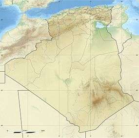
 Location of Keddara Dam in Algeria | |
| Official name | Barrage Keddara |
| Country | Algeria |
| Location | Keddara |
| Coordinates | 36°39′02″N 03°24′58″E / 36.65056°N 3.41611°ECoordinates: 36°39′02″N 03°24′58″E / 36.65056°N 3.41611°E |
| Status | Operational |
| Construction began | 1982 |
| Opening date | 1987 |
| Dam and spillways | |
| Type of dam | Embankment, rock-fill clay core |
| Impounds | Boudouaou River |
| Height | 108 m (354 ft) |
| Length | 470 m (1,542 ft) |
| Width (crest) | 12 m (39 ft) |
| Width (base) | 380 m (1,247 ft) |
| Dam volume | 4,081,000 m3 (5,337,746 cu yd) |
| Reservoir | |
| Total capacity | 146,500,000 m3 (118,769 acre·ft) |
| Surface area | 5.2 km2 (2 sq mi) |
The Keddara Dam, or Barrage Keddara, is an embankment dam 6 km (4 mi) northwest of Keddara on the Boudouaou River in Boumerdès Province, Algeria. Constructed between 1982 and 1987, the primary purpose of the dam is water supply for irrigation and municipal use in Algiers which is located 35 km (22 mi) to the west. The dam's reservoir has a capacity of 146,500,000 m3 (118,769 acre·ft) which is collected from drainage and the Hamiz Dam 7.6 km (5 mi) to the west and the Beni Amrane Dam 17 km (11 mi) to the east.[1][2]
References
- ↑ "Keddara". Hidrotehnika-Hidroenergetika. Retrieved 22 August 2011.
- ↑ "Keddara embankment dam". Serbia Construction. Retrieved 22 August 2011.
This article is issued from Wikipedia - version of the 8/3/2016. The text is available under the Creative Commons Attribution/Share Alike but additional terms may apply for the media files.