Kebili Governorate
| Kebili ڨبلي | ||
|---|---|---|
| Governorate | ||
| ||
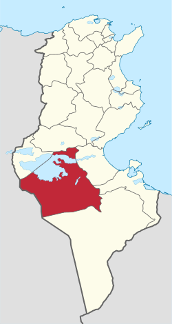 Map of Tunisia with Kebili highlighted | ||
| Coordinates: 33°42′7″N 8°58′25″E / 33.70194°N 8.97361°ECoordinates: 33°42′7″N 8°58′25″E / 33.70194°N 8.97361°E | ||
| Country | Tunisia | |
| Created | September 1981 | |
| Capital | Kebili | |
| Government | ||
| • Governor | Ibrahim El-Breeki (DCR) | |
| Area | ||
| • Total | 22,454 km2 (8,670 sq mi) | |
| Area rank | Ranked 2nd of 24 | |
| Population (2014) | ||
| • Total | 156,961 | |
| • Rank | Ranked 22nd of 24 | |
| • Density | 7.0/km2 (18/sq mi) | |
| Demonym(s) |
Kebilian (Arabic: قبلاوي, Kebelawi) | |
| Time zone | CET (UTC+01) | |
| Postal prefix | 42xx | |
| Calling code | 75-4 | |
| ISO 3166 code | TN-73 | |

Kebili Governorate (Arabic: ولاية ڨبلي Gibillī pronounced [ˈɡbɪl.liː]) is the second largest of the 24 governorates (provinces) of Tunisia. It is situated in south-western Tunisia, bordering Algeria. It covers an area of 22,454 square kilometres (8,670 sq mi)[1] and had a population of 156,961 at the 2014 census.[2] The capital is Kebili.
Geography
Kebili climate is very difficult in winter (very cold at night) and in summer (high temperature). The region is very nice to visit in spring and in the end of autumn.
Kebili contains a significant part of Tunisia’s largest salt pan, which is known as Chott el-Jerid, as well as the western end of Chott el Fejej.
Administrative divisions
Kebili Governorate is subdivided into six delegations:
- Douz North
- Douz South
- Faouar
- Kebili North
- Kebili South
- Souk El Ahed
The following five municipalities are located in Kebili Governorate:
| Code | Municipality | Population (2014)[3] |
|---|---|---|
| 6311 | Kebili | 20,623 |
| 6312 | Djemna | 7,194 |
| 6313 | Douz | 30,245 |
| 6314 | El Golâa | 7,912 |
| 6315 | Souk Lahad | 18,905 |
References
- ↑ Portail de l'industrie tunisienne, Gouvernorat de Kébili.
- ↑ (French) Census 2014 (National Institute of Statistics)
- ↑ Recensement Général de la Population et de l'Habitat 2014 – Population, logements et ménages par commune et arrondissement [Census 2014 results – population, accommodation and households per municipality and delegation] (Report) (in French). National Institute of Statistics. 1 April 2015. Retrieved 18 February 2016.
WikiProject Tunisia | ||