Kauai County, Hawaii
| Kauai County, Hawaii | ||
|---|---|---|
| ||
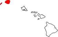 Location in the U.S. state of Hawaii | ||
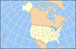 Hawaii's location in the U.S. | ||
| Founded | 1905 | |
| Seat | Lihue | |
| Largest community | Kapa‘a | |
| Area | ||
| • Total | 1,266 sq mi (3,279 km2) | |
| • Land | 620 sq mi (1,606 km2) | |
| • Water | 646 sq mi (1,673 km2), 51.0% | |
| Population (est.) | ||
| • (2015) | 71,735 | |
| • Density | 108/sq mi (42/km²) | |
| Congressional district | 2nd | |
| Time zone | Hawaii-Aleutian: UTC-10 | |
| Website |
www | |

Kauaʻi County is a county located in the U.S. state of Hawaiʻi. It consists of the islands of Kauaʻi, Niʻihau, Lehua, and Kaʻula. As of the 2010 Census the population was 67,091.[1] The county seat is Līhuʻe.[2]
The Kapa'a Micropolitan Statistical Area includes all of Kauai County.
Geography
According to the U.S. Census Bureau, the county has a total area of 1,266 square miles (3,280 km2), of which 620 square miles (1,600 km2) is land and 646 square miles (1,670 km2) (51.0%) is water.[3] The Pacific Ocean surrounds the county.
Adjacent county
- Honolulu County, Hawaii - southeast
National protected areas
- Hanalei National Wildlife Refuge
- Huleia National Wildlife Refuge
- Kilauea Point National Wildlife Refuge
Government
Kauaʻi County has a mayor-council form of municipal government. Executive authority is vested in the Mayor of Kauaʻi, elected by the voters on a non-partisan basis to a four-year term. Legislative authority is vested in the seven-member County Council. All members of the County Council are elected on a non-partisan, at-large basis to two-year terms.
Demographics
| Historical population | |||
|---|---|---|---|
| Census | Pop. | %± | |
| 1900 | 20,734 | — | |
| 1910 | 23,952 | 15.5% | |
| 1920 | 29,438 | 22.9% | |
| 1930 | 35,942 | 22.1% | |
| 1940 | 35,818 | −0.3% | |
| 1950 | 29,905 | −16.5% | |
| 1960 | 28,176 | −5.8% | |
| 1970 | 29,761 | 5.6% | |
| 1980 | 39,082 | 31.3% | |
| 1990 | 51,177 | 30.9% | |
| 2000 | 58,463 | 14.2% | |
| 2010 | 67,091 | 14.8% | |
| Est. 2015 | 71,735 | [4] | 6.9% |
| U.S. Decennial Census[5] 1790-1960[6] 1900-1990[7] 1990-2000[8] 2010-2015[1] | |||
As of the census[9] of 2000, there were 58,463 people, 20,183 households, and 14,572 families residing in the county. The population density was 94 people per square mile (36/km²). There were 25,331 housing units at an average density of 41 per square mile (16/km²). The racial makeup of the county was 29.5% White, 0.3% Black or African American, 0.4% Native American, 36.0% Asian, 9.1% Pacific Islander, 0.9% from other races, and 23.8% from two or more races. 8.2% of the population were Hispanic or Latino of any race.
There were 20,183 households out of which 34.0% had children under the age of 18 living with them, 53.9% were married couples living together, 12.8% had a female householder with no husband present, and 27.8% were non-families. 21.4% of all households were made up of individuals and 7.7% had someone living alone who was 65 years of age or older. The average household size was 2.87 and the average family size was 3.34.
In the county the population was spread out with 26.4% under the age of 18, 7.1% from 18 to 24, 27.2% from 25 to 44, 25.5% from 45 to 64, and 13.8% who were 65 years of age or older. The median age was 38 years. For every 100 females there were 100.10 males. For every 100 females age 18 and over, there were 97.50 males.
Economy
Top employers
According to the County's 2010 Comprehensive Annual Financial Report,[10] the top non-government employers in the county are:
| # | Employer | # of Employees |
|---|---|---|
| 1 | Grand Hyatt Kauai Resort and Spa | 997 |
| 2 | Kauai Marriott Resort & Beach Club | 564 |
| 3 | Manu Kai (ITT/Ke`aki Technologies joint venture) | 529 |
| 4 | Wilcox Memorial Hospital | 486 |
| 5 | Walmart | 417 |
| 6 | Big Save | 410 |
| 7 | The St. Regis Princeville Resort | 336 |
| 8 | Sheraton Kauai Resort | 309 |
| 9 | Kauai Beach Resort | 250 |
| 10 | Nursefinders | 238 |
Transportation
Lihue Airport serves the island of Kauai. Bus service is provided by The Kauai Bus.
Major Highways
 Route 50
 Route 51
 Route 56
 Route 58
 Route 520
 Route 540
 Route 550
 Route 570
 Route 580
 Route 581
 Route 583
Communities
Sister cities
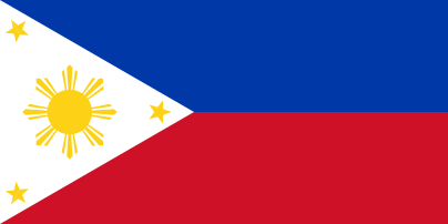 Bagued, Philippines
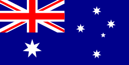 Cooktown, Australia
 Hualien, Taiwan
 Ishigaki, Japan
- Moriyama, Japan
- Ōshima, Japan
 Papaenoo, Tahiti
- Santa, Philippines
- Urdaneta, Philippines
 Whitby, England, United Kingdom
References
- 1 2 "State & County QuickFacts". United States Census Bureau. Retrieved June 28, 2014.
- ↑ "Find a County". National Association of Counties. Retrieved 2011-06-07.
- ↑ "US Gazetteer files: 2010, 2000, and 1990". United States Census Bureau. 2011-02-12. Retrieved 2011-04-23.
- ↑ "County Totals Dataset: Population, Population Change and Estimated Components of Population Change: April 1, 2010 to July 1, 2015". Retrieved July 2, 2016.
- ↑ "U.S. Decennial Census". United States Census Bureau. Retrieved June 28, 2014.
- ↑ "Historical Census Browser". University of Virginia Library. Retrieved June 28, 2014.
- ↑ "Population of Counties by Decennial Census: 1900 to 1990". United States Census Bureau. Retrieved June 28, 2014.
- ↑ "Census 2000 PHC-T-4. Ranking Tables for Counties: 1990 and 2000" (PDF). United States Census Bureau. Retrieved June 28, 2014.
- ↑ "American FactFinder". United States Census Bureau. Retrieved 2008-01-31.
- ↑ County of Kauai CAFR
Islands, municipalities, and communities of Kauai County, Hawaii, United States | ||
|---|---|---|
| CDPs | | |
| Unincorporated communities | ||
Honolulu (capital) | ||
| Topics | ||
| Society | ||
| Main Islands | ||
| Northwestern Islands | ||
| Communities | ||
| Counties | ||
| Sovereignty Movement | ||
Coordinates: 22°04′N 159°39′W / 22.067°N 159.650°W