Kataujpani
| Kataujpani कटौजपानी | |
|---|---|
| Village development committee | |
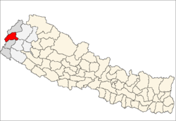
 Kataujpani Location in Nepal | |
| Coordinates: 29°35′N 80°35′E / 29.58°N 80.58°ECoordinates: 29°35′N 80°35′E / 29.58°N 80.58°E | |
| Country | Nepal |
| Zone | Mahakali Zone |
| District | Baitadi District |
| Population (1991) | |
| • Total | 3,705 |
| • Religions | Hindu |
| Time zone | Nepal Time (UTC+5:45) |
Kataujpani is a village development committee in Baitadi District in the Mahakali Zone of western Nepal. At the time of the 1991 Nepal census it had a population of 3,705 and had 634 houses in the town.[1]
References
- ↑ "Nepal Census 2001". Nepal's Village Development Committees. Digital Himalaya. Archived from the original on October 12, 2008. Retrieved 2008-08-26.
This article is issued from Wikipedia - version of the 9/11/2016. The text is available under the Creative Commons Attribution/Share Alike but additional terms may apply for the media files.